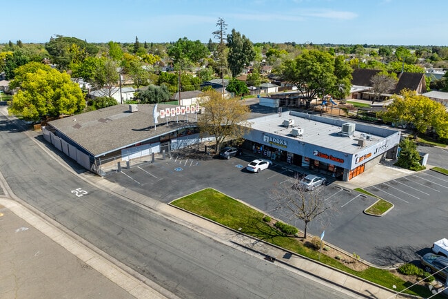
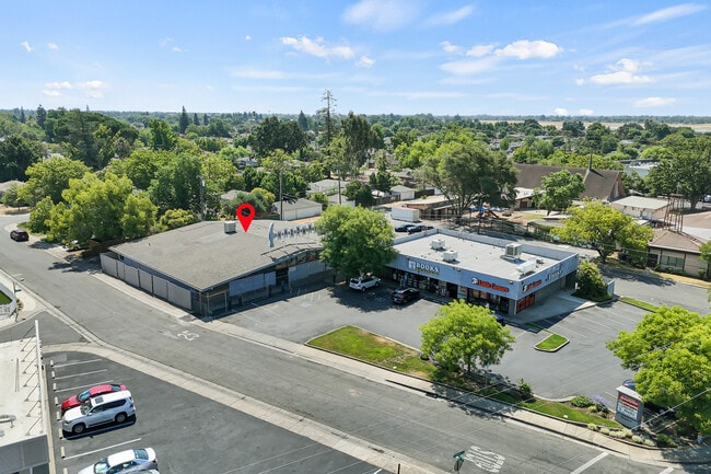
Property Record
5303 Freeport Blvd, Sacramento, CA 95822

Current Lease Availabilities
NEARBY LISTINGS FOR SALE OR LEASE
Property Detail
5303 Freeport Blvd
Sacramento--Roseville--Arden-Arcade, CA
Hollywood Park
018-0221-015
POR OF LOTS H, J, K, & L, HOLLYWOOD PARK UNIT NO 3, & OF ABND20 FT ALLEY ADJ TO SLY LN OF SD LOTS, DESC AS: BEG AT THE NECOR
Storebuilding
Sacramento
X
California
06067C0190H
h,j
2024
0.75 AC
2025
South Sacramento
003502
Sacramento
11,162 SF
DEMOGRAPHICS near 5303 Freeport Blvd
1 Mile
3 Mile
5 Mile
2024 Total Population
13,852
158,562
389,854
2029 Population
13,932
159,925
393,471
Pop Growth 2024-2029
+ 0.58%
+ 0.86%
+ 0.93%
Average Age
42
39
38
2024 Total Households
5,799
60,146
146,685
HH Growth 2024-2029
+ 0.55%
+ 0.89%
+ 1.07%
Median Household Inc
$82,121
$71,984
$71,576
Avg Household Size
2.40
2.50
2.50
2024 Avg HH Vehicles
2.00
2.00
2.00
Median Home Value
$519,756
$512,898
$472,313
Median Year Built
1954
1962
1968
Nearby Places
Map Layers
Map Styles
 Street
 Aerial
- Restaurants
- Banks
- Shops
- Fitness
- Groceries
PUBLIC TRANSPORTATION
TRANSIT/SUBWAY
Fruitridge (Blue Line - Sacramento Regional Transit District Light Rail (The RT))
DRIVE
WALK
Distance
Fruitridge (Blue Line - Sacramento Regional Transit District Light Rail (The RT))
2 min
19 min
1.0 mi
COMMUTER RAIL
Sacramento (Capitol Corridor - Capitol Corridor Joint Powers Authority)
DRIVE
WALK
Distance
Sacramento (Capitol Corridor - Capitol Corridor Joint Powers Authority)
9 min
5.1 mi
AIRPORT
Sacramento International
DRIVE
WALK
Distance
Sacramento International
23 min
15.4 mi
Freight Ports
Port of Stockton
DRIVE
WALK
Distance
Port of Stockton
51 min
42.6 mi
Nearby Properties
Address
Land Use
TOTAL SIZE
Lot Size
Zoning
Address
Land Use
TOTAL SIZE
Lot Size
Zoning
299,943 SF
4.95 AC
H
Address
Land Use
TOTAL SIZE
Lot Size
Zoning
1.33 AC
R-1
Address
Land Use
TOTAL SIZE
Lot Size
Zoning
1.15 AC
R-1
Address
Land Use
TOTAL SIZE
Lot Size
Zoning
200,616 SF
2.54 AC
C-2-SPD
Address
Land Use
TOTAL SIZE
Lot Size
Zoning
320,072 SF
2.65 AC
C-2
Address
Land Use
TOTAL SIZE
Lot Size
Zoning
R-4-PUD C-
Address
Land Use
TOTAL SIZE
Lot Size
Zoning
253,984 SF
11.58 AC
R-2B-PUD
Address
Land Use
TOTAL SIZE
Lot Size
Zoning
2.59 AC
OB-R
Address
Land Use
TOTAL SIZE
Lot Size
Zoning
122,425 SF
0.59 AC
C-2-SPD
Address
Land Use
TOTAL SIZE
Lot Size
Zoning
926 SF
0.07 AC
C-2-SPD
Address
Land Use
TOTAL SIZE
Lot Size
Zoning
180,344 SF
11.86 AC
R-2A
Address
Land Use
TOTAL SIZE
Lot Size
Zoning
R-4-PUD
Address
Land Use
TOTAL SIZE
Lot Size
Zoning
1.15 AC
R-1
Address
Land Use
TOTAL SIZE
Lot Size
Zoning
280,519 SF
2.50 AC
C-2-SPD
Address
Land Use
TOTAL SIZE
Lot Size
Zoning
218,656 SF
0.08 AC
MU
Address
Land Use
TOTAL SIZE
Lot Size
Zoning
112,154 SF
1.18 AC
RMX-PUD-SP
Address
Land Use
TOTAL SIZE
Lot Size
Zoning
88,400 SF
1.18 AC
OB-PUD-SPD
Address
Land Use
TOTAL SIZE
Lot Size
Zoning
213,260 SF
14.35 AC
R-3-R
Address
Land Use
TOTAL SIZE
Lot Size
Zoning
53,386 SF
7.75 AC
C-2-SPD
Address
Land Use
TOTAL SIZE
Lot Size
Zoning
140,408 SF
5.90 AC
R-3
Address
Land Use
TOTAL SIZE
Lot Size
Zoning
0.59 AC
RMX-SPD
Address
Land Use
TOTAL SIZE
Lot Size
Zoning
148,600 SF
0.94 AC
C-2-SPD
Address
Land Use
TOTAL SIZE
Lot Size
Zoning
127,062 SF
8.50 AC
C2
Address
Land Use
TOTAL SIZE
Lot Size
Zoning
65,933 SF
11.09 AC
C2
Address
Land Use
TOTAL SIZE
Lot Size
Zoning
122,668 SF
3.10 AC
C-4 R-3 R-
Address
Land Use
TOTAL SIZE
Lot Size
Zoning
66,372 SF
0.38 AC
C-2
Address
Land Use
TOTAL SIZE
Lot Size
Zoning
137,226 SF
0.68 AC
C-2-SPD
Address
Land Use
TOTAL SIZE
Lot Size
Zoning
Address
Land Use
TOTAL SIZE
Lot Size
Zoning
102,930 SF
4.87 AC
R-3
Address
Land Use
TOTAL SIZE
Lot Size
Zoning
27,288 SF
1.25 AC
C-2-SPD
The World's #1 Commercial Real Estate Marketplace
Connect with us
© 2025 CoStar Group
The information above has been obtained from sources believed reliable. While we do not doubt its accuracy we have not verified it and make no guarantee, warranty or representation about it. It is your responsibility to independently confirm its accuracy and completeness. Any projections, opinions, assumptions, or estimates used are for example only and do not represent the current or future performance of the property. The value of this transaction to you depends on tax and other factors which should be evaluated by your tax, financial, and legal advisors. You and your advisors should conduct a careful, independent investigation of the property to determine to your satisfaction the suitability of the property for your needs.