Property Record
5304 Beecher Rd, Flint, MI 48532
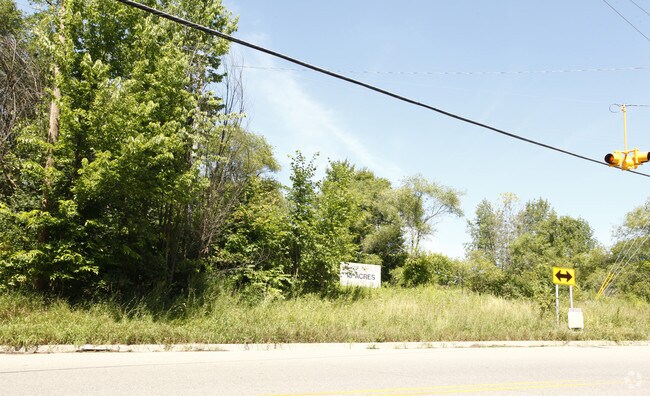

Property Detail
5304 Beecher Rd
Flint, MI
PART OF SW 1/4 & PART OF GOVT LOT 4 BEG AT S 1/4 COR OF SEC TH N 89 DEG 08 MIN 51 SEC W 168.6 FT TH N 0 DEG 01 MIN 41 SEC W
07-05-400-001
GENESEE
Residentialacreage
Michigan
AE The base floodplain where base flood elevations are provided. AE Zones are now used on new format FIRMs instead of A1-A30 Zones.
4
2024
15 AC
2025
Flint
010810
Detroit
NEARBY LISTINGS FOR SALE OR LEASE
DEMOGRAPHICS near 5304 Beecher Rd
1 mile
3 mile
5 mile
2025 Total Population
3,549
33,966
96,288
2030 Population
3,462
33,611
96,715
Pop Growth 2025-2030
(2.45%)
(1.05%)
+ 0.44%
Average Age
44
42
41
2025 Total Households
1,444
14,169
40,049
HH Growth 2025-2030
(2.35%)
(1.09%)
+ 0.47%
Median Household Inc
$72,313
$56,182
$50,034
Avg Household Size
2.40
2.30
2.30
2025 Avg HH Vehicles
2.00
2.00
2.00
Median Home Value
$221,739
$151,527
$116,589
Median Year Built
1973
1968
1962
Nearby Places
Map Layers
Map Styles
 Street
 Aerial
Layers
 Traffic
 Biking
Places
Listings with unknown addresses are not visible on the map
- Restaurants
- Banks
- Shops
- Fitness
- Groceries
PUBLIC TRANSPORTATION
COMMUTER RAIL
Flint Amtrak Station (Blue Water - Amtrak)
Drive
Walk
Distance
Flint Amtrak Station (Blue Water - Amtrak)
18 min
9.6 mi
AIRPORT
Bishop International
Drive
Walk
Distance
Bishop International
22 min
7.7 mi
Freight Ports
Port of Toledo
Drive
Walk
Distance
Port of Toledo
139 min
116.1 mi
SALE & LEASE HISTORY
LISTING DATE
SALE/LEASE

Sep 25, 2016
For Lease
Nearby Properties
Address
Land Use
TOTAL SIZE
Lot Size
Zoning
Address
Land Use
TOTAL SIZE
Lot Size
Zoning
101,590 SF
5.54 AC
Address
Land Use
TOTAL SIZE
Lot Size
Zoning
54,651 SF
3.06 AC
Address
Land Use
TOTAL SIZE
Lot Size
Zoning
571,389 SF
584 AC
Address
Land Use
TOTAL SIZE
Lot Size
Zoning
99,992 SF
8.39 AC
Address
Land Use
TOTAL SIZE
Lot Size
Zoning
59,232 SF
3.65 AC
Address
Land Use
TOTAL SIZE
Lot Size
Zoning
247,555 SF
198 AC
Address
Land Use
TOTAL SIZE
Lot Size
Zoning
85,936 SF
12.71 AC
Address
Land Use
TOTAL SIZE
Lot Size
Zoning
61,892 SF
10.61 AC
Address
Land Use
TOTAL SIZE
Lot Size
Zoning
76,823 SF
114 AC
Address
Land Use
TOTAL SIZE
Lot Size
Zoning
23,500 SF
4.96 AC
Address
Land Use
TOTAL SIZE
Lot Size
Zoning
207,043 SF
24.20 AC
Address
Land Use
TOTAL SIZE
Lot Size
Zoning
92,158 SF
8.40 AC
FM,MULT
Address
Land Use
TOTAL SIZE
Lot Size
Zoning
187,019 SF
180 AC
Address
Land Use
TOTAL SIZE
Lot Size
Zoning
290,502 SF
272.83 AC
Address
Land Use
TOTAL SIZE
Lot Size
Zoning
157,068 SF
160 AC
Address
Land Use
TOTAL SIZE
Lot Size
Zoning
11.97 AC
Address
Land Use
TOTAL SIZE
Lot Size
Zoning
209,058 SF
9.02 AC
Address
Land Use
TOTAL SIZE
Lot Size
Zoning
95,300 SF
9.26 AC
Address
Land Use
TOTAL SIZE
Lot Size
Zoning
403,803 SF
252 AC
Address
Land Use
TOTAL SIZE
Lot Size
Zoning
10.30 AC
Address
Land Use
TOTAL SIZE
Lot Size
Zoning
41,298 SF
9.49 AC
Address
Land Use
TOTAL SIZE
Lot Size
Zoning
Address
Land Use
TOTAL SIZE
Lot Size
Zoning
44,864 SF
5.54 AC
Address
Land Use
TOTAL SIZE
Lot Size
Zoning
59,173 SF
11.43 AC
Address
Land Use
TOTAL SIZE
Lot Size
Zoning
55,979 SF
13.87 AC
Address
Land Use
TOTAL SIZE
Lot Size
Zoning
1,900 SF
13.71 AC
GC,GENE
Address
Land Use
TOTAL SIZE
Lot Size
Zoning
95,813 SF
11.26 AC
Address
Land Use
TOTAL SIZE
Lot Size
Zoning
135,350 SF
12.53 AC
Address
Land Use
TOTAL SIZE
Lot Size
Zoning
22,792 SF
3.89 AC
Address
Land Use
TOTAL SIZE
Lot Size
Zoning
11.12 AC
The World's #1 Commercial Real Estate Marketplace
Connect with us
© 2026 CoStar Group
The information above has been obtained from sources believed reliable. While we do not doubt its accuracy we have not verified it and make no guarantee, warranty or representation about it. It is your responsibility to independently confirm its accuracy and completeness. Any projections, opinions, assumptions, or estimates used are for example only and do not represent the current or future performance of the property. The value of this transaction to you depends on tax and other factors which should be evaluated by your tax, financial, and legal advisors. You and your advisors should conduct a careful, independent investigation of the property to determine to your satisfaction the suitability of the property for your needs.