Property Record
5304 Interstate 70 Dr Se, Columbia, MO 65201

This Property Is For Sale
NEARBY LISTINGS FOR SALE OR LEASE
Property Detail
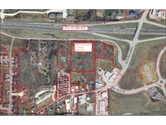
5304 Interstate 70 Dr Se
17-204-00-00-011-00-01
E PT NW SUR 3371-51
Agriculturalland
Boone
X
Missouri
29019C0284E
5.16 AC
2025
Columbia/Jefferson City
2025
Other Market Areas
001003
Columbia, MO
DEMOGRAPHICS near 5304 Interstate 70 Dr Se
1 Mile
3 Mile
5 Mile
2024 Total Population
7,532
30,743
87,469
2029 Population
8,048
32,817
92,888
Pop Growth 2024-2029
+ 6.85%
+ 6.75%
+ 6.20%
Average Age
35
37
34
2024 Total Households
3,206
13,496
34,658
HH Growth 2024-2029
+ 6.99%
+ 6.82%
+ 6.67%
Median Household Inc
$56,424
$61,023
$49,930
Avg Household Size
2.30
2.20
2.20
2024 Avg HH Vehicles
2.00
2.00
2.00
Median Home Value
$158,695
$181,756
$181,076
Median Year Built
2000
1990
1992
Nearby Places
Map Layers
Map Styles
 Street
 Aerial
- Restaurants
- Banks
- Shops
- Fitness
- Groceries
PUBLIC TRANSPORTATION
AIRPORT
Columbia Regional
DRIVE
WALK
Distance
Columbia Regional
18 min
14.1 mi
Freight Ports
Tulsa Port of Inola
DRIVE
WALK
Distance
Tulsa Port of Inola
378 min
336.8 mi
Nearby Properties
Address
Land Use
TOTAL SIZE
Lot Size
Zoning
Address
Land Use
TOTAL SIZE
Lot Size
Zoning
171,157 SF
5.60 AC
O1
Address
Land Use
TOTAL SIZE
Lot Size
Zoning
149,686 SF
15.26 AC
MC
Address
Land Use
TOTAL SIZE
Lot Size
Zoning
6,390 SF
28.23 AC
Address
Land Use
TOTAL SIZE
Lot Size
Zoning
11,760 SF
22.98 AC
Address
Land Use
TOTAL SIZE
Lot Size
Zoning
89,638 SF
6.42 AC
C3
Address
Land Use
TOTAL SIZE
Lot Size
Zoning
57,520 SF
56.57 AC
Address
Land Use
TOTAL SIZE
Lot Size
Zoning
12,098 SF
45.85 AC
Address
Land Use
TOTAL SIZE
Lot Size
Zoning
125,487 SF
3.36 AC
Address
Land Use
TOTAL SIZE
Lot Size
Zoning
33,732 SF
3.34 AC
O1
Address
Land Use
TOTAL SIZE
Lot Size
Zoning
264,960 SF
40.01 AC
R1
Address
Land Use
TOTAL SIZE
Lot Size
Zoning
184,413 SF
17.63 AC
CP
Address
Land Use
TOTAL SIZE
Lot Size
Zoning
70,783 SF
5.07 AC
O1
Address
Land Use
TOTAL SIZE
Lot Size
Zoning
125,907 SF
22.59 AC
C3
Address
Land Use
TOTAL SIZE
Lot Size
Zoning
26,544 SF
1.24 AC
R1
Address
Land Use
TOTAL SIZE
Lot Size
Zoning
68,117 SF
9.13 AC
O1
Address
Land Use
TOTAL SIZE
Lot Size
Zoning
44,364 SF
7.32 AC
CP
Address
Land Use
TOTAL SIZE
Lot Size
Zoning
32,686 SF
3.20 AC
O1
Address
Land Use
TOTAL SIZE
Lot Size
Zoning
167,255 SF
14.14 AC
Address
Land Use
TOTAL SIZE
Lot Size
Zoning
137,347 SF
16.53 AC
C3
Address
Land Use
TOTAL SIZE
Lot Size
Zoning
56,334 SF
7.69 AC
O1
Address
Land Use
TOTAL SIZE
Lot Size
Zoning
104,910 SF
5.92 AC
O1R1
Address
Land Use
TOTAL SIZE
Lot Size
Zoning
83,115 SF
6.78 AC
C1
Address
Land Use
TOTAL SIZE
Lot Size
Zoning
58,021 SF
2.32 AC
C1
Address
Land Use
TOTAL SIZE
Lot Size
Zoning
30,872 SF
4.70 AC
Address
Land Use
TOTAL SIZE
Lot Size
Zoning
109,280 SF
13.08 AC
C1
Address
Land Use
TOTAL SIZE
Lot Size
Zoning
81,345 SF
2.87 AC
Address
Land Use
TOTAL SIZE
Lot Size
Zoning
5,200 SF
11 AC
M1
Address
Land Use
TOTAL SIZE
Lot Size
Zoning
88,738 SF
3.55 AC
CP
Address
Land Use
TOTAL SIZE
Lot Size
Zoning
120,052 SF
13.59 AC
C3
Address
Land Use
TOTAL SIZE
Lot Size
Zoning
65,759 SF
4.90 AC
MC
The World's #1 Commercial Real Estate Marketplace
Connect with us
© 2025 CoStar Group
The information above has been obtained from sources believed reliable. While we do not doubt its accuracy we have not verified it and make no guarantee, warranty or representation about it. It is your responsibility to independently confirm its accuracy and completeness. Any projections, opinions, assumptions, or estimates used are for example only and do not represent the current or future performance of the property. The value of this transaction to you depends on tax and other factors which should be evaluated by your tax, financial, and legal advisors. You and your advisors should conduct a careful, independent investigation of the property to determine to your satisfaction the suitability of the property for your needs.