Property Record
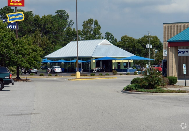
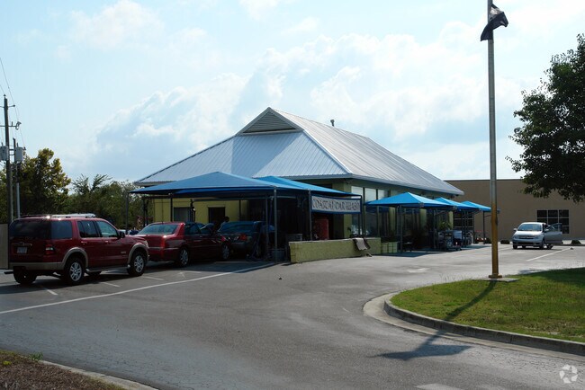
5309 Carolina Beach Rd, Wilmington, NC 28412

Property Detail
5309 Carolina Beach Rd
R07600-001-013-000
PARCEL 2 Z A SNEEDEN LLC & PT TRACTS 19-21 MYRTLE GROVE FARM
Communitycenter
New Hanover
B-2,BUSINE
North Carolina
AE The base floodplain where base flood elevations are provided. AE Zones are now used on new format FIRMs instead of A1-A30 Zones.
13
2025
22.34 AC
2025
Monkey Junction
012008
Wilmington
120,825 SF
Wilmington, NC
NEARBY LISTINGS FOR SALE OR LEASE
-
-
View all Wilmington listings for sale on LoopNet.com
DEMOGRAPHICS near 5309 Carolina Beach Rd
1 mile
3 mile
5 mile
2025 Total Population
8,218
51,826
84,435
2030 Population
8,595
54,639
88,838
Pop Growth 2025-2030
+ 4.59%
+ 5.43%
+ 5.21%
Average Age
42
43
42
2025 Total Households
3,453
22,412
36,098
HH Growth 2025-2030
+ 4.58%
+ 5.61%
+ 5.33%
Median Household Inc
$78,706
$85,876
$81,490
Avg Household Size
2.30
2.30
2.30
2025 Avg HH Vehicles
2.00
2.00
2.00
Median Home Value
$344,368
$381,986
$387,387
Median Year Built
1998
1998
1995
Nearby Places
Map Layers
Map Styles
 Street
 Aerial
Layers
 Traffic
 Biking
Places
Listings with unknown addresses are not visible on the map
- Restaurants
- Banks
- Shops
- Fitness
- Groceries
PUBLIC TRANSPORTATION
AIRPORT
Wilmington International
Drive
Walk
Distance
Wilmington International
28 min
14.4 mi
Freight Ports
Port of Wilmington
Drive
Walk
Distance
Port of Wilmington
12 min
6.1 mi
Nearby Properties
Address
Land Use
TOTAL SIZE
Lot Size
Zoning
Address
Land Use
TOTAL SIZE
Lot Size
Zoning
116,271 SF
199.82 AC
R-15,RESID
Address
Land Use
TOTAL SIZE
Lot Size
Zoning
49,980 SF
48.54 AC
EDZD
Address
Land Use
TOTAL SIZE
Lot Size
Zoning
126,336 SF
14.54 AC
MD-17
Address
Land Use
TOTAL SIZE
Lot Size
Zoning
1,152 SF
21.73 AC
MX
Address
Land Use
TOTAL SIZE
Lot Size
Zoning
41,076 SF
5.29 AC
MX
Address
Land Use
TOTAL SIZE
Lot Size
Zoning
41,118 SF
4.05 AC
MX
Address
Land Use
TOTAL SIZE
Lot Size
Zoning
1,646 SF
48.98 AC
R-15,RESID
Address
Land Use
TOTAL SIZE
Lot Size
Zoning
39,866 SF
15.89 AC
R-15,RESID
Address
Land Use
TOTAL SIZE
Lot Size
Zoning
79,920 SF
9.59 AC
MD-17
Address
Land Use
TOTAL SIZE
Lot Size
Zoning
3,190 SF
59.66 AC
R-15,RESID
Address
Land Use
TOTAL SIZE
Lot Size
Zoning
64,100 SF
6.66 AC
O&I,OFFICE
Address
Land Use
TOTAL SIZE
Lot Size
Zoning
55,917 SF
9.75 AC
RB,REGIONA
Address
Land Use
TOTAL SIZE
Lot Size
Zoning
100,430 SF
25.96 AC
R-15,RESID
Address
Land Use
TOTAL SIZE
Lot Size
Zoning
71,282 SF
8.70 AC
CB,COMMUNI
Address
Land Use
TOTAL SIZE
Lot Size
Zoning
1,872 SF
1.23 AC
I-1,INDUST
Address
Land Use
TOTAL SIZE
Lot Size
Zoning
206,988 SF
24.80 AC
B-2,BUSINE
Address
Land Use
TOTAL SIZE
Lot Size
Zoning
55,910 SF
3.88 AC
CS,COMMERC
Address
Land Use
TOTAL SIZE
Lot Size
Zoning
70,845 SF
3.86 AC
R-15,RESID
Address
Land Use
TOTAL SIZE
Lot Size
Zoning
25,550 SF
7.08 AC
B-2,BUSINE
Address
Land Use
TOTAL SIZE
Lot Size
Zoning
81,330 SF
15.02 AC
O&I,OFFICE
Address
Land Use
TOTAL SIZE
Lot Size
Zoning
7,320 SF
19.68 AC
B-2,BUSINE
Address
Land Use
TOTAL SIZE
Lot Size
Zoning
16,000 SF
10.04 AC
B-2,BUSINE
Address
Land Use
TOTAL SIZE
Lot Size
Zoning
65,689 SF
10.12 AC
B-1,BUSINE
Address
Land Use
TOTAL SIZE
Lot Size
Zoning
57,580 SF
2.29 AC
RB,REGIONA
Address
Land Use
TOTAL SIZE
Lot Size
Zoning
1,676 SF
59.33 AC
IND
Address
Land Use
TOTAL SIZE
Lot Size
Zoning
17,860 SF
7.48 AC
B-2,BUSINE
Address
Land Use
TOTAL SIZE
Lot Size
Zoning
135,802 SF
19.37 AC
B-2,BUSINE
Address
Land Use
TOTAL SIZE
Lot Size
Zoning
1,816 SF
2.56 AC
R-15,RESID
Address
Land Use
TOTAL SIZE
Lot Size
Zoning
11,730 SF
39.51 AC
MD-17
The World's #1 Commercial Real Estate Marketplace
Connect with us
© 2026 CoStar Group
The information above has been obtained from sources believed reliable. While we do not doubt its accuracy we have not verified it and make no guarantee, warranty or representation about it. It is your responsibility to independently confirm its accuracy and completeness. Any projections, opinions, assumptions, or estimates used are for example only and do not represent the current or future performance of the property. The value of this transaction to you depends on tax and other factors which should be evaluated by your tax, financial, and legal advisors. You and your advisors should conduct a careful, independent investigation of the property to determine to your satisfaction the suitability of the property for your needs.