Property Record
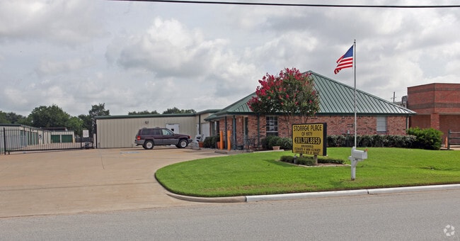
5310 E 5Th St, Katy, TX 77493


Property Detail
5310 E 5Th St
Houston-Pasadena-The Woodlands, TX
LT 21 & TRS 18A 19A 20A 22A 23A & 24A-2 MOTHERAL SEC 1
0740730000022
HARRIS
Publicstorage
Texas
2024
21
2025
2.71 AC
542700
Katy/Grand Parkway West
41,820 SF
Houston
NEARBY LISTINGS FOR SALE OR LEASE
DEMOGRAPHICS near 5310 E 5Th St
1 mile
3 mile
5 mile
2025 Total Population
7,649
88,871
252,587
2030 Population
8,342
98,232
280,026
Pop Growth 2025-2030
+ 9.06%
+ 10.53%
+ 10.86%
Average Age
39
37
36
2025 Total Households
2,835
30,453
82,227
HH Growth 2025-2030
+ 9.21%
+ 10.65%
+ 10.97%
Median Household Inc
$88,243
$103,479
$114,199
Avg Household Size
2.60
2.90
3.00
2025 Avg HH Vehicles
2.00
2.00
2.00
Median Home Value
$299,302
$364,035
$384,920
Median Year Built
2002
2010
2010
Nearby Places
Map Layers
Map Styles
 Street
 Aerial
Transit
 Traffic
 Biking
Places
Listings with unknown addresses are not visible on the map
- Restaurants
- Banks
- Shops
- Fitness
- Groceries
SALE & LEASE HISTORY
LISTING DATE
SALE/LEASE

Aug 15, 2019
For Lease
Nearby Properties
Address
Land Use
TOTAL SIZE
Lot Size
Zoning
Address
Land Use
TOTAL SIZE
Lot Size
Zoning
1,655,920 SF
121.35 AC
Address
Land Use
TOTAL SIZE
Lot Size
Zoning
720,217 SF
65.17 AC
Address
Land Use
TOTAL SIZE
Lot Size
Zoning
765,465 SF
63.65 AC
Address
Land Use
TOTAL SIZE
Lot Size
Zoning
329,918 SF
19.18 AC
Address
Land Use
TOTAL SIZE
Lot Size
Zoning
185,815 SF
30.28 AC
Address
Land Use
TOTAL SIZE
Lot Size
Zoning
380,278 SF
12.61 AC
Address
Land Use
TOTAL SIZE
Lot Size
Zoning
346,736 SF
14.28 AC
Address
Land Use
TOTAL SIZE
Lot Size
Zoning
352,733 SF
13.66 AC
Address
Land Use
TOTAL SIZE
Lot Size
Zoning
455,592 SF
27.53 AC
Address
Land Use
TOTAL SIZE
Lot Size
Zoning
455,592 SF
20.95 AC
Address
Land Use
TOTAL SIZE
Lot Size
Zoning
41,083 SF
23.66 AC
Address
Land Use
TOTAL SIZE
Lot Size
Zoning
278,212 SF
8.15 AC
Address
Land Use
TOTAL SIZE
Lot Size
Zoning
351,758 SF
18.23 AC
Address
Land Use
TOTAL SIZE
Lot Size
Zoning
361,382 SF
14.60 AC
Address
Land Use
TOTAL SIZE
Lot Size
Zoning
375,757 SF
18.37 AC
Address
Land Use
TOTAL SIZE
Lot Size
Zoning
297,040 SF
11.64 AC
Address
Land Use
TOTAL SIZE
Lot Size
Zoning
363,173 SF
13.57 AC
Address
Land Use
TOTAL SIZE
Lot Size
Zoning
327,699 SF
11.64 AC
Address
Land Use
TOTAL SIZE
Lot Size
Zoning
6.13 AC
Address
Land Use
TOTAL SIZE
Lot Size
Zoning
12.50 AC
Address
Land Use
TOTAL SIZE
Lot Size
Zoning
348,199 SF
16.69 AC
Address
Land Use
TOTAL SIZE
Lot Size
Zoning
440,214 SF
23.66 AC
Address
Land Use
TOTAL SIZE
Lot Size
Zoning
261,803 SF
12.51 AC
Address
Land Use
TOTAL SIZE
Lot Size
Zoning
319,341 SF
14.88 AC
Address
Land Use
TOTAL SIZE
Lot Size
Zoning
324,201 SF
12.39 AC
Address
Land Use
TOTAL SIZE
Lot Size
Zoning
290,973 SF
15 AC
Address
Land Use
TOTAL SIZE
Lot Size
Zoning
Address
Land Use
TOTAL SIZE
Lot Size
Zoning
327,793 SF
10.86 AC
Address
Land Use
TOTAL SIZE
Lot Size
Zoning
329,094 SF
13.78 AC
Address
Land Use
TOTAL SIZE
Lot Size
Zoning
270,728 SF
9.45 AC
The World's #1 Commercial Real Estate Marketplace
Connect with us
© 2026 CoStar Group
The information above has been obtained from sources believed reliable. While we do not doubt its accuracy we have not verified it and make no guarantee, warranty or representation about it. It is your responsibility to independently confirm its accuracy and completeness. Any projections, opinions, assumptions, or estimates used are for example only and do not represent the current or future performance of the property. The value of this transaction to you depends on tax and other factors which should be evaluated by your tax, financial, and legal advisors. You and your advisors should conduct a careful, independent investigation of the property to determine to your satisfaction the suitability of the property for your needs.