Property Record
5310 Matt Hwy, Cumming, GA 30028
NEARBY LISTINGS FOR SALE OR LEASE
-
-
View all Cumming listings for lease on LoopNet.com
Property Detail
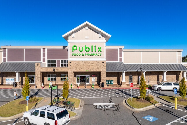
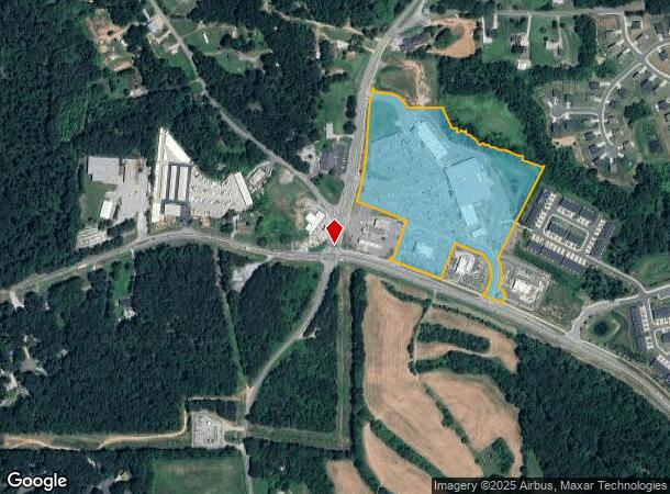
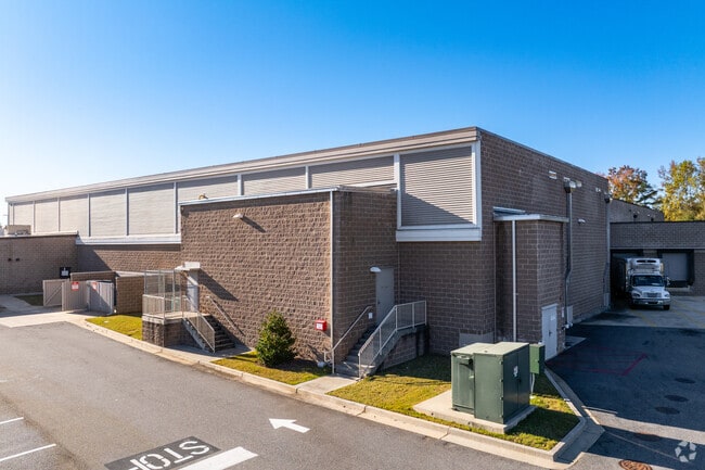
5310 Matt Hwy
145-011
Matt Comm Dis
Commercialnec
3-1 336-337-385 TR 2
X
Forsyth
13117C0045F
Georgia
2024
16.44 AC
2025
Cumming/Forsyth Cnty
130203
Atlanta
16,221 SF
Atlanta-Sandy Springs-Roswell, GA
DEMOGRAPHICS near 5310 Matt Hwy
1 Mile
3 Mile
5 Mile
2024 Total Population
2,472
21,596
51,362
2029 Population
2,972
25,496
60,609
Pop Growth 2024-2029
+ 20.23%
+ 18.06%
+ 18.00%
Average Age
38
38
38
2024 Total Households
802
6,897
16,810
HH Growth 2024-2029
+ 20.20%
+ 18.15%
+ 18.09%
Median Household Inc
$90,908
$115,439
$111,274
Avg Household Size
3.00
3.10
3.00
2024 Avg HH Vehicles
2.00
3.00
2.00
Median Home Value
$337,226
$408,890
$384,410
Median Year Built
2007
2003
2004
Nearby Places
- Restaurants
- Banks
- Shops
- Fitness
- Groceries
SALE & LEASE HISTORY
LISTING DATE
SALE/LEASE

Nov 01, 2018
For Lease
Nearby Properties
Address
Land Use
TOTAL SIZE
Lot Size
Zoning
Address
Land Use
TOTAL SIZE
Lot Size
Zoning
275,993 SF
127.91 AC
R2R
Address
Land Use
TOTAL SIZE
Lot Size
Zoning
2 SF
184.48 AC
RES3
Address
Land Use
TOTAL SIZE
Lot Size
Zoning
175.07 AC
A1
Address
Land Use
TOTAL SIZE
Lot Size
Zoning
2,352 SF
145.10 AC
MP
Address
Land Use
TOTAL SIZE
Lot Size
Zoning
1,787 SF
A1
Address
Land Use
TOTAL SIZE
Lot Size
Zoning
651 SF
41.02 AC
A1
Address
Land Use
TOTAL SIZE
Lot Size
Zoning
67,200 SF
7.92 AC
A1
Address
Land Use
TOTAL SIZE
Lot Size
Zoning
9,481 SF
14.15 AC
A1
Address
Land Use
TOTAL SIZE
Lot Size
Zoning
3,696 SF
6.67 AC
CBD
Address
Land Use
TOTAL SIZE
Lot Size
Zoning
7,734 SF
10.92 AC
A1
Address
Land Use
TOTAL SIZE
Lot Size
Zoning
18.23 AC
CR1
Address
Land Use
TOTAL SIZE
Lot Size
Zoning
4,382 SF
A1
Address
Land Use
TOTAL SIZE
Lot Size
Zoning
4,469 SF
22.03 AC
A1
Address
Land Use
TOTAL SIZE
Lot Size
Zoning
4,626 SF
31.02 AC
A1
Address
Land Use
TOTAL SIZE
Lot Size
Zoning
31,394 SF
7.98 AC
M1
Address
Land Use
TOTAL SIZE
Lot Size
Zoning
5,266 SF
5.18 AC
A1
Address
Land Use
TOTAL SIZE
Lot Size
Zoning
25,660 SF
20.99 AC
MP
Address
Land Use
TOTAL SIZE
Lot Size
Zoning
5,670 SF
5.81 AC
A1
Address
Land Use
TOTAL SIZE
Lot Size
Zoning
8,074 SF
75.54 AC
A1
Address
Land Use
TOTAL SIZE
Lot Size
Zoning
3,706 SF
18.18 AC
A1
Address
Land Use
TOTAL SIZE
Lot Size
Zoning
4,450 SF
13.46 AC
A1
Address
Land Use
TOTAL SIZE
Lot Size
Zoning
10,141 SF
59.80 AC
A1
Address
Land Use
TOTAL SIZE
Lot Size
Zoning
6,974 SF
13.50 AC
A1
Address
Land Use
TOTAL SIZE
Lot Size
Zoning
4,870 SF
10 AC
A1
Address
Land Use
TOTAL SIZE
Lot Size
Zoning
3,783 SF
16.58 AC
A1
Address
Land Use
TOTAL SIZE
Lot Size
Zoning
6,881 SF
3.53 AC
A1
Address
Land Use
TOTAL SIZE
Lot Size
Zoning
5,894 SF
37.98 AC
A1
Address
Land Use
TOTAL SIZE
Lot Size
Zoning
17,500 SF
15.21 AC
A1
Address
Land Use
TOTAL SIZE
Lot Size
Zoning
21,848 SF
17.58 AC
M1
The World's #1 Commercial Real Estate Marketplace
Connect with us
© 2025 CoStar Group
The information above has been obtained from sources believed reliable. While we do not doubt its accuracy we have not verified it and make no guarantee, warranty or representation about it. It is your responsibility to independently confirm its accuracy and completeness. Any projections, opinions, assumptions, or estimates used are for example only and do not represent the current or future performance of the property. The value of this transaction to you depends on tax and other factors which should be evaluated by your tax, financial, and legal advisors. You and your advisors should conduct a careful, independent investigation of the property to determine to your satisfaction the suitability of the property for your needs.