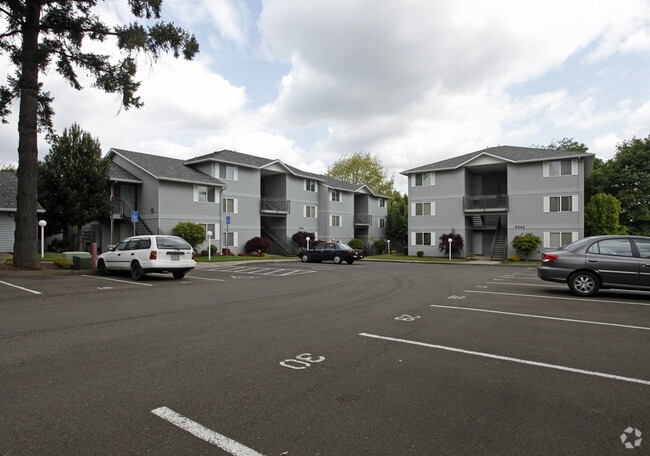
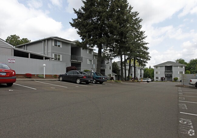
Property Record
5314 Skyline Rd S, Salem, OR 97306

Save to a Folder
{{folder.Name}}
{{folder.ListingIds.length}} Properties
{{folder.ListingIds.length}} Property
Create a New Folder
Property Detail
5314 Skyline Rd S
532423
ACRES 1.23
Multifamilydwelling
Marion
RM2
Oregon
B and X Area of moderate flood hazard, usually the area between the limits of the 100-year and 500-year floods.
1.23 AC
2024
Sunnyslope
2025
Portland
002301
Salem, OR
26,426 SF
NEARBY LISTINGS FOR SALE OR LEASE
DEMOGRAPHICS near 5314 Skyline Rd S
1 mile
3 mile
5 mile
2025 Total Population
10,757
58,096
102,994
2030 Population
10,850
58,555
104,121
Pop Growth 2025-2030
+ 0.86%
+ 0.79%
+ 1.09%
Average Age
40
41
40
2025 Total Households
4,092
22,796
38,947
HH Growth 2025-2030
+ 0.98%
+ 0.88%
+ 1.17%
Median Household Inc
$97,370
$92,144
$83,143
Avg Household Size
2.60
2.50
2.50
2025 Avg HH Vehicles
2.00
2.00
2.00
Median Home Value
$476,882
$472,289
$471,138
Median Year Built
1987
1983
1979
Nearby Places
Map Layers
Map Styles
 Street
 Aerial
Layers
 Traffic
 Biking
Places
Listings with unknown addresses are not visible on the map
- Restaurants
- Banks
- Shops
- Fitness
- Groceries
PUBLIC TRANSPORTATION
COMMUTER RAIL
Drive
Walk
Distance
9 min
5.1 mi
Nearby Properties
Address
Land Use
TOTAL SIZE
Lot Size
Zoning
Address
Land Use
TOTAL SIZE
Lot Size
Zoning
62,708 SF
30.21 AC
PH
Address
Land Use
TOTAL SIZE
Lot Size
Zoning
102,124 SF
10.53 AC
CR
Address
Land Use
TOTAL SIZE
Lot Size
Zoning
204,178 SF
10.43 AC
RM2; PA
Address
Land Use
TOTAL SIZE
Lot Size
Zoning
140,505 SF
5.84 AC
RM2; RS
Address
Land Use
TOTAL SIZE
Lot Size
Zoning
74,710 SF
9.83 AC
PS
Address
Land Use
TOTAL SIZE
Lot Size
Zoning
144,616 SF
7.07 AC
RM2; CO
Address
Land Use
TOTAL SIZE
Lot Size
Zoning
143,684 SF
9.43 AC
CR; RS
Address
Land Use
TOTAL SIZE
Lot Size
Zoning
120,648 SF
16.05 AC
CR
Address
Land Use
TOTAL SIZE
Lot Size
Zoning
124,947 SF
6.27 AC
RM2
Address
Land Use
TOTAL SIZE
Lot Size
Zoning
130,360 SF
6.34 AC
RM2
Address
Land Use
TOTAL SIZE
Lot Size
Zoning
115,612 SF
5.87 AC
RM2
Address
Land Use
TOTAL SIZE
Lot Size
Zoning
114,559 SF
5.26 AC
RM2
Address
Land Use
TOTAL SIZE
Lot Size
Zoning
54,664 SF
5.81 AC
CO; RM2
Address
Land Use
TOTAL SIZE
Lot Size
Zoning
53,822 SF
3.50 AC
CR
Address
Land Use
TOTAL SIZE
Lot Size
Zoning
62,413 SF
4.91 AC
CR
Address
Land Use
TOTAL SIZE
Lot Size
Zoning
61,013 SF
205.38 AC
P; UT-20
Address
Land Use
TOTAL SIZE
Lot Size
Zoning
83,885 SF
4.22 AC
CR
Address
Land Use
TOTAL SIZE
Lot Size
Zoning
62,916 SF
2.23 AC
CO
Address
Land Use
TOTAL SIZE
Lot Size
Zoning
57,933 SF
5.29 AC
CR; RS
Address
Land Use
TOTAL SIZE
Lot Size
Zoning
106,010 SF
6.21 AC
RM2; RM1
Address
Land Use
TOTAL SIZE
Lot Size
Zoning
110,200 SF
5.19 AC
RM2
Address
Land Use
TOTAL SIZE
Lot Size
Zoning
96,322 SF
5.12 AC
RM2
Address
Land Use
TOTAL SIZE
Lot Size
Zoning
89,970 SF
4.39 AC
RM2
Address
Land Use
TOTAL SIZE
Lot Size
Zoning
23,064 SF
3.30 AC
CR
Address
Land Use
TOTAL SIZE
Lot Size
Zoning
71,300 SF
7.09 AC
CO; RS
Address
Land Use
TOTAL SIZE
Lot Size
Zoning
82,425 SF
4.39 AC
RM2; CO
Address
Land Use
TOTAL SIZE
Lot Size
Zoning
71,443 SF
6.23 AC
CR
Address
Land Use
TOTAL SIZE
Lot Size
Zoning
109,056 SF
5.32 AC
RM2
Address
Land Use
TOTAL SIZE
Lot Size
Zoning
45,567 SF
5.56 AC
CR
Address
Land Use
TOTAL SIZE
Lot Size
Zoning
79,349 SF
4.89 AC
RM2
The World's #1 Commercial Real Estate Marketplace
Connect with us
© 2026 CoStar Group
The information above has been obtained from sources believed reliable. While we do not doubt its accuracy we have not verified it and make no guarantee, warranty or representation about it. It is your responsibility to independently confirm its accuracy and completeness. Any projections, opinions, assumptions, or estimates used are for example only and do not represent the current or future performance of the property. The value of this transaction to you depends on tax and other factors which should be evaluated by your tax, financial, and legal advisors. You and your advisors should conduct a careful, independent investigation of the property to determine to your satisfaction the suitability of the property for your needs.