Property Record
5315 N Summit St, Toledo, OH 43611


NEARBY LISTINGS FOR SALE OR LEASE
-
-
View all Toledo listings for sale on LoopNet.com
Property Detail
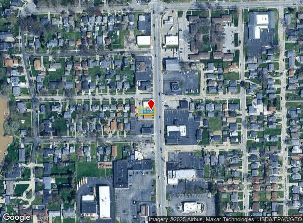
5315 N Summit St
Toledo, OH
Thurstin Beach
15-02561
THURSTIN BEACH LOT 45
Storebuilding
Lucas
X
Ohio
39095C0103F
45
2025
0.09 AC
2025
North Toledo
005501
Toledo
1,950 SF
DEMOGRAPHICS near 5315 N Summit St
1 Mile
3 Mile
5 Mile
2024 Total Population
8,556
20,198
77,062
2029 Population
8,314
19,920
76,920
Pop Growth 2024-2029
(2.83%)
(1.38%)
(0.18%)
Average Age
43
41
39
2024 Total Households
3,762
8,270
31,794
HH Growth 2024-2029
(2.98%)
(1.51%)
(0.33%)
Median Household Inc
$64,082
$55,417
$39,550
Avg Household Size
2.20
2.30
2.30
2024 Avg HH Vehicles
2.00
2.00
2.00
Median Home Value
$115,212
$111,954
$88,161
Median Year Built
1955
1959
1954
Nearby Places
Map Layers
Map Styles
 Street
 Aerial
- Restaurants
- Banks
- Shops
- Fitness
- Groceries
PUBLIC TRANSPORTATION
COMMUTER RAIL
DRIVE
WALK
Distance
14 min
7.1 mi
AIRPORT
Eugene F Kranz Toledo Express
DRIVE
WALK
Distance
Eugene F Kranz Toledo Express
44 min
25.3 mi
Detroit Metro Wayne County
DRIVE
WALK
Distance
Detroit Metro Wayne County
51 min
39.9 mi
Nearby Properties
Address
Land Use
TOTAL SIZE
Lot Size
Zoning
Address
Land Use
TOTAL SIZE
Lot Size
Zoning
286,525 SF
105.33 AC
10-RS6
Address
Land Use
TOTAL SIZE
Lot Size
Zoning
169.42 AC
10-IG
Address
Land Use
TOTAL SIZE
Lot Size
Zoning
Address
Land Use
TOTAL SIZE
Lot Size
Zoning
169.42 AC
10-IG
Address
Land Use
TOTAL SIZE
Lot Size
Zoning
33.48 AC
10-IG
Address
Land Use
TOTAL SIZE
Lot Size
Zoning
28.51 AC
10-IG
Address
Land Use
TOTAL SIZE
Lot Size
Zoning
230,400 SF
18 AC
10-CR
Address
Land Use
TOTAL SIZE
Lot Size
Zoning
90,113 SF
8.12 AC
21-PO
Address
Land Use
TOTAL SIZE
Lot Size
Zoning
175,978 SF
10.02 AC
10-IL
Address
Land Use
TOTAL SIZE
Lot Size
Zoning
106.75 AC
AC = AG
Address
Land Use
TOTAL SIZE
Lot Size
Zoning
92,888 SF
20.24 AC
10-IL
Address
Land Use
TOTAL SIZE
Lot Size
Zoning
159,798 SF
8.32 AC
10-IL
Address
Land Use
TOTAL SIZE
Lot Size
Zoning
123,258 SF
23.59 AC
Address
Land Use
TOTAL SIZE
Lot Size
Zoning
191,297 SF
28.74 AC
10-CRSO
Address
Land Use
TOTAL SIZE
Lot Size
Zoning
48,427 SF
20.29 AC
Address
Land Use
TOTAL SIZE
Lot Size
Zoning
53,306 SF
2 AC
10-CO
Address
Land Use
TOTAL SIZE
Lot Size
Zoning
70,404 SF
8.07 AC
10-RS6
Address
Land Use
TOTAL SIZE
Lot Size
Zoning
454,080 SF
54.59 AC
10-IG
Address
Land Use
TOTAL SIZE
Lot Size
Zoning
22.56 AC
10-IG
Address
Land Use
TOTAL SIZE
Lot Size
Zoning
398,978 SF
79.82 AC
40-M2
Address
Land Use
TOTAL SIZE
Lot Size
Zoning
42,780 SF
1 AC
10-CO
Address
Land Use
TOTAL SIZE
Lot Size
Zoning
202,584 SF
15.12 AC
10-IG
Address
Land Use
TOTAL SIZE
Lot Size
Zoning
5,416 SF
87.73 AC
MHP
Address
Land Use
TOTAL SIZE
Lot Size
Zoning
3,391,887 SF
10-IG
Address
Land Use
TOTAL SIZE
Lot Size
Zoning
79,128 SF
9.01 AC
10-CRSO
Address
Land Use
TOTAL SIZE
Lot Size
Zoning
322,018 SF
20.24 AC
10-IG
Address
Land Use
TOTAL SIZE
Lot Size
Zoning
220,400 SF
13.32 AC
10-IG
Address
Land Use
TOTAL SIZE
Lot Size
Zoning
181,828 SF
17.74 AC
10-IG
Address
Land Use
TOTAL SIZE
Lot Size
Zoning
6,696 SF
81.72 AC
MARINA
Address
Land Use
TOTAL SIZE
Lot Size
Zoning
163,319 SF
66.75 AC
10-IG
The World's #1 Commercial Real Estate Marketplace
Connect with us
© 2026 CoStar Group
The information above has been obtained from sources believed reliable. While we do not doubt its accuracy we have not verified it and make no guarantee, warranty or representation about it. It is your responsibility to independently confirm its accuracy and completeness. Any projections, opinions, assumptions, or estimates used are for example only and do not represent the current or future performance of the property. The value of this transaction to you depends on tax and other factors which should be evaluated by your tax, financial, and legal advisors. You and your advisors should conduct a careful, independent investigation of the property to determine to your satisfaction the suitability of the property for your needs.