Property Record
5317 Nuckols Crossing Rd, Austin, TX 78744


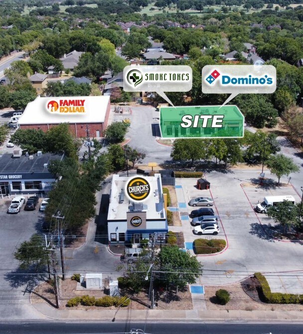
Property Detail
5317 Nuckols Crossing Rd
Austin-Round Rock-San Marcos, TX
LOT 2C WILLIAMSON CREEK COMMERCIAL 2A RESUB OF LOT 2
776792
Travis
Storemultistory
Texas
B and X Area of moderate flood hazard, usually the area between the limits of the 100-year and 500-year floods.
2c,2
2025
0.96 AC
2025
Southeast
002448
Austin
2,774 SF
NEARBY LISTINGS FOR SALE OR LEASE
DEMOGRAPHICS near 5317 Nuckols Crossing Rd
1 mile
3 mile
5 mile
2025 Total Population
15,386
109,139
275,099
2030 Population
16,046
114,958
290,239
Pop Growth 2025-2030
+ 4.29%
+ 5.33%
+ 5.50%
Average Age
35
35
36
2025 Total Households
4,397
43,617
121,932
HH Growth 2025-2030
+ 4.98%
+ 6.03%
+ 6.18%
Median Household Inc
$77,568
$74,646
$85,098
Avg Household Size
3.30
2.40
2.20
2025 Avg HH Vehicles
2.00
2.00
2.00
Median Home Value
$357,189
$420,017
$507,359
Median Year Built
1991
1999
2001
Nearby Places
Map Layers
Map Styles
 Street
 Aerial
Layers
 Traffic
 Biking
Places
Listings with unknown addresses are not visible on the map
- Restaurants
- Banks
- Shops
- Fitness
- Groceries
PUBLIC TRANSPORTATION
COMMUTER RAIL
Austin (Texas Eagle - Amtrak)
Drive
Walk
Distance
Austin (Texas Eagle - Amtrak)
14 min
7.8 mi
AIRPORT
Austin-Bergstrom International
Drive
Walk
Distance
Austin-Bergstrom International
17 min
7.5 mi
Freight Ports
Calhoun Port
Drive
Walk
Distance
Calhoun Port
182 min
151.0 mi
SALE & LEASE HISTORY
LISTING DATE
SALE/LEASE

Sep 18, 2023
For Sale
Nov 18, 2021
For Lease
May 15, 2018
For Lease
Jul 01, 2022
For Sale
Jan 20, 2023
For Sale
Nearby Properties
Address
Land Use
TOTAL SIZE
Lot Size
Zoning
Address
Land Use
TOTAL SIZE
Lot Size
Zoning
8,213 SF
36.95 AC
Address
Land Use
TOTAL SIZE
Lot Size
Zoning
456,650 SF
15 AC
Address
Land Use
TOTAL SIZE
Lot Size
Zoning
454,740 SF
27.77 AC
Address
Land Use
TOTAL SIZE
Lot Size
Zoning
290,643 SF
13.59 AC
Address
Land Use
TOTAL SIZE
Lot Size
Zoning
539,533 SF
26.50 AC
Address
Land Use
TOTAL SIZE
Lot Size
Zoning
386,952 SF
6.77 AC
Address
Land Use
TOTAL SIZE
Lot Size
Zoning
335,913 SF
13.83 AC
Address
Land Use
TOTAL SIZE
Lot Size
Zoning
390,384 SF
34.08 AC
Address
Land Use
TOTAL SIZE
Lot Size
Zoning
256,182 SF
3.63 AC
Address
Land Use
TOTAL SIZE
Lot Size
Zoning
266,871 SF
9.13 AC
Address
Land Use
TOTAL SIZE
Lot Size
Zoning
287,925 SF
9.92 AC
Address
Land Use
TOTAL SIZE
Lot Size
Zoning
372,125 SF
26.22 AC
Address
Land Use
TOTAL SIZE
Lot Size
Zoning
314,325 SF
29.53 AC
Address
Land Use
TOTAL SIZE
Lot Size
Zoning
287,267 SF
13.28 AC
Address
Land Use
TOTAL SIZE
Lot Size
Zoning
297,552 SF
15.93 AC
Address
Land Use
TOTAL SIZE
Lot Size
Zoning
193,788 SF
107.16 AC
Address
Land Use
TOTAL SIZE
Lot Size
Zoning
359,144 SF
Address
Land Use
TOTAL SIZE
Lot Size
Zoning
210,375 SF
3.36 AC
Address
Land Use
TOTAL SIZE
Lot Size
Zoning
288,174 SF
18.91 AC
Address
Land Use
TOTAL SIZE
Lot Size
Zoning
262,576 SF
15.68 AC
Address
Land Use
TOTAL SIZE
Lot Size
Zoning
315,198 SF
8.88 AC
Address
Land Use
TOTAL SIZE
Lot Size
Zoning
287,100 SF
13.20 AC
Address
Land Use
TOTAL SIZE
Lot Size
Zoning
226,050 SF
2.28 AC
Address
Land Use
TOTAL SIZE
Lot Size
Zoning
1 SF
25.43 AC
Address
Land Use
TOTAL SIZE
Lot Size
Zoning
333,746 SF
53.90 AC
Address
Land Use
TOTAL SIZE
Lot Size
Zoning
422,500 SF
30.52 AC
Address
Land Use
TOTAL SIZE
Lot Size
Zoning
323,360 SF
20.93 AC
Address
Land Use
TOTAL SIZE
Lot Size
Zoning
162,000 SF
12.62 AC
Address
Land Use
TOTAL SIZE
Lot Size
Zoning
371,705 SF
25.94 AC
Address
Land Use
TOTAL SIZE
Lot Size
Zoning
286,768 SF
21.34 AC
The World's #1 Commercial Real Estate Marketplace
Connect with us
© 2026 CoStar Group
The information above has been obtained from sources believed reliable. While we do not doubt its accuracy we have not verified it and make no guarantee, warranty or representation about it. It is your responsibility to independently confirm its accuracy and completeness. Any projections, opinions, assumptions, or estimates used are for example only and do not represent the current or future performance of the property. The value of this transaction to you depends on tax and other factors which should be evaluated by your tax, financial, and legal advisors. You and your advisors should conduct a careful, independent investigation of the property to determine to your satisfaction the suitability of the property for your needs.