Property Record
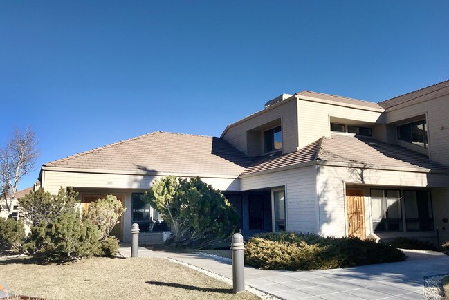
530 Commons Dr, Golden, CO 80401


Property Detail
530 Commons Dr
41-131-01-009
SECTION 13 TOWNSHIP 04 RANGE 71 QTR N2 SUBDIVISIONCD 275800 SUBDIVISIONNAME GENESEE OFFICE COMMERCIAL FLG #2 L 11 EX SUR 2 BLOCK LOT 0011 SIZE: 37026 TRACT 00B VALUE: .850
Commercialnec
JEFFERSON
PD
Colorado
B and X Area of moderate flood hazard, usually the area between the limits of the 100-year and 500-year floods.
11
2025
0.85 AC
2025
West Denver
009845
Denver
10,742 SF
Denver-Aurora-Centennial, CO
NEARBY LISTINGS FOR SALE OR LEASE
DEMOGRAPHICS near 530 Commons Dr
1 mile
3 mile
5 mile
2025 Total Population
1,949
6,560
33,102
2030 Population
1,941
6,526
33,129
Pop Growth 2025-2030
(0.41%)
(0.52%)
+ 0.08%
Average Age
48
49
42
2025 Total Households
803
2,743
12,876
HH Growth 2025-2030
(0.62%)
(0.66%)
+ 0.05%
Median Household Inc
$173,063
$182,692
$124,219
Avg Household Size
2.40
2.40
2.30
2025 Avg HH Vehicles
2.00
2.00
2.00
Median Home Value
$1,018,557
$1,022,148
$928,970
Median Year Built
1987
1985
1985
Nearby Places
Map Layers
Map Styles
 Street
 Aerial
Layers
 Traffic
 Biking
Places
Listings with unknown addresses are not visible on the map
- Restaurants
- Banks
- Shops
- Fitness
- Groceries
SALE & LEASE HISTORY
LISTING DATE
SALE/LEASE

Jan 31, 2019
For Lease
Nearby Properties
Address
Land Use
TOTAL SIZE
Lot Size
Zoning
Address
Land Use
TOTAL SIZE
Lot Size
Zoning
57,775 SF
4.47 AC
Address
Land Use
TOTAL SIZE
Lot Size
Zoning
4,655 SF
566.76 AC
CO
Address
Land Use
TOTAL SIZE
Lot Size
Zoning
160,578 SF
15.07 AC
C1
Address
Land Use
TOTAL SIZE
Lot Size
Zoning
46,955 SF
7.84 AC
PD
Address
Land Use
TOTAL SIZE
Lot Size
Zoning
47,651 SF
5 AC
C1
Address
Land Use
TOTAL SIZE
Lot Size
Zoning
53,739 SF
1.51 AC
MR1
Address
Land Use
TOTAL SIZE
Lot Size
Zoning
82,457 SF
9.38 AC
C1
Address
Land Use
TOTAL SIZE
Lot Size
Zoning
51,200 SF
3.80 AC
PD
Address
Land Use
TOTAL SIZE
Lot Size
Zoning
75,008 SF
2.17 AC
PD
Address
Land Use
TOTAL SIZE
Lot Size
Zoning
31,437 SF
12.36 AC
PD
Address
Land Use
TOTAL SIZE
Lot Size
Zoning
53,231 SF
77.01 AC
A2
Address
Land Use
TOTAL SIZE
Lot Size
Zoning
27,303 SF
6.99 AC
PD
Address
Land Use
TOTAL SIZE
Lot Size
Zoning
321.19 AC
C2
Address
Land Use
TOTAL SIZE
Lot Size
Zoning
73,388 SF
9.37 AC
PD
Address
Land Use
TOTAL SIZE
Lot Size
Zoning
36,402 SF
5.64 AC
PD
Address
Land Use
TOTAL SIZE
Lot Size
Zoning
29,748 SF
257.77 AC
Address
Land Use
TOTAL SIZE
Lot Size
Zoning
27,518 SF
64.78 AC
CO
Address
Land Use
TOTAL SIZE
Lot Size
Zoning
39,265 SF
6.07 AC
PD
Address
Land Use
TOTAL SIZE
Lot Size
Zoning
7,584 SF
58 AC
CO
Address
Land Use
TOTAL SIZE
Lot Size
Zoning
12,322 SF
5.69 AC
Address
Land Use
TOTAL SIZE
Lot Size
Zoning
19,820 SF
4.39 AC
C1
Address
Land Use
TOTAL SIZE
Lot Size
Zoning
51,506 SF
5.50 AC
PD
Address
Land Use
TOTAL SIZE
Lot Size
Zoning
320 AC
A2
Address
Land Use
TOTAL SIZE
Lot Size
Zoning
9,168 SF
9.56 AC
SR5
Address
Land Use
TOTAL SIZE
Lot Size
Zoning
305 AC
A2
Address
Land Use
TOTAL SIZE
Lot Size
Zoning
1,452 SF
687.71 AC
CO
Address
Land Use
TOTAL SIZE
Lot Size
Zoning
24,593 SF
52.38 AC
MR1
Address
Land Use
TOTAL SIZE
Lot Size
Zoning
18,904 SF
6.65 AC
PD
Address
Land Use
TOTAL SIZE
Lot Size
Zoning
4,523 SF
1.60 AC
C1
Address
Land Use
TOTAL SIZE
Lot Size
Zoning
12,898 SF
0.72 AC
PD
The World's #1 Commercial Real Estate Marketplace
Connect with us
© 2026 CoStar Group
The information above has been obtained from sources believed reliable. While we do not doubt its accuracy we have not verified it and make no guarantee, warranty or representation about it. It is your responsibility to independently confirm its accuracy and completeness. Any projections, opinions, assumptions, or estimates used are for example only and do not represent the current or future performance of the property. The value of this transaction to you depends on tax and other factors which should be evaluated by your tax, financial, and legal advisors. You and your advisors should conduct a careful, independent investigation of the property to determine to your satisfaction the suitability of the property for your needs.