Property Record
5320 66Th St W, University Place, WA 98467

NEARBY LISTINGS FOR SALE OR LEASE
Property Detail
5320 66Th St W
Seattle-Tacoma-Bellevue, WA
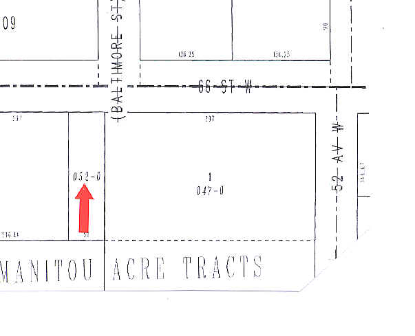
Manitou Acre Tracts
545500-0510
SECTION 26 TOWNSHIP 20 RANGE 02 QUARTER 11 MANITOU ACRE TRACTS: MANITOU ACRE TRACTS L 6 B 26 LESS ELY 50 FT LESS PART FOR CO RD
Servicestationmarket
Pierce
X
Washington
53053C0284E
6
2024
0.76 AC
2025
Tacoma Suburban
071803
Seattle/Puget Sound
4,900 SF
DEMOGRAPHICS near 5320 66Th St W
1 Mile
3 Mile
5 Mile
2024 Total Population
15,330
123,273
308,613
2029 Population
15,832
127,268
319,285
Pop Growth 2024-2029
+ 3.27%
+ 3.24%
+ 3.46%
Average Age
38
38
38
2024 Total Households
6,064
48,715
119,985
HH Growth 2024-2029
+ 3.43%
+ 3.33%
+ 3.61%
Median Household Inc
$69,379
$68,613
$71,374
Avg Household Size
2.50
2.40
2.40
2024 Avg HH Vehicles
2.00
2.00
2.00
Median Home Value
$418,585
$416,251
$425,074
Median Year Built
1984
1977
1973
Nearby Places
Map Layers
Map Styles
 Street
 Aerial
- Restaurants
- Banks
- Shops
- Fitness
- Groceries
PUBLIC TRANSPORTATION
COMMUTER RAIL
DRIVE
WALK
Distance
4 min
1.9 mi
DRIVE
WALK
Distance
9 min
3.9 mi
AIRPORT
Seattle-Tacoma International
DRIVE
WALK
Distance
Seattle-Tacoma International
44 min
27.0 mi
Freight Ports
Port of Tacoma
DRIVE
WALK
Distance
Port of Tacoma
17 min
8.5 mi
Nearby Properties
Address
Land Use
TOTAL SIZE
Lot Size
Zoning
Address
Land Use
TOTAL SIZE
Lot Size
Zoning
515,971 SF
42.45 AC
Address
Land Use
TOTAL SIZE
Lot Size
Zoning
1,379,695 SF
215.71 AC
LKWD
Address
Land Use
TOTAL SIZE
Lot Size
Zoning
566,355 SF
69.03 AC
Address
Land Use
TOTAL SIZE
Lot Size
Zoning
1,056,518 SF
65.31 AC
LKWD
Address
Land Use
TOTAL SIZE
Lot Size
Zoning
12,075 SF
254.10 AC
LKWD
Address
Land Use
TOTAL SIZE
Lot Size
Zoning
412,549 SF
56.87 AC
R1
Address
Land Use
TOTAL SIZE
Lot Size
Zoning
309,156 SF
33.79 AC
M2
Address
Land Use
TOTAL SIZE
Lot Size
Zoning
296,154 SF
46.83 AC
R2
Address
Land Use
TOTAL SIZE
Lot Size
Zoning
358,200 SF
27.25 AC
R3
Address
Land Use
TOTAL SIZE
Lot Size
Zoning
8,177 SF
343.30 AC
R1
Address
Land Use
TOTAL SIZE
Lot Size
Zoning
238,852 SF
15.34 AC
OSR1
Address
Land Use
TOTAL SIZE
Lot Size
Zoning
100,856 SF
19.76 AC
R2
Address
Land Use
TOTAL SIZE
Lot Size
Zoning
244,143 SF
11.79 AC
MF3
Address
Land Use
TOTAL SIZE
Lot Size
Zoning
211,786 SF
16.84 AC
MF2
Address
Land Use
TOTAL SIZE
Lot Size
Zoning
149,844 SF
11.50 AC
MF
Address
Land Use
TOTAL SIZE
Lot Size
Zoning
254,934 SF
5.02 AC
MF
Address
Land Use
TOTAL SIZE
Lot Size
Zoning
140,287 SF
12.95 AC
MF2
Address
Land Use
TOTAL SIZE
Lot Size
Zoning
162,000 SF
9.93 AC
Address
Land Use
TOTAL SIZE
Lot Size
Zoning
378,996 SF
34.43 AC
MHR
Address
Land Use
TOTAL SIZE
Lot Size
Zoning
125,725 SF
9.17 AC
MF2
Address
Land Use
TOTAL SIZE
Lot Size
Zoning
393,488 SF
15.58 AC
MHR
Address
Land Use
TOTAL SIZE
Lot Size
Zoning
149,364 SF
35.69 AC
PI
Address
Land Use
TOTAL SIZE
Lot Size
Zoning
332,140 SF
9.23 AC
M2
Address
Land Use
TOTAL SIZE
Lot Size
Zoning
124,308 SF
9.38 AC
PI
Address
Land Use
TOTAL SIZE
Lot Size
Zoning
128,914 SF
16.03 AC
Address
Land Use
TOTAL SIZE
Lot Size
Zoning
267,056 SF
39.14 AC
PI
Address
Land Use
TOTAL SIZE
Lot Size
Zoning
61.20 AC
M2
Address
Land Use
TOTAL SIZE
Lot Size
Zoning
190,976 SF
6.49 AC
R4L
Address
Land Use
TOTAL SIZE
Lot Size
Zoning
160,514 SF
15.61 AC
MF2
Address
Land Use
TOTAL SIZE
Lot Size
Zoning
293,624 SF
21.16 AC
IBP
The World's #1 Commercial Real Estate Marketplace
Connect with us
© 2025 CoStar Group
The information above has been obtained from sources believed reliable. While we do not doubt its accuracy we have not verified it and make no guarantee, warranty or representation about it. It is your responsibility to independently confirm its accuracy and completeness. Any projections, opinions, assumptions, or estimates used are for example only and do not represent the current or future performance of the property. The value of this transaction to you depends on tax and other factors which should be evaluated by your tax, financial, and legal advisors. You and your advisors should conduct a careful, independent investigation of the property to determine to your satisfaction the suitability of the property for your needs.