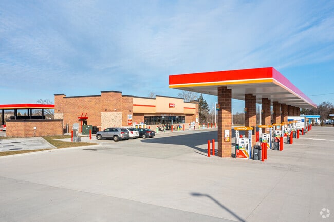
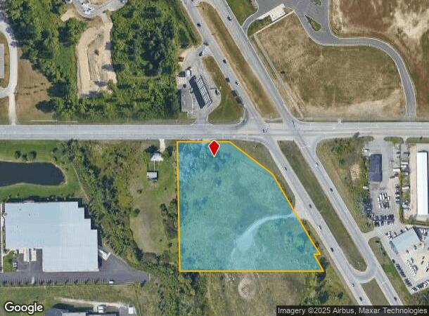
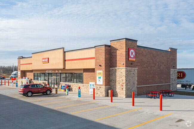
Property Record
5320 68Th St Se, Caledonia, MI 49316
NEARBY LISTINGS FOR SALE OR LEASE
Property Detail
5320 68Th St Se
41-23-07-226-004
412307226004 THAT PART OF N 561 FT OF E 1/2 NE 1/4 LYING WLY OF CL OF BROADMOOR AVE * SEC 7 T5N R10W 6.52 A. SPLIT/COMBINED
Supermarket
Kent
X
Michigan
26005C0150G
6.52 AC
2024
SE Kent County/Caledonia
2025
West Michigan
014811
Grand Rapids-Wyoming-Kentwood, MI
5,290 SF
DEMOGRAPHICS near 5320 68Th St Se
1 Mile
3 Mile
5 Mile
2024 Total Population
2,652
15,911
55,691
2029 Population
2,698
16,176
56,472
Pop Growth 2024-2029
+ 1.73%
+ 1.67%
+ 1.40%
Average Age
34
38
39
2024 Total Households
689
5,547
20,743
HH Growth 2024-2029
+ 2.47%
+ 1.73%
+ 1.43%
Median Household Inc
$84,434
$92,704
$84,478
Avg Household Size
2.70
2.70
2.60
2024 Avg HH Vehicles
2.00
2.00
2.00
Median Home Value
$222,312
$279,497
$277,844
Median Year Built
2005
2000
1992
Nearby Places
Map Layers
Map Styles
 Street
 Aerial
- Restaurants
- Banks
- Shops
- Fitness
- Groceries
PUBLIC TRANSPORTATION
AIRPORT
Gerald R Ford International
DRIVE
WALK
Distance
Gerald R Ford International
8 min
2.9 mi
Freight Ports
Port Milwaukee
DRIVE
WALK
Distance
Port Milwaukee
310 min
267.2 mi
Nearby Properties
Address
Land Use
TOTAL SIZE
Lot Size
Zoning
Address
Land Use
TOTAL SIZE
Lot Size
Zoning
719,632 SF
127.88 AC
PUD-PL UNI
Address
Land Use
TOTAL SIZE
Lot Size
Zoning
90.99 AC
Address
Land Use
TOTAL SIZE
Lot Size
Zoning
855,000 SF
PUD LSP-LG
Address
Land Use
TOTAL SIZE
Lot Size
Zoning
24.96 AC
Address
Land Use
TOTAL SIZE
Lot Size
Zoning
Address
Land Use
TOTAL SIZE
Lot Size
Zoning
438,644 SF
117.24 AC
PUD
Address
Land Use
TOTAL SIZE
Lot Size
Zoning
874,605 SF
87.68 AC
I-PUD
Address
Land Use
TOTAL SIZE
Lot Size
Zoning
47.13 AC
PUD
Address
Land Use
TOTAL SIZE
Lot Size
Zoning
155.84 AC
Address
Land Use
TOTAL SIZE
Lot Size
Zoning
223,592 SF
26.33 AC
PUD LSP-LG
Address
Land Use
TOTAL SIZE
Lot Size
Zoning
208.39 AC
I-PUD
Address
Land Use
TOTAL SIZE
Lot Size
Zoning
292,825 SF
15.01 AC
R-PUD-1
Address
Land Use
TOTAL SIZE
Lot Size
Zoning
685,902 SF
38.89 AC
I1
Address
Land Use
TOTAL SIZE
Lot Size
Zoning
266,630 SF
41.30 AC
I1-LIGHT I
Address
Land Use
TOTAL SIZE
Lot Size
Zoning
68.10 AC
Address
Land Use
TOTAL SIZE
Lot Size
Zoning
267,336 SF
13.99 AC
R-PUD-1
Address
Land Use
TOTAL SIZE
Lot Size
Zoning
210,096 SF
75.30 AC
PUD
Address
Land Use
TOTAL SIZE
Lot Size
Zoning
63.52 AC
Address
Land Use
TOTAL SIZE
Lot Size
Zoning
455,880 SF
24.91 AC
I1
Address
Land Use
TOTAL SIZE
Lot Size
Zoning
148.14 AC
Address
Land Use
TOTAL SIZE
Lot Size
Zoning
146.43 AC
Address
Land Use
TOTAL SIZE
Lot Size
Zoning
196,764 SF
R1
Address
Land Use
TOTAL SIZE
Lot Size
Zoning
165,589 SF
Address
Land Use
TOTAL SIZE
Lot Size
Zoning
119.44 AC
I-PUD
Address
Land Use
TOTAL SIZE
Lot Size
Zoning
116,480 SF
Address
Land Use
TOTAL SIZE
Lot Size
Zoning
194,254 SF
13.55 AC
I1
Address
Land Use
TOTAL SIZE
Lot Size
Zoning
150,797 SF
11.81 AC
PUD
Address
Land Use
TOTAL SIZE
Lot Size
Zoning
151,788 SF
18.31 AC
PUD-PL UNI
Address
Land Use
TOTAL SIZE
Lot Size
Zoning
245,000 SF
17.43 AC
I1
Address
Land Use
TOTAL SIZE
Lot Size
Zoning
13.96 AC
I-PUD
The World's #1 Commercial Real Estate Marketplace
Connect with us
© 2026 CoStar Group
The information above has been obtained from sources believed reliable. While we do not doubt its accuracy we have not verified it and make no guarantee, warranty or representation about it. It is your responsibility to independently confirm its accuracy and completeness. Any projections, opinions, assumptions, or estimates used are for example only and do not represent the current or future performance of the property. The value of this transaction to you depends on tax and other factors which should be evaluated by your tax, financial, and legal advisors. You and your advisors should conduct a careful, independent investigation of the property to determine to your satisfaction the suitability of the property for your needs.