Property Record
2130 Se 54Th St, Ocala, FL 34480


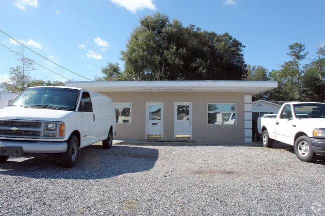
Property Detail
2130 Se 54Th St
35909-000-00
SEC 04 TWP 16 RGE 22 COM 619.35 FT E & 472.21 FT S OF NW COR OF NE 1/4 TH S 313.19 FT E 385 FT N 100 FT W 280 FT N 25 FT E TO WLY LINE OF HWY NO 25 TH N 26 DEG 34` W ALONG HWY RWY LINE 210.13 FT TH W 523.62 FT TO POB
Storebuilding
MARION
B4
Florida
B and X Area of moderate flood hazard, usually the area between the limits of the 100-year and 500-year floods.
3.23 AC
2025
Greater Ocala
2025
Ocala
002302
Ocala, FL
13,120 SF
NEARBY LISTINGS FOR SALE OR LEASE
DEMOGRAPHICS near 2130 Se 54Th St
1 mile
3 mile
5 mile
2025 Total Population
3,110
28,991
98,456
2030 Population
3,501
32,518
110,534
Pop Growth 2025-2030
+ 12.57%
+ 12.17%
+ 12.27%
Average Age
41
42
41
2025 Total Households
1,208
11,334
39,384
HH Growth 2025-2030
+ 12.91%
+ 12.46%
+ 12.56%
Median Household Inc
$68,518
$71,480
$61,870
Avg Household Size
2.60
2.50
2.40
2025 Avg HH Vehicles
2.00
2.00
2.00
Median Home Value
$306,250
$349,534
$283,178
Median Year Built
1988
1986
1986
Nearby Places
Map Layers
Map Styles
 Street
 Aerial
Layers
 Traffic
 Biking
Places
Listings with unknown addresses are not visible on the map
- Restaurants
- Banks
- Shops
- Fitness
- Groceries
Nearby Properties
Address
Land Use
TOTAL SIZE
Lot Size
Zoning
Address
Land Use
TOTAL SIZE
Lot Size
Zoning
189,025 SF
35.42 AC
PD08
Address
Land Use
TOTAL SIZE
Lot Size
Zoning
211,884 SF
80 AC
GU
Address
Land Use
TOTAL SIZE
Lot Size
Zoning
88,462 SF
31.76 AC
INST
Address
Land Use
TOTAL SIZE
Lot Size
Zoning
89,719 SF
15.16 AC
PD12
Address
Land Use
TOTAL SIZE
Lot Size
Zoning
56,484 SF
12.50 AC
PD14
Address
Land Use
TOTAL SIZE
Lot Size
Zoning
5,815 SF
186.33 AC
GU
Address
Land Use
TOTAL SIZE
Lot Size
Zoning
71,065 SF
12.01 AC
B2
Address
Land Use
TOTAL SIZE
Lot Size
Zoning
49,963 SF
9.84 AC
PD14
Address
Land Use
TOTAL SIZE
Lot Size
Zoning
58,040 SF
10.24 AC
INST
Address
Land Use
TOTAL SIZE
Lot Size
Zoning
82,124 SF
20 AC
A1
Address
Land Use
TOTAL SIZE
Lot Size
Zoning
48,056 SF
9.02 AC
R3
Address
Land Use
TOTAL SIZE
Lot Size
Zoning
46,008 SF
10.25 AC
R3
Address
Land Use
TOTAL SIZE
Lot Size
Zoning
70,325 SF
11.62 AC
PD14
Address
Land Use
TOTAL SIZE
Lot Size
Zoning
34,531 SF
3.13 AC
R3
Address
Land Use
TOTAL SIZE
Lot Size
Zoning
390,591 SF
30.62 AC
M2
Address
Land Use
TOTAL SIZE
Lot Size
Zoning
64,190 SF
17.71 AC
INST
Address
Land Use
TOTAL SIZE
Lot Size
Zoning
12,200 SF
3.78 AC
OP
Address
Land Use
TOTAL SIZE
Lot Size
Zoning
70,667 SF
20.30 AC
INST
Address
Land Use
TOTAL SIZE
Lot Size
Zoning
22,495 SF
2.26 AC
OP
Address
Land Use
TOTAL SIZE
Lot Size
Zoning
268,173 SF
18.70 AC
M2
Address
Land Use
TOTAL SIZE
Lot Size
Zoning
48,299 SF
9.10 AC
B1
Address
Land Use
TOTAL SIZE
Lot Size
Zoning
71,754 SF
12.83 AC
R1
Address
Land Use
TOTAL SIZE
Lot Size
Zoning
16,237 SF
2.11 AC
OP
Address
Land Use
TOTAL SIZE
Lot Size
Zoning
58,772 SF
3.69 AC
O1
Address
Land Use
TOTAL SIZE
Lot Size
Zoning
501 SF
428.83 AC
B4
Address
Land Use
TOTAL SIZE
Lot Size
Zoning
65,444 SF
12.17 AC
M1
Address
Land Use
TOTAL SIZE
Lot Size
Zoning
43,629 SF
3.93 AC
B2
Address
Land Use
TOTAL SIZE
Lot Size
Zoning
11,705 SF
4.38 AC
INST
Address
Land Use
TOTAL SIZE
Lot Size
Zoning
64,020 SF
9.08 AC
B5
Address
Land Use
TOTAL SIZE
Lot Size
Zoning
31,638 SF
16.27 AC
INST
The World's #1 Commercial Real Estate Marketplace
Connect with us
© 2026 CoStar Group
The information above has been obtained from sources believed reliable. While we do not doubt its accuracy we have not verified it and make no guarantee, warranty or representation about it. It is your responsibility to independently confirm its accuracy and completeness. Any projections, opinions, assumptions, or estimates used are for example only and do not represent the current or future performance of the property. The value of this transaction to you depends on tax and other factors which should be evaluated by your tax, financial, and legal advisors. You and your advisors should conduct a careful, independent investigation of the property to determine to your satisfaction the suitability of the property for your needs.