Property Record
5320 Webb Pky Nw, Lilburn, GA 30047
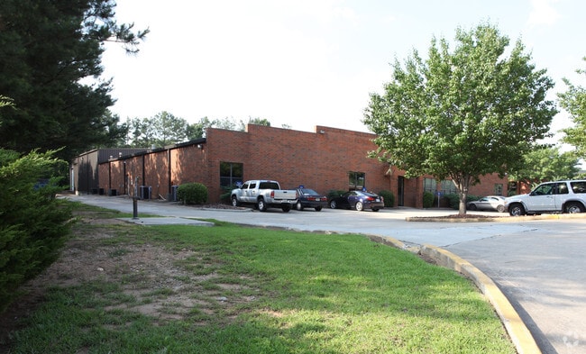

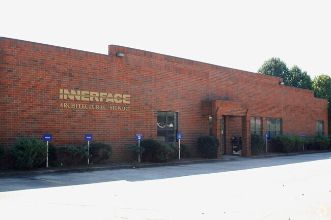

Property Detail
5320 Webb Pky Nw
6-136-155
L5 BA ROCKBRIDGE STA #1
Railroadfacility
Gwinnett
IA
Georgia
B and X Area of moderate flood hazard, usually the area between the limits of the 100-year and 500-year floods.
5
2025
1.50 AC
2025
Stone Mountain
050459
Atlanta
32,425 SF
Atlanta-Sandy Springs-Roswell, GA
NEARBY LISTINGS FOR SALE OR LEASE
DEMOGRAPHICS near 5320 Webb Pky Nw
1 mile
3 mile
5 mile
2025 Total Population
6,794
87,263
235,303
2030 Population
7,099
90,199
243,131
Pop Growth 2025-2030
+ 4.49%
+ 3.36%
+ 3.33%
Average Age
40
37
37
2025 Total Households
2,186
28,102
80,553
HH Growth 2025-2030
+ 4.62%
+ 3.32%
+ 3.27%
Median Household Inc
$74,902
$71,869
$67,330
Avg Household Size
3.10
3.00
2.90
2025 Avg HH Vehicles
2.00
2.00
2.00
Median Home Value
$362,478
$362,866
$361,788
Median Year Built
1984
1985
1985
Nearby Places
Map Layers
Map Styles
 Street
 Aerial
Transit
 Traffic
 Biking
Places
Listings with unknown addresses are not visible on the map
- Restaurants
- Banks
- Shops
- Fitness
- Groceries
PUBLIC TRANSPORTATION
AIRPORT
Hartsfield - Jackson Atlanta International
Drive
Walk
Distance
Hartsfield - Jackson Atlanta International
43 min
29.5 mi
Nearby Properties
Address
Land Use
TOTAL SIZE
Lot Size
Zoning
Address
Land Use
TOTAL SIZE
Lot Size
Zoning
338,670 SF
28.61 AC
RM
Address
Land Use
TOTAL SIZE
Lot Size
Zoning
483,912 SF
43.10 AC
OI
Address
Land Use
TOTAL SIZE
Lot Size
Zoning
273,492 SF
23.08 AC
RM
Address
Land Use
TOTAL SIZE
Lot Size
Zoning
413,878 SF
29.13 AC
CB
Address
Land Use
TOTAL SIZE
Lot Size
Zoning
321,956 SF
26.87 AC
RM13
Address
Land Use
TOTAL SIZE
Lot Size
Zoning
334,795 SF
42.50 AC
RM13
Address
Land Use
TOTAL SIZE
Lot Size
Zoning
257,050 SF
26.17 AC
RM13
Address
Land Use
TOTAL SIZE
Lot Size
Zoning
284,236 SF
22.25 AC
RM100
Address
Land Use
TOTAL SIZE
Lot Size
Zoning
285,384 SF
21.32 AC
RM
Address
Land Use
TOTAL SIZE
Lot Size
Zoning
287,502 SF
43.15 AC
R1
Address
Land Use
TOTAL SIZE
Lot Size
Zoning
276,262 SF
22.17 AC
RM13
Address
Land Use
TOTAL SIZE
Lot Size
Zoning
526,306 SF
77.45 AC
R100
Address
Land Use
TOTAL SIZE
Lot Size
Zoning
367,517 SF
34.61 AC
RM13
Address
Land Use
TOTAL SIZE
Lot Size
Zoning
245,165 SF
16.66 AC
RA200
Address
Land Use
TOTAL SIZE
Lot Size
Zoning
225,939 SF
19.79 AC
RM13
Address
Land Use
TOTAL SIZE
Lot Size
Zoning
353,094 SF
23.33 AC
RM
Address
Land Use
TOTAL SIZE
Lot Size
Zoning
244,131 SF
32.59 AC
RM8
Address
Land Use
TOTAL SIZE
Lot Size
Zoning
174,905 SF
35.72 AC
R1
Address
Land Use
TOTAL SIZE
Lot Size
Zoning
195,253 SF
21.87 AC
R100
Address
Land Use
TOTAL SIZE
Lot Size
Zoning
200,227 SF
21.17 AC
RM10
Address
Land Use
TOTAL SIZE
Lot Size
Zoning
156,635 SF
13.67 AC
RM
Address
Land Use
TOTAL SIZE
Lot Size
Zoning
186,766 SF
11.21 AC
R100
Address
Land Use
TOTAL SIZE
Lot Size
Zoning
366,008 SF
39.23 AC
IA
Address
Land Use
TOTAL SIZE
Lot Size
Zoning
175,028 SF
9.53 AC
M
Address
Land Use
TOTAL SIZE
Lot Size
Zoning
168,542 SF
19.16 AC
R75
Address
Land Use
TOTAL SIZE
Lot Size
Zoning
180,940 SF
11.78 AC
M1
Address
Land Use
TOTAL SIZE
Lot Size
Zoning
46,163 SF
4.05 AC
CB
Address
Land Use
TOTAL SIZE
Lot Size
Zoning
173,080 SF
13.05 AC
R2
Address
Land Use
TOTAL SIZE
Lot Size
Zoning
93,239 SF
9.74 AC
RM85
Address
Land Use
TOTAL SIZE
Lot Size
Zoning
106,822 SF
8.38 AC
RM
The World's #1 Commercial Real Estate Marketplace
Connect with us
© 2026 CoStar Group
The information above has been obtained from sources believed reliable. While we do not doubt its accuracy we have not verified it and make no guarantee, warranty or representation about it. It is your responsibility to independently confirm its accuracy and completeness. Any projections, opinions, assumptions, or estimates used are for example only and do not represent the current or future performance of the property. The value of this transaction to you depends on tax and other factors which should be evaluated by your tax, financial, and legal advisors. You and your advisors should conduct a careful, independent investigation of the property to determine to your satisfaction the suitability of the property for your needs.