Property Record
5322 Nc Highway 55 Hwy, Durham, NC 27713
NEARBY LISTINGS FOR SALE OR LEASE
Property Detail
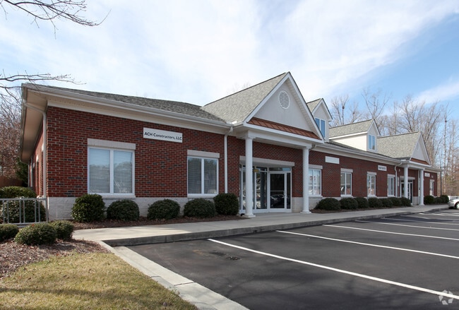
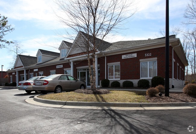
5322 Nc Highway 55 Hwy
Durham-Chapel Hill, NC
Kitt Creek
204442
KITT CREEK OFFICE PARK CO NDOS/BLDG:5322/UT#104 DB PL:CD0008-000202
Officecondo
Durham
AE
North Carolina
3720073700K
104
2025
10.25 AC
2025
Research Triangle
002022
Raleigh/Durham
1,800 SF
DEMOGRAPHICS near 5322 Nc Highway 55 Hwy
1 Mile
3 Mile
5 Mile
2024 Total Population
4,754
42,160
131,668
2029 Population
4,958
44,138
140,183
Pop Growth 2024-2029
+ 4.29%
+ 4.69%
+ 6.47%
Average Age
39
38
37
2024 Total Households
2,083
18,848
55,404
HH Growth 2024-2029
+ 4.56%
+ 4.85%
+ 6.41%
Median Household Inc
$62,380
$87,828
$95,624
Avg Household Size
2.20
2.20
2.30
2024 Avg HH Vehicles
2.00
2.00
2.00
Median Home Value
$258,125
$323,798
$363,908
Median Year Built
1990
2001
2005
Nearby Places
Map Layers
Map Styles
 Street
 Aerial
- Restaurants
- Banks
- Shops
- Fitness
- Groceries
PUBLIC TRANSPORTATION
COMMUTER RAIL
Durham Amtrak Station (Carolinian - Amtrak, Piedmont - Amtrak)
DRIVE
WALK
Distance
Durham Amtrak Station (Carolinian - Amtrak, Piedmont - Amtrak)
16 min
7.6 mi
AIRPORT
Raleigh-Durham International
DRIVE
WALK
Distance
Raleigh-Durham International
18 min
10.3 mi
Freight Ports
Port of Wilmington
DRIVE
WALK
Distance
Port of Wilmington
178 min
154.4 mi
SALE & LEASE HISTORY
LISTING DATE
SALE/LEASE

Sep 25, 2016
For Lease
Nov 08, 2019
For Lease
May 24, 2019
For Lease
Nearby Properties
Address
Land Use
TOTAL SIZE
Lot Size
Zoning
Address
Land Use
TOTAL SIZE
Lot Size
Zoning
778,433 SF
90.38 AC
CC(D)
Address
Land Use
TOTAL SIZE
Lot Size
Zoning
11,568 SF
39.56 AC
RS-M(D)
Address
Land Use
TOTAL SIZE
Lot Size
Zoning
444,254 SF
58.71 AC
SRP
Address
Land Use
TOTAL SIZE
Lot Size
Zoning
35.03 AC
RS-M(D)
Address
Land Use
TOTAL SIZE
Lot Size
Zoning
23,889 SF
50.95 AC
OI
Address
Land Use
TOTAL SIZE
Lot Size
Zoning
7,080 SF
30.67 AC
OI,RS-M
Address
Land Use
TOTAL SIZE
Lot Size
Zoning
6,948 SF
21.22 AC
RS-M(D)
Address
Land Use
TOTAL SIZE
Lot Size
Zoning
10,143 SF
46.78 AC
PDR 5.940
Address
Land Use
TOTAL SIZE
Lot Size
Zoning
7,241 SF
25.34 AC
PDR 5.370
Address
Land Use
TOTAL SIZE
Lot Size
Zoning
8,199 SF
28.28 AC
PDR 12.000
Address
Land Use
TOTAL SIZE
Lot Size
Zoning
555,485 SF
34.84 AC
SRP
Address
Land Use
TOTAL SIZE
Lot Size
Zoning
4,744 SF
12.90 AC
MU(D)
Address
Land Use
TOTAL SIZE
Lot Size
Zoning
9,816 SF
26.57 AC
RS-M
Address
Land Use
TOTAL SIZE
Lot Size
Zoning
9,696 SF
20.94 AC
RS-M(D)
Address
Land Use
TOTAL SIZE
Lot Size
Zoning
13,634 SF
32.31 AC
RS-M
Address
Land Use
TOTAL SIZE
Lot Size
Zoning
12,864 SF
24.27 AC
RS-M
Address
Land Use
TOTAL SIZE
Lot Size
Zoning
240,537 SF
43.98 AC
IL
Address
Land Use
TOTAL SIZE
Lot Size
Zoning
217,507 SF
71.32 AC
CG(D)
Address
Land Use
TOTAL SIZE
Lot Size
Zoning
12,432 SF
26.15 AC
RS-M(D)
Address
Land Use
TOTAL SIZE
Lot Size
Zoning
411,834 SF
29.02 AC
IP(D)
Address
Land Use
TOTAL SIZE
Lot Size
Zoning
12,366 SF
46.02 AC
RS-M(D)
Address
Land Use
TOTAL SIZE
Lot Size
Zoning
11,748 SF
35.02 AC
PDR 8.130
Address
Land Use
TOTAL SIZE
Lot Size
Zoning
1,846 SF
31.05 AC
PDR 3.650
Address
Land Use
TOTAL SIZE
Lot Size
Zoning
105.27 AC
SRP
Address
Land Use
TOTAL SIZE
Lot Size
Zoning
6,000 SF
27.57 AC
RS-M
Address
Land Use
TOTAL SIZE
Lot Size
Zoning
303,620 SF
150.86 AC
SRP
Address
Land Use
TOTAL SIZE
Lot Size
Zoning
199,294 SF
21.63 AC
MU(D)
Address
Land Use
TOTAL SIZE
Lot Size
Zoning
4,074 SF
33.53 AC
RS-M(D)
Address
Land Use
TOTAL SIZE
Lot Size
Zoning
130,390 SF
7.98 AC
OI(D)
Address
Land Use
TOTAL SIZE
Lot Size
Zoning
214,678 SF
15.87 AC
MU(D)
The World's #1 Commercial Real Estate Marketplace
Connect with us
© 2025 CoStar Group
The information above has been obtained from sources believed reliable. While we do not doubt its accuracy we have not verified it and make no guarantee, warranty or representation about it. It is your responsibility to independently confirm its accuracy and completeness. Any projections, opinions, assumptions, or estimates used are for example only and do not represent the current or future performance of the property. The value of this transaction to you depends on tax and other factors which should be evaluated by your tax, financial, and legal advisors. You and your advisors should conduct a careful, independent investigation of the property to determine to your satisfaction the suitability of the property for your needs.