Property Record
5325 E Southport Rd, Indianapolis, IN 46237

NEARBY LISTINGS FOR SALE OR LEASE
Property Detail
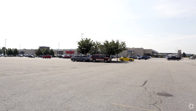
5325 E Southport Rd
49-15-15-102-015.000-300
PT NW1/4 S15 T14 R4 BEG 815.11 E & 905.7 SW402.45 SERLY 51.31FT S TO BEG SE 361.45FTE 935FT S 465FT W 155FT NW 300FT W 430FT SW 395FTNW 155.01FT N 433.95FT TO BEG 9.63AC
Commercialacreage
Marion
X
Indiana
18097C0262G
9.63 AC
2023
Beech Grove/SE County
2024
Indianapolis
390405
Indianapolis-Carmel-Greenwood, IN
DEMOGRAPHICS near 5325 E Southport Rd
1 Mile
3 Mile
5 Mile
2024 Total Population
7,609
76,955
186,906
2029 Population
7,547
75,844
187,240
Pop Growth 2024-2029
(0.81%)
(1.44%)
+ 0.18%
Average Age
40
38
38
2024 Total Households
3,116
29,763
72,451
HH Growth 2024-2029
(0.77%)
(1.41%)
+ 0.28%
Median Household Inc
$83,195
$70,340
$67,640
Avg Household Size
2.30
2.50
2.50
2024 Avg HH Vehicles
2.00
2.00
2.00
Median Home Value
$275,767
$200,562
$196,094
Median Year Built
1998
1986
1982
Nearby Places
Map Layers
Map Styles
 Street
 Aerial
- Restaurants
- Banks
- Shops
- Fitness
- Groceries
PUBLIC TRANSPORTATION
COMMUTER RAIL
Indianapolis (Cardinal - Amtrak)
DRIVE
WALK
Distance
Indianapolis (Cardinal - Amtrak)
14 min
9.3 mi
AIRPORT
Indianapolis International
DRIVE
WALK
Distance
Indianapolis International
34 min
20.2 mi
Freight Ports
Port of Toledo
DRIVE
WALK
Distance
Port of Toledo
277 min
231.6 mi
Nearby Properties
Address
Land Use
TOTAL SIZE
Lot Size
Zoning
Address
Land Use
TOTAL SIZE
Lot Size
Zoning
31,217 SF
105.06 AC
ZO01
Address
Land Use
TOTAL SIZE
Lot Size
Zoning
10,540 SF
49.19 AC
ZO01
Address
Land Use
TOTAL SIZE
Lot Size
Zoning
5,846 SF
43.64 AC
ZO01
Address
Land Use
TOTAL SIZE
Lot Size
Zoning
420,084 SF
23.83 AC
Address
Land Use
TOTAL SIZE
Lot Size
Zoning
3,586 SF
30.28 AC
ZO01
Address
Land Use
TOTAL SIZE
Lot Size
Zoning
493,560 SF
31.39 AC
Address
Land Use
TOTAL SIZE
Lot Size
Zoning
511,680 SF
37.57 AC
Address
Land Use
TOTAL SIZE
Lot Size
Zoning
667,500 SF
33.46 AC
Address
Land Use
TOTAL SIZE
Lot Size
Zoning
5,576 SF
14.15 AC
ZO01
Address
Land Use
TOTAL SIZE
Lot Size
Zoning
81,996 SF
8.56 AC
Address
Land Use
TOTAL SIZE
Lot Size
Zoning
181,458 SF
6 AC
Address
Land Use
TOTAL SIZE
Lot Size
Zoning
6,786 SF
45.81 AC
Address
Land Use
TOTAL SIZE
Lot Size
Zoning
273,000 SF
22.28 AC
Address
Land Use
TOTAL SIZE
Lot Size
Zoning
1,362 SF
6.66 AC
ZO01
Address
Land Use
TOTAL SIZE
Lot Size
Zoning
21,784 SF
30.75 AC
ZO01
Address
Land Use
TOTAL SIZE
Lot Size
Zoning
5,401 SF
21.94 AC
ZO01
Address
Land Use
TOTAL SIZE
Lot Size
Zoning
2,911 SF
24.62 AC
ZO01
Address
Land Use
TOTAL SIZE
Lot Size
Zoning
110,598 SF
22.82 AC
ZO01
Address
Land Use
TOTAL SIZE
Lot Size
Zoning
232,156 SF
23.19 AC
Address
Land Use
TOTAL SIZE
Lot Size
Zoning
352,000 SF
22.72 AC
ZO01
Address
Land Use
TOTAL SIZE
Lot Size
Zoning
99,178 SF
18.04 AC
Address
Land Use
TOTAL SIZE
Lot Size
Zoning
155,088 SF
20.85 AC
ZO01
Address
Land Use
TOTAL SIZE
Lot Size
Zoning
3,935 SF
36.09 AC
ZO01
Address
Land Use
TOTAL SIZE
Lot Size
Zoning
2,320 SF
7.92 AC
ZO01
Address
Land Use
TOTAL SIZE
Lot Size
Zoning
3,202 SF
18.62 AC
ZO01
Address
Land Use
TOTAL SIZE
Lot Size
Zoning
37,718 SF
11.77 AC
ZO01
Address
Land Use
TOTAL SIZE
Lot Size
Zoning
168,560 SF
14.49 AC
Address
Land Use
TOTAL SIZE
Lot Size
Zoning
73,680 SF
5.62 AC
ZO01
Address
Land Use
TOTAL SIZE
Lot Size
Zoning
232,500 SF
17.19 AC
Address
Land Use
TOTAL SIZE
Lot Size
Zoning
1,960 SF
23.76 AC
The World's #1 Commercial Real Estate Marketplace
Connect with us
© 2026 CoStar Group
The information above has been obtained from sources believed reliable. While we do not doubt its accuracy we have not verified it and make no guarantee, warranty or representation about it. It is your responsibility to independently confirm its accuracy and completeness. Any projections, opinions, assumptions, or estimates used are for example only and do not represent the current or future performance of the property. The value of this transaction to you depends on tax and other factors which should be evaluated by your tax, financial, and legal advisors. You and your advisors should conduct a careful, independent investigation of the property to determine to your satisfaction the suitability of the property for your needs.