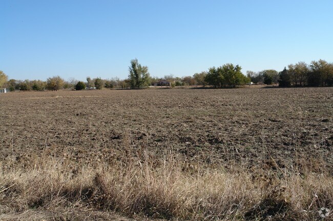
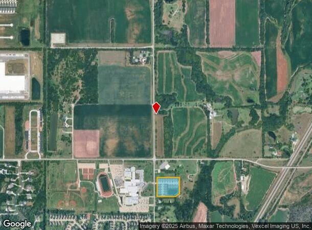
Property Record
5326 N Hillside Ave, Wichita, KS 67219
NEARBY LISTINGS FOR SALE OR LEASE
Property Detail
5326 N Hillside Ave
Wichita, KS
Kenny Rogers Add
096-23-0-22-01-002.00
LOT 1 BLOCK 1 KENNY ROGERS ADD
Apartment
Sedgwick
X
Kansas
20173C0218G
1
2024
5.61 AC
2025
Northeast
010113
Wichita
2,304 SF
DEMOGRAPHICS near 5326 N Hillside Ave
1 Mile
3 Mile
5 Mile
2024 Total Population
1,331
21,569
83,419
2029 Population
1,335
21,789
84,860
Pop Growth 2024-2029
+ 0.30%
+ 1.02%
+ 1.73%
Average Age
34
38
38
2024 Total Households
469
8,170
32,038
HH Growth 2024-2029
+ 0.21%
+ 0.92%
+ 1.65%
Median Household Inc
$99,778
$81,254
$60,122
Avg Household Size
2.90
2.60
2.50
2024 Avg HH Vehicles
2.00
2.00
2.00
Median Home Value
$231,504
$176,466
$165,856
Median Year Built
2007
1993
1980
Nearby Places
Map Layers
Map Styles
 Street
 Aerial
- Restaurants
- Banks
- Shops
- Fitness
- Groceries
PUBLIC TRANSPORTATION
AIRPORT
Wichita Dwight D Eisenhower Ntl
DRIVE
WALK
Distance
Wichita Dwight D Eisenhower Ntl
22 min
14.2 mi
Freight Ports
Tulsa Port Of Catoosa
DRIVE
WALK
Distance
Tulsa Port Of Catoosa
214 min
200.1 mi
Nearby Properties
Address
Land Use
TOTAL SIZE
Lot Size
Zoning
Address
Land Use
TOTAL SIZE
Lot Size
Zoning
924,000 SF
58.58 AC
SF-20
Address
Land Use
TOTAL SIZE
Lot Size
Zoning
304,863 SF
74.13 AC
SF5
Address
Land Use
TOTAL SIZE
Lot Size
Zoning
305,447 SF
46.77 AC
GI
Address
Land Use
TOTAL SIZE
Lot Size
Zoning
129,965 SF
41.88 AC
R3
Address
Land Use
TOTAL SIZE
Lot Size
Zoning
1,079,902 SF
68.86 AC
Address
Land Use
TOTAL SIZE
Lot Size
Zoning
79,739 SF
10.11 AC
R6
Address
Land Use
TOTAL SIZE
Lot Size
Zoning
147,784 SF
39.28 AC
SF-5
Address
Land Use
TOTAL SIZE
Lot Size
Zoning
102,200 SF
8.77 AC
R6
Address
Land Use
TOTAL SIZE
Lot Size
Zoning
40,267 SF
10.55 AC
R6
Address
Land Use
TOTAL SIZE
Lot Size
Zoning
92,735 SF
7.28 AC
R4
Address
Land Use
TOTAL SIZE
Lot Size
Zoning
292,500 SF
12.15 AC
LI
Address
Land Use
TOTAL SIZE
Lot Size
Zoning
72,001 SF
21.99 AC
LI
Address
Land Use
TOTAL SIZE
Lot Size
Zoning
34,050 SF
10.23 AC
Address
Land Use
TOTAL SIZE
Lot Size
Zoning
1,179,118 SF
171.49 AC
LI
Address
Land Use
TOTAL SIZE
Lot Size
Zoning
76,382 SF
8.77 AC
R4
Address
Land Use
TOTAL SIZE
Lot Size
Zoning
52,156 SF
5.89 AC
R6
Address
Land Use
TOTAL SIZE
Lot Size
Zoning
91,702 SF
53.96 AC
I-1
Address
Land Use
TOTAL SIZE
Lot Size
Zoning
94,251 SF
6.46 AC
C2
Address
Land Use
TOTAL SIZE
Lot Size
Zoning
76,039 SF
9.43 AC
R2
Address
Land Use
TOTAL SIZE
Lot Size
Zoning
33,505 SF
4.75 AC
R6
Address
Land Use
TOTAL SIZE
Lot Size
Zoning
33,361 SF
3.63 AC
Address
Land Use
TOTAL SIZE
Lot Size
Zoning
20,014 SF
8.17 AC
R3
Address
Land Use
TOTAL SIZE
Lot Size
Zoning
1,139,104 SF
89.68 AC
GI,LI
Address
Land Use
TOTAL SIZE
Lot Size
Zoning
50,838 SF
10.03 AC
GI
Address
Land Use
TOTAL SIZE
Lot Size
Zoning
90,100 SF
5.91 AC
GC
Address
Land Use
TOTAL SIZE
Lot Size
Zoning
35,000 SF
16.26 AC
Address
Land Use
TOTAL SIZE
Lot Size
Zoning
20,969 SF
8.85 AC
I-1
Address
Land Use
TOTAL SIZE
Lot Size
Zoning
349,549 SF
19.11 AC
I1
Address
Land Use
TOTAL SIZE
Lot Size
Zoning
31,982 SF
9.77 AC
SF-5
The World's #1 Commercial Real Estate Marketplace
Connect with us
© 2026 CoStar Group
The information above has been obtained from sources believed reliable. While we do not doubt its accuracy we have not verified it and make no guarantee, warranty or representation about it. It is your responsibility to independently confirm its accuracy and completeness. Any projections, opinions, assumptions, or estimates used are for example only and do not represent the current or future performance of the property. The value of this transaction to you depends on tax and other factors which should be evaluated by your tax, financial, and legal advisors. You and your advisors should conduct a careful, independent investigation of the property to determine to your satisfaction the suitability of the property for your needs.