Property Record
533 N Frankford Ave, Lubbock, TX 79416
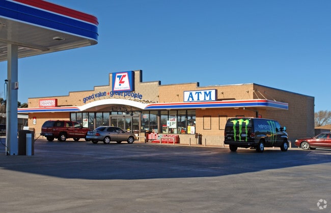

Property Detail
533 N Frankford Ave
Lubbock, TX
SHADOW HILLS TR B-1
R93215
Lubbock
Commercialnec
Texas
B and X Area of moderate flood hazard, usually the area between the limits of the 100-year and 500-year floods.
10
2024
1.57 AC
2025
North Outer Lubbock
010417
Lubbock
4,545 SF
NEARBY LISTINGS FOR SALE OR LEASE
DEMOGRAPHICS near 533 N Frankford Ave
1 mile
3 mile
5 mile
2025 Total Population
10,899
50,533
125,288
2030 Population
11,413
52,638
130,561
Pop Growth 2025-2030
+ 4.72%
+ 4.17%
+ 4.21%
Average Age
34
35
34
2025 Total Households
4,364
20,935
49,995
HH Growth 2025-2030
+ 4.90%
+ 4.56%
+ 4.80%
Median Household Inc
$58,390
$53,232
$48,984
Avg Household Size
2.40
2.30
2.30
2025 Avg HH Vehicles
2.00
2.00
2.00
Median Home Value
$209,392
$211,520
$184,988
Median Year Built
1999
1992
1983
Nearby Places
Map Layers
Map Styles
 Street
 Aerial
Layers
 Traffic
 Biking
Places
Listings with unknown addresses are not visible on the map
- Restaurants
- Banks
- Shops
- Fitness
- Groceries
PUBLIC TRANSPORTATION
AIRPORT
Lubbock Preston Smith International
Drive
Walk
Distance
Lubbock Preston Smith International
28 min
14.7 mi
SALE & LEASE HISTORY
LISTING DATE
SALE/LEASE

Oct 02, 2024
For Sale
Nearby Properties
Address
Land Use
TOTAL SIZE
Lot Size
Zoning
Address
Land Use
TOTAL SIZE
Lot Size
Zoning
103,717 SF
25.26 AC
Address
Land Use
TOTAL SIZE
Lot Size
Zoning
380,785 SF
36.72 AC
Address
Land Use
TOTAL SIZE
Lot Size
Zoning
379,029 SF
29.43 AC
Address
Land Use
TOTAL SIZE
Lot Size
Zoning
409,380 SF
30.13 AC
Address
Land Use
TOTAL SIZE
Lot Size
Zoning
360,108 SF
18.63 AC
Address
Land Use
TOTAL SIZE
Lot Size
Zoning
244,983 SF
14.26 AC
Address
Land Use
TOTAL SIZE
Lot Size
Zoning
274,547 SF
18.92 AC
Address
Land Use
TOTAL SIZE
Lot Size
Zoning
473,857 SF
17.64 AC
Address
Land Use
TOTAL SIZE
Lot Size
Zoning
355,384 SF
19.63 AC
Address
Land Use
TOTAL SIZE
Lot Size
Zoning
244,834 SF
14.54 AC
Address
Land Use
TOTAL SIZE
Lot Size
Zoning
88,803 SF
7.23 AC
Address
Land Use
TOTAL SIZE
Lot Size
Zoning
207.36 AC
Address
Land Use
TOTAL SIZE
Lot Size
Zoning
102,209 SF
14 AC
Address
Land Use
TOTAL SIZE
Lot Size
Zoning
67,759 SF
6.37 AC
Address
Land Use
TOTAL SIZE
Lot Size
Zoning
207,374 SF
15.51 AC
Address
Land Use
TOTAL SIZE
Lot Size
Zoning
169,556 SF
12 AC
Address
Land Use
TOTAL SIZE
Lot Size
Zoning
156,495 SF
15.85 AC
Address
Land Use
TOTAL SIZE
Lot Size
Zoning
41,592 SF
13.72 AC
Address
Land Use
TOTAL SIZE
Lot Size
Zoning
156,038 SF
12.05 AC
Address
Land Use
TOTAL SIZE
Lot Size
Zoning
625.50 AC
Address
Land Use
TOTAL SIZE
Lot Size
Zoning
205,567 SF
34.16 AC
Address
Land Use
TOTAL SIZE
Lot Size
Zoning
100,132 SF
8.42 AC
Address
Land Use
TOTAL SIZE
Lot Size
Zoning
183,541 SF
10.02 AC
Address
Land Use
TOTAL SIZE
Lot Size
Zoning
151,211 SF
8 AC
Address
Land Use
TOTAL SIZE
Lot Size
Zoning
151,519 SF
7.55 AC
Address
Land Use
TOTAL SIZE
Lot Size
Zoning
51,672 SF
14.47 AC
Address
Land Use
TOTAL SIZE
Lot Size
Zoning
205,734 SF
10.61 AC
Address
Land Use
TOTAL SIZE
Lot Size
Zoning
164,196 SF
8.48 AC
Address
Land Use
TOTAL SIZE
Lot Size
Zoning
77,553 SF
9.63 AC
Address
Land Use
TOTAL SIZE
Lot Size
Zoning
425,004 SF
19.88 AC
The World's #1 Commercial Real Estate Marketplace
Connect with us
© 2026 CoStar Group
The information above has been obtained from sources believed reliable. While we do not doubt its accuracy we have not verified it and make no guarantee, warranty or representation about it. It is your responsibility to independently confirm its accuracy and completeness. Any projections, opinions, assumptions, or estimates used are for example only and do not represent the current or future performance of the property. The value of this transaction to you depends on tax and other factors which should be evaluated by your tax, financial, and legal advisors. You and your advisors should conduct a careful, independent investigation of the property to determine to your satisfaction the suitability of the property for your needs.