Property Record
533 Niagara St, Tonawanda, NY 14150
NEARBY LISTINGS FOR SALE OR LEASE
Property Detail
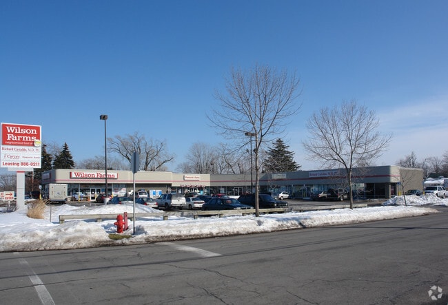
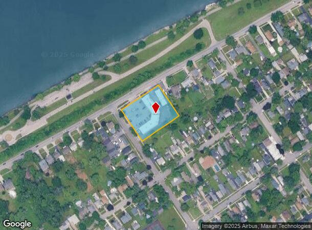
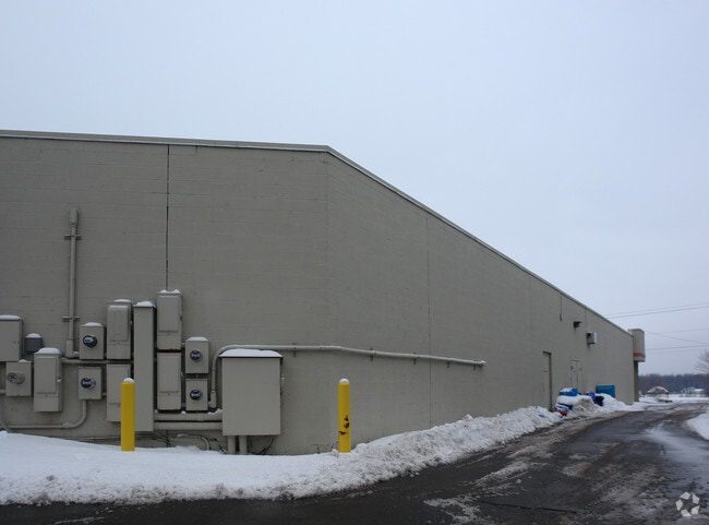
533 Niagara St
141600-038-660-0004-001-000
348FT W GIBSON GL 88 BL 87 248.4X 214.7
Stripcommercialcenter
Erie
X
New York
36029C0044J
1.000
2025
1.20 AC
2024
North
007800
Buffalo/Niagara Falls
10,731 SF
Buffalo-Cheektowaga-Niagara Falls, NY
DEMOGRAPHICS near 533 Niagara St
1 Mile
3 Mile
5 Mile
2024 Total Population
8,701
62,021
192,006
2029 Population
8,628
61,381
189,403
Pop Growth 2024-2029
(0.84%)
(1.03%)
(1.36%)
Average Age
43
43
41
2024 Total Households
3,927
28,507
85,346
HH Growth 2024-2029
(0.97%)
(1.17%)
(1.40%)
Median Household Inc
$62,932
$61,734
$64,261
Avg Household Size
2.20
2.10
2.20
2024 Avg HH Vehicles
2.00
2.00
2.00
Median Home Value
$158,651
$161,281
$173,836
Median Year Built
1952
1954
1954
Nearby Places
- Restaurants
- Banks
- Shops
- Fitness
- Groceries
PUBLIC TRANSPORTATION
AIRPORT
Niagara Falls International
DRIVE
WALK
Distance
Niagara Falls International
17 min
8.4 mi
Buffalo Niagara International
DRIVE
WALK
Distance
Buffalo Niagara International
24 min
12.8 mi
Nearby Properties
Address
Land Use
TOTAL SIZE
Lot Size
Zoning
Address
Land Use
TOTAL SIZE
Lot Size
Zoning
139,224 SF
13.72 AC
WID
Address
Land Use
TOTAL SIZE
Lot Size
Zoning
239,735 SF
17.73 AC
TND
Address
Land Use
TOTAL SIZE
Lot Size
Zoning
223,916 SF
8.25 AC
R-C
Address
Land Use
TOTAL SIZE
Lot Size
Zoning
9,626 SF
31.67 AC
Address
Land Use
TOTAL SIZE
Lot Size
Zoning
4,707 SF
13.60 AC
WD NT
Address
Land Use
TOTAL SIZE
Lot Size
Zoning
368,190 SF
98.37 AC
R1D
Address
Land Use
TOTAL SIZE
Lot Size
Zoning
173,303 SF
24.40 AC
R1-2
Address
Land Use
TOTAL SIZE
Lot Size
Zoning
2,474 SF
24.84 AC
Address
Land Use
TOTAL SIZE
Lot Size
Zoning
67,000 SF
6.50 AC
Address
Land Use
TOTAL SIZE
Lot Size
Zoning
356,891 SF
21.33 AC
B
Address
Land Use
TOTAL SIZE
Lot Size
Zoning
16 AC
G-1
Address
Land Use
TOTAL SIZE
Lot Size
Zoning
107,490 SF
3.55 AC
Address
Land Use
TOTAL SIZE
Lot Size
Zoning
81,224 SF
0.45 AC
Address
Land Use
TOTAL SIZE
Lot Size
Zoning
33,970 SF
9.70 AC
Address
Land Use
TOTAL SIZE
Lot Size
Zoning
135,140 SF
25.60 AC
Address
Land Use
TOTAL SIZE
Lot Size
Zoning
11,442 SF
23.87 AC
Address
Land Use
TOTAL SIZE
Lot Size
Zoning
Address
Land Use
TOTAL SIZE
Lot Size
Zoning
Address
Land Use
TOTAL SIZE
Lot Size
Zoning
Address
Land Use
TOTAL SIZE
Lot Size
Zoning
137,200 SF
3.56 AC
WD
Address
Land Use
TOTAL SIZE
Lot Size
Zoning
1,323 SF
26.39 AC
R-2
Address
Land Use
TOTAL SIZE
Lot Size
Zoning
76,932 SF
5.32 AC
TND
Address
Land Use
TOTAL SIZE
Lot Size
Zoning
1,588 SF
116.66 AC
Address
Land Use
TOTAL SIZE
Lot Size
Zoning
34,100 SF
15.75 AC
C-1
Address
Land Use
TOTAL SIZE
Lot Size
Zoning
Address
Land Use
TOTAL SIZE
Lot Size
Zoning
33,608 SF
33.01 AC
Address
Land Use
TOTAL SIZE
Lot Size
Zoning
Address
Land Use
TOTAL SIZE
Lot Size
Zoning
51,232 SF
2.55 AC
WD
Address
Land Use
TOTAL SIZE
Lot Size
Zoning
51,232 SF
1.62 AC
WD
Address
Land Use
TOTAL SIZE
Lot Size
Zoning
109,732 SF
10.50 AC
The World's #1 Commercial Real Estate Marketplace
Connect with us
© 2025 CoStar Group
The information above has been obtained from sources believed reliable. While we do not doubt its accuracy we have not verified it and make no guarantee, warranty or representation about it. It is your responsibility to independently confirm its accuracy and completeness. Any projections, opinions, assumptions, or estimates used are for example only and do not represent the current or future performance of the property. The value of this transaction to you depends on tax and other factors which should be evaluated by your tax, financial, and legal advisors. You and your advisors should conduct a careful, independent investigation of the property to determine to your satisfaction the suitability of the property for your needs.