Property Record
5330 N Fry Rd, Katy, TX 77449
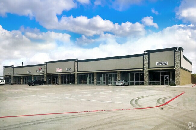

Property Detail
5330 N Fry Rd
1167100000009
RES A8 VILLAGES OF BEAR CREEK PLAZA
Stripcommercialcenter
HARRIS
B and X Area of moderate flood hazard, usually the area between the limits of the 100-year and 500-year floods.
Texas
2024
2.28 AC
2025
Far Katy North
542105
Houston
20,400 SF
Houston-Pasadena-The Woodlands, TX
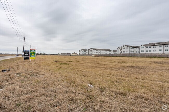
NEARBY LISTINGS FOR SALE OR LEASE
DEMOGRAPHICS near 5330 N Fry Rd
1 mile
3 mile
5 mile
2025 Total Population
24,244
154,106
332,742
2030 Population
26,043
163,928
355,895
Pop Growth 2025-2030
+ 7.42%
+ 6.37%
+ 6.96%
Average Age
33
35
35
2025 Total Households
6,825
45,051
104,284
HH Growth 2025-2030
+ 7.63%
+ 6.54%
+ 7.13%
Median Household Inc
$87,708
$91,015
$88,720
Avg Household Size
3.40
3.40
3.10
2025 Avg HH Vehicles
2.00
2.00
2.00
Median Home Value
$271,431
$263,408
$279,542
Median Year Built
2009
2004
2003
Nearby Places
Map Layers
Map Styles
 Street
 Aerial
Layers
 Traffic
 Biking
Places
Listings with unknown addresses are not visible on the map
- Restaurants
- Banks
- Shops
- Fitness
- Groceries
PUBLIC TRANSPORTATION
AIRPORT
George Bush Intcntl/Houston
Drive
Walk
Distance
George Bush Intcntl/Houston
46 min
30.5 mi
William P Hobby
Drive
Walk
Distance
William P Hobby
59 min
39.4 mi
Freight Ports
Port of Houston
Drive
Walk
Distance
Port of Houston
53 min
36.2 mi
Nearby Properties
Address
Land Use
TOTAL SIZE
Lot Size
Zoning
Address
Land Use
TOTAL SIZE
Lot Size
Zoning
838,700 SF
36.68 AC
Address
Land Use
TOTAL SIZE
Lot Size
Zoning
323,609 SF
12.71 AC
Address
Land Use
TOTAL SIZE
Lot Size
Zoning
347,834 SF
15.25 AC
Address
Land Use
TOTAL SIZE
Lot Size
Zoning
335,899 SF
12.62 AC
Address
Land Use
TOTAL SIZE
Lot Size
Zoning
331,263 SF
11.36 AC
Address
Land Use
TOTAL SIZE
Lot Size
Zoning
266,532 SF
6.45 AC
Address
Land Use
TOTAL SIZE
Lot Size
Zoning
236,406 SF
11.40 AC
Address
Land Use
TOTAL SIZE
Lot Size
Zoning
262,174 SF
11.64 AC
Address
Land Use
TOTAL SIZE
Lot Size
Zoning
267,766 SF
12.96 AC
Address
Land Use
TOTAL SIZE
Lot Size
Zoning
147,923 SF
11.60 AC
Address
Land Use
TOTAL SIZE
Lot Size
Zoning
171,000 SF
7.08 AC
Address
Land Use
TOTAL SIZE
Lot Size
Zoning
117,860 SF
12.44 AC
Address
Land Use
TOTAL SIZE
Lot Size
Zoning
228,152 SF
22.61 AC
Address
Land Use
TOTAL SIZE
Lot Size
Zoning
150,734 SF
29.67 AC
Address
Land Use
TOTAL SIZE
Lot Size
Zoning
122,880 SF
15 AC
Address
Land Use
TOTAL SIZE
Lot Size
Zoning
143,950 SF
10.30 AC
Address
Land Use
TOTAL SIZE
Lot Size
Zoning
163,770 SF
5.08 AC
Address
Land Use
TOTAL SIZE
Lot Size
Zoning
144,736 SF
2.55 AC
Address
Land Use
TOTAL SIZE
Lot Size
Zoning
58,014 SF
22.85 AC
Address
Land Use
TOTAL SIZE
Lot Size
Zoning
52,035 SF
9.23 AC
Address
Land Use
TOTAL SIZE
Lot Size
Zoning
83,750 SF
4.88 AC
Address
Land Use
TOTAL SIZE
Lot Size
Zoning
57,300 SF
7.89 AC
Address
Land Use
TOTAL SIZE
Lot Size
Zoning
1,178 SF
22.91 AC
Address
Land Use
TOTAL SIZE
Lot Size
Zoning
105,500 SF
5.49 AC
Address
Land Use
TOTAL SIZE
Lot Size
Zoning
57,012 SF
7.10 AC
Address
Land Use
TOTAL SIZE
Lot Size
Zoning
77,483 SF
215.76 AC
Address
Land Use
TOTAL SIZE
Lot Size
Zoning
121,560 SF
12.22 AC
Address
Land Use
TOTAL SIZE
Lot Size
Zoning
67,312 SF
6.95 AC
Address
Land Use
TOTAL SIZE
Lot Size
Zoning
46,400 SF
2.78 AC
Address
Land Use
TOTAL SIZE
Lot Size
Zoning
104,270 SF
8.56 AC
The World's #1 Commercial Real Estate Marketplace
Connect with us
© 2026 CoStar Group
The information above has been obtained from sources believed reliable. While we do not doubt its accuracy we have not verified it and make no guarantee, warranty or representation about it. It is your responsibility to independently confirm its accuracy and completeness. Any projections, opinions, assumptions, or estimates used are for example only and do not represent the current or future performance of the property. The value of this transaction to you depends on tax and other factors which should be evaluated by your tax, financial, and legal advisors. You and your advisors should conduct a careful, independent investigation of the property to determine to your satisfaction the suitability of the property for your needs.