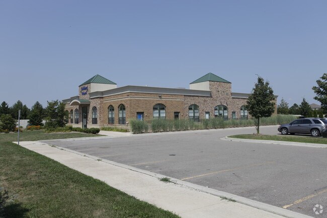
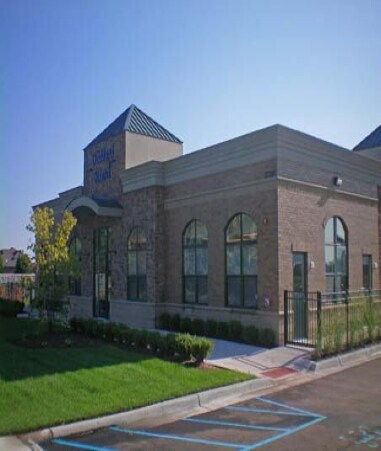
Property Record
53300 Hayes Rd, Macomb, MI 48042

Property Detail
53300 Hayes Rd
20-08-07-300-015
T3N, R13E SEC 7 COMM AT SW COR SEC 7, TH N00*04'23" W 97.91 FT, TH N00*01'56" E 522.84 FT TO POB; TH N00*01'56" E 248.00 FT;
Daycare
Macomb
CF
Michigan
B and X Area of moderate flood hazard, usually the area between the limits of the 100-year and 500-year floods.
1.37 AC
2025
Macomb East
2025
Detroit
223801
Detroit-Warren-Dearborn, MI
8,251 SF
NEARBY LISTINGS FOR SALE OR LEASE
DEMOGRAPHICS near 53300 Hayes Rd
1 mile
3 mile
5 mile
2025 Total Population
10,973
63,953
165,910
2030 Population
11,034
64,851
167,863
Pop Growth 2025-2030
+ 0.56%
+ 1.40%
+ 1.18%
Average Age
43
42
42
2025 Total Households
3,757
22,196
61,781
HH Growth 2025-2030
+ 0.51%
+ 1.19%
+ 1.12%
Median Household Inc
$142,480
$119,282
$101,228
Avg Household Size
2.90
2.90
2.60
2025 Avg HH Vehicles
3.00
2.00
2.00
Median Home Value
$406,701
$390,559
$366,705
Median Year Built
1995
1997
1995
Nearby Places
Map Layers
Map Styles
 Street
 Aerial
Layers
 Traffic
 Biking
Places
Listings with unknown addresses are not visible on the map
- Restaurants
- Banks
- Shops
- Fitness
- Groceries
PUBLIC TRANSPORTATION
AIRPORT
Windsor International
Drive
Walk
Distance
Windsor International
68 min
42.1 mi
Freight Ports
Port of Toledo
Drive
Walk
Distance
Port of Toledo
119 min
92.6 mi
Nearby Properties
Address
Land Use
TOTAL SIZE
Lot Size
Zoning
Address
Land Use
TOTAL SIZE
Lot Size
Zoning
447,434 SF
23.29 AC
LM
Address
Land Use
TOTAL SIZE
Lot Size
Zoning
371,520 SF
21.91 AC
CK MAP
Address
Land Use
TOTAL SIZE
Lot Size
Zoning
89,559 SF
44.54 AC
O2
Address
Land Use
TOTAL SIZE
Lot Size
Zoning
118,343 SF
7.33 AC
R1
Address
Land Use
TOTAL SIZE
Lot Size
Zoning
10.29 AC
LM
Address
Land Use
TOTAL SIZE
Lot Size
Zoning
160,104 SF
22.65 AC
CONSENT-R1
Address
Land Use
TOTAL SIZE
Lot Size
Zoning
90,185 SF
14.73 AC
C2
Address
Land Use
TOTAL SIZE
Lot Size
Zoning
224,323 SF
22.15 AC
C-3
Address
Land Use
TOTAL SIZE
Lot Size
Zoning
73.49 AC
CK MAP
Address
Land Use
TOTAL SIZE
Lot Size
Zoning
79,942 SF
4.65 AC
M1
Address
Land Use
TOTAL SIZE
Lot Size
Zoning
120,658 SF
13.97 AC
C-3
Address
Land Use
TOTAL SIZE
Lot Size
Zoning
8.81 AC
C-6
Address
Land Use
TOTAL SIZE
Lot Size
Zoning
121,156 SF
9.40 AC
CK MAP
Address
Land Use
TOTAL SIZE
Lot Size
Zoning
293,800 SF
M1
Address
Land Use
TOTAL SIZE
Lot Size
Zoning
134,400 SF
7.55 AC
CK MAP
Address
Land Use
TOTAL SIZE
Lot Size
Zoning
108,799 SF
25.03 AC
CONSENT-R1
Address
Land Use
TOTAL SIZE
Lot Size
Zoning
122,540 SF
CK MAP
Address
Land Use
TOTAL SIZE
Lot Size
Zoning
214,282 SF
22.26 AC
M1
Address
Land Use
TOTAL SIZE
Lot Size
Zoning
150,854 SF
8.50 AC
LM
Address
Land Use
TOTAL SIZE
Lot Size
Zoning
148,438 SF
4.82 AC
LM
Address
Land Use
TOTAL SIZE
Lot Size
Zoning
99,619 SF
8.24 AC
M1
Address
Land Use
TOTAL SIZE
Lot Size
Zoning
74,354 SF
10.62 AC
C3
Address
Land Use
TOTAL SIZE
Lot Size
Zoning
312,087 SF
25.65 AC
M1
Address
Land Use
TOTAL SIZE
Lot Size
Zoning
56,766 SF
5.06 AC
C2
Address
Land Use
TOTAL SIZE
Lot Size
Zoning
99,188 SF
7.99 AC
LM
Address
Land Use
TOTAL SIZE
Lot Size
Zoning
104,455 SF
15.28 AC
LM
Address
Land Use
TOTAL SIZE
Lot Size
Zoning
66,693 SF
2.80 AC
CK MAP
Address
Land Use
TOTAL SIZE
Lot Size
Zoning
89,830 SF
CK MAP
Address
Land Use
TOTAL SIZE
Lot Size
Zoning
28,746 SF
10.70 AC
C3
Address
Land Use
TOTAL SIZE
Lot Size
Zoning
50,476 SF
7.53 AC
C-2
The World's #1 Commercial Real Estate Marketplace
Connect with us
© 2026 CoStar Group
The information above has been obtained from sources believed reliable. While we do not doubt its accuracy we have not verified it and make no guarantee, warranty or representation about it. It is your responsibility to independently confirm its accuracy and completeness. Any projections, opinions, assumptions, or estimates used are for example only and do not represent the current or future performance of the property. The value of this transaction to you depends on tax and other factors which should be evaluated by your tax, financial, and legal advisors. You and your advisors should conduct a careful, independent investigation of the property to determine to your satisfaction the suitability of the property for your needs.