Property Record
5331 River Rd, Cincinnati, OH 45233
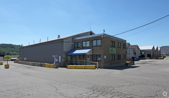

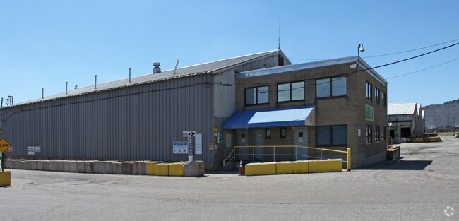
Property Detail
5331 River Rd
162-0001-0009
RIVER RD FT IRR PT LAND ADJ PARS 9-12-14-16-17-26 CON
Industrialgeneral
HAMILTON
RFM
Ohio
AE The base floodplain where base flood elevations are provided. AE Zones are now used on new format FIRMs instead of A1-A30 Zones.
27.49 AC
2025
West
2025
Cincinnati/Dayton
021302
Cincinnati, OH-KY-IN
70,683 SF
NEARBY LISTINGS FOR SALE OR LEASE
DEMOGRAPHICS near 5331 River Rd
1 mile
3 mile
5 mile
2025 Total Population
1,527
40,211
152,800
2030 Population
1,566
40,361
154,981
Pop Growth 2025-2030
+ 2.55%
+ 0.37%
+ 1.43%
Average Age
42
41
39
2025 Total Households
531
15,339
59,231
HH Growth 2025-2030
+ 2.82%
+ 0.38%
+ 1.34%
Median Household Inc
$72,999
$85,014
$70,850
Avg Household Size
2.30
2.50
2.50
2025 Avg HH Vehicles
2.00
2.00
2.00
Median Home Value
$230,124
$220,112
$223,357
Median Year Built
1970
1967
1965
Nearby Places
Map Layers
Map Styles
 Street
 Aerial
Transit
 Traffic
 Biking
Places
Listings with unknown addresses are not visible on the map
- Restaurants
- Banks
- Shops
- Fitness
- Groceries
PUBLIC TRANSPORTATION
COMMUTER RAIL
Cincinnati Union Terminal (Cardinal - Amtrak)
Drive
Walk
Distance
Cincinnati Union Terminal (Cardinal - Amtrak)
16 min
8.6 mi
AIRPORT
Cincinnati/Northern Kentucky International
Drive
Walk
Distance
Cincinnati/Northern Kentucky International
35 min
6.6 mi
Freight Ports
Port of Toledo
Drive
Walk
Distance
Port of Toledo
254 min
213.4 mi
Nearby Properties
Address
Land Use
TOTAL SIZE
Lot Size
Zoning
Address
Land Use
TOTAL SIZE
Lot Size
Zoning
39.05 AC
Address
Land Use
TOTAL SIZE
Lot Size
Zoning
21.76 AC
Address
Land Use
TOTAL SIZE
Lot Size
Zoning
177,092 SF
8.64 AC
Address
Land Use
TOTAL SIZE
Lot Size
Zoning
38.97 AC
Address
Land Use
TOTAL SIZE
Lot Size
Zoning
64,481 SF
16.99 AC
Address
Land Use
TOTAL SIZE
Lot Size
Zoning
3.90 AC
RFC
Address
Land Use
TOTAL SIZE
Lot Size
Zoning
177,200 SF
16.27 AC
Address
Land Use
TOTAL SIZE
Lot Size
Zoning
26.62 AC
Address
Land Use
TOTAL SIZE
Lot Size
Zoning
493,680 SF
25 AC
Address
Land Use
TOTAL SIZE
Lot Size
Zoning
458,800 SF
49.35 AC
Address
Land Use
TOTAL SIZE
Lot Size
Zoning
30.43 AC
AA
Address
Land Use
TOTAL SIZE
Lot Size
Zoning
426,420 SF
20.59 AC
Address
Land Use
TOTAL SIZE
Lot Size
Zoning
396,000 SF
24 AC
Address
Land Use
TOTAL SIZE
Lot Size
Zoning
136,000 SF
20.52 AC
Address
Land Use
TOTAL SIZE
Lot Size
Zoning
15,672 SF
20.74 AC
Address
Land Use
TOTAL SIZE
Lot Size
Zoning
14.89 AC
Address
Land Use
TOTAL SIZE
Lot Size
Zoning
9.50 AC
Address
Land Use
TOTAL SIZE
Lot Size
Zoning
Address
Land Use
TOTAL SIZE
Lot Size
Zoning
8.27 AC
Address
Land Use
TOTAL SIZE
Lot Size
Zoning
276,837 SF
16.79 AC
Address
Land Use
TOTAL SIZE
Lot Size
Zoning
66,040 SF
22.34 AC
Address
Land Use
TOTAL SIZE
Lot Size
Zoning
5.89 AC
Address
Land Use
TOTAL SIZE
Lot Size
Zoning
299,520 SF
19.36 AC
Address
Land Use
TOTAL SIZE
Lot Size
Zoning
316,800 SF
15.66 AC
Address
Land Use
TOTAL SIZE
Lot Size
Zoning
320,000 SF
18.50 AC
Address
Land Use
TOTAL SIZE
Lot Size
Zoning
1,132,632 SF
7.11 AC
Address
Land Use
TOTAL SIZE
Lot Size
Zoning
130,500 SF
11.20 AC
Address
Land Use
TOTAL SIZE
Lot Size
Zoning
19.95 AC
Address
Land Use
TOTAL SIZE
Lot Size
Zoning
217,800 SF
9.22 AC
Address
Land Use
TOTAL SIZE
Lot Size
Zoning
80,520 SF
10.85 AC
The World's #1 Commercial Real Estate Marketplace
Connect with us
© 2026 CoStar Group
The information above has been obtained from sources believed reliable. While we do not doubt its accuracy we have not verified it and make no guarantee, warranty or representation about it. It is your responsibility to independently confirm its accuracy and completeness. Any projections, opinions, assumptions, or estimates used are for example only and do not represent the current or future performance of the property. The value of this transaction to you depends on tax and other factors which should be evaluated by your tax, financial, and legal advisors. You and your advisors should conduct a careful, independent investigation of the property to determine to your satisfaction the suitability of the property for your needs.