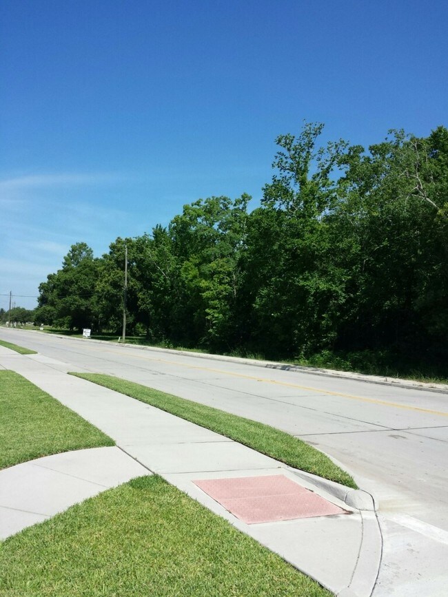
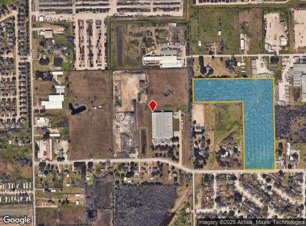
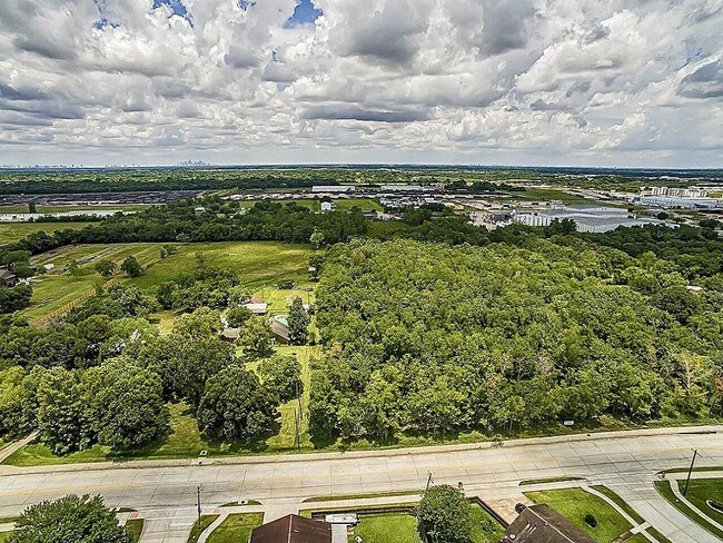
Property Record
5331 W Orange St, Pearland, TX 77581
NEARBY LISTINGS FOR SALE OR LEASE
Property Detail
5331 W Orange St
Houston-The Woodlands-Sugar Land, TX
H T & B R R (Pearland)
0543-0056-110
A0543 H T & B R R (PEARLAND), TRACT 23-30B, ACRES 17.0901
Agriculturalland
Brazoria
X
Texas
48039C0035K
17.09 AC
2024
South
2025
Houston
660503
DEMOGRAPHICS near 5331 W Orange St
1 Mile
3 Mile
5 Mile
2024 Total Population
5,917
58,686
178,112
2029 Population
6,527
64,177
189,908
Pop Growth 2024-2029
+ 10.31%
+ 9.36%
+ 6.62%
Average Age
37
36
37
2024 Total Households
2,044
19,799
58,654
HH Growth 2024-2029
+ 10.42%
+ 9.50%
+ 6.77%
Median Household Inc
$80,573
$91,787
$89,760
Avg Household Size
2.80
2.90
3.00
2024 Avg HH Vehicles
2.00
2.00
2.00
Median Home Value
$235,640
$267,913
$253,366
Median Year Built
1984
1999
1998
Nearby Places
Map Layers
Map Styles
 Street
 Aerial
- Restaurants
- Banks
- Shops
- Fitness
- Groceries
PUBLIC TRANSPORTATION
AIRPORT
William P Hobby
DRIVE
WALK
Distance
William P Hobby
16 min
6.6 mi
George Bush Intcntl/Houston
DRIVE
WALK
Distance
George Bush Intcntl/Houston
52 min
37.3 mi
Freight Ports
Port of Houston
DRIVE
WALK
Distance
Port of Houston
28 min
14.8 mi
SALE & LEASE HISTORY
LISTING DATE
SALE/LEASE

Sep 24, 2016
For Sale
Aug 25, 2017
For Sale
Apr 04, 2017
For Sale
Nearby Properties
Address
Land Use
TOTAL SIZE
Lot Size
Zoning
Address
Land Use
TOTAL SIZE
Lot Size
Zoning
1,226,700 SF
92.85 AC
Address
Land Use
TOTAL SIZE
Lot Size
Zoning
66.85 AC
0047
Address
Land Use
TOTAL SIZE
Lot Size
Zoning
603,780 SF
36.94 AC
Address
Land Use
TOTAL SIZE
Lot Size
Zoning
589,830 SF
47.20 AC
Address
Land Use
TOTAL SIZE
Lot Size
Zoning
359,985 SF
12.56 AC
Address
Land Use
TOTAL SIZE
Lot Size
Zoning
64.56 AC
0016
Address
Land Use
TOTAL SIZE
Lot Size
Zoning
379,071 SF
20.02 AC
Address
Land Use
TOTAL SIZE
Lot Size
Zoning
236,642 SF
11.48 AC
Address
Land Use
TOTAL SIZE
Lot Size
Zoning
309,102 SF
16.81 AC
Address
Land Use
TOTAL SIZE
Lot Size
Zoning
7.42 AC
Address
Land Use
TOTAL SIZE
Lot Size
Zoning
316,800 SF
16.03 AC
Address
Land Use
TOTAL SIZE
Lot Size
Zoning
387,389 SF
21.40 AC
Address
Land Use
TOTAL SIZE
Lot Size
Zoning
128,754 SF
14.83 AC
Address
Land Use
TOTAL SIZE
Lot Size
Zoning
252,472 SF
13.28 AC
Address
Land Use
TOTAL SIZE
Lot Size
Zoning
79.45 AC
1000
Address
Land Use
TOTAL SIZE
Lot Size
Zoning
16,677 SF
12.38 AC
Address
Land Use
TOTAL SIZE
Lot Size
Zoning
72,543 SF
22.64 AC
Address
Land Use
TOTAL SIZE
Lot Size
Zoning
221,401 SF
11 AC
Address
Land Use
TOTAL SIZE
Lot Size
Zoning
14.93 AC
Address
Land Use
TOTAL SIZE
Lot Size
Zoning
65,854 SF
18.96 AC
Address
Land Use
TOTAL SIZE
Lot Size
Zoning
344,782 SF
14.14 AC
Address
Land Use
TOTAL SIZE
Lot Size
Zoning
144,879 SF
8.91 AC
Address
Land Use
TOTAL SIZE
Lot Size
Zoning
285,328 SF
40.75 AC
Address
Land Use
TOTAL SIZE
Lot Size
Zoning
199,360 SF
11.13 AC
Address
Land Use
TOTAL SIZE
Lot Size
Zoning
110,990 SF
18.25 AC
Address
Land Use
TOTAL SIZE
Lot Size
Zoning
161,000 SF
9.82 AC
Address
Land Use
TOTAL SIZE
Lot Size
Zoning
89.23 AC
Address
Land Use
TOTAL SIZE
Lot Size
Zoning
195,856 SF
20.81 AC
Address
Land Use
TOTAL SIZE
Lot Size
Zoning
155,524 SF
7.86 AC
Address
Land Use
TOTAL SIZE
Lot Size
Zoning
148,902 SF
11.40 AC
The World's #1 Commercial Real Estate Marketplace
Connect with us
© 2025 CoStar Group
The information above has been obtained from sources believed reliable. While we do not doubt its accuracy we have not verified it and make no guarantee, warranty or representation about it. It is your responsibility to independently confirm its accuracy and completeness. Any projections, opinions, assumptions, or estimates used are for example only and do not represent the current or future performance of the property. The value of this transaction to you depends on tax and other factors which should be evaluated by your tax, financial, and legal advisors. You and your advisors should conduct a careful, independent investigation of the property to determine to your satisfaction the suitability of the property for your needs.