Property Record
5334 S Prince St, Littleton, CO 80120


NEARBY LISTINGS FOR SALE OR LEASE
Property Detail
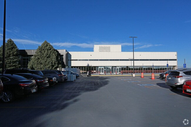
5334 S Prince St
2077-16-2-00-045
Arapahoe Arpt Center Joint Ven
Officebuilding
SECTION 16 TOWNSHIP 05 RANGE 68 THAT PART OF NW 1/4 OF SEC 16-5-68 DESC AS BEG 30 FT E OF NW COR OF SW 1/4 OF SD NW 1/4 TH E 1144.49 FT M/L TH SW 564.74 FT M/L TO A PT ON N ROW LINE OF W CRESTLINE AVE TH WLY ALG SD ROW LINE TO E LINE OF S PRINCE ST T
X
Arapahoe
08005C0432N
Colorado
0
11.35 AC
2024
Southwest Denver
006501
Denver
137,526 SF
Denver-Aurora-Lakewood, CO
DEMOGRAPHICS near 5334 S Prince St
1 Mile
3 Mile
5 Mile
2024 Total Population
13,707
93,377
284,140
2029 Population
13,800
93,609
286,527
Pop Growth 2024-2029
+ 0.68%
+ 0.25%
+ 0.84%
Average Age
41
41
41
2024 Total Households
6,768
39,373
117,053
HH Growth 2024-2029
+ 0.71%
+ 0.27%
+ 1.00%
Median Household Inc
$65,687
$83,752
$91,217
Avg Household Size
1.90
2.30
2.30
2024 Avg HH Vehicles
2.00
2.00
2.00
Median Home Value
$444,948
$553,078
$569,306
Median Year Built
1978
1972
1976
Nearby Places
Map Layers
Map Styles
 Street
 Aerial
- Restaurants
- Banks
- Shops
- Fitness
- Groceries
PUBLIC TRANSPORTATION
TRANSIT/SUBWAY
Littletown-Downtown (C Line - Denver Regional Transportation District Light Rail (TheRide), D Line - Denver Regional Transportation District Light Rail (TheRide))
DRIVE
WALK
Distance
Littletown-Downtown (C Line - Denver Regional Transportation District Light Rail (TheRide), D Line - Denver Regional Transportation District Light Rail (TheRide))
3 min
14 min
0.7 mi
AIRPORT
Denver International
DRIVE
WALK
Distance
Denver International
45 min
32.8 mi
Freight Ports
Tulsa Port Of Catoosa
DRIVE
WALK
Distance
Tulsa Port Of Catoosa
742 min
715.5 mi
Nearby Properties
Address
Land Use
TOTAL SIZE
Lot Size
Zoning
Address
Land Use
TOTAL SIZE
Lot Size
Zoning
665,722 SF
615.85 AC
OS-B
Address
Land Use
TOTAL SIZE
Lot Size
Zoning
248,291 SF
128.77 AC
CMP-H2
Address
Land Use
TOTAL SIZE
Lot Size
Zoning
330,776 SF
48.11 AC
CMP-H2
Address
Land Use
TOTAL SIZE
Lot Size
Zoning
251,583 SF
38.03 AC
Address
Land Use
TOTAL SIZE
Lot Size
Zoning
208,529 SF
34.81 AC
R-5
Address
Land Use
TOTAL SIZE
Lot Size
Zoning
133,908 SF
9.39 AC
LPD-C
Address
Land Use
TOTAL SIZE
Lot Size
Zoning
221,025 SF
8.45 AC
PUD
Address
Land Use
TOTAL SIZE
Lot Size
Zoning
107,159 SF
26.40 AC
Address
Land Use
TOTAL SIZE
Lot Size
Zoning
47.24 AC
Address
Land Use
TOTAL SIZE
Lot Size
Zoning
7,035 SF
12.90 AC
LPD-R
Address
Land Use
TOTAL SIZE
Lot Size
Zoning
110,016 SF
1.29 AC
Address
Land Use
TOTAL SIZE
Lot Size
Zoning
10,260 SF
49.33 AC
CMP-H2
Address
Land Use
TOTAL SIZE
Lot Size
Zoning
250,402 SF
21 AC
Address
Land Use
TOTAL SIZE
Lot Size
Zoning
229,830 SF
11.33 AC
Address
Land Use
TOTAL SIZE
Lot Size
Zoning
206,632 SF
33.68 AC
Address
Land Use
TOTAL SIZE
Lot Size
Zoning
94,367 SF
10.02 AC
R-2
Address
Land Use
TOTAL SIZE
Lot Size
Zoning
39.44 AC
Address
Land Use
TOTAL SIZE
Lot Size
Zoning
157,145 SF
15.70 AC
Address
Land Use
TOTAL SIZE
Lot Size
Zoning
115,056 SF
6.17 AC
CMP-EI2
Address
Land Use
TOTAL SIZE
Lot Size
Zoning
133,594 SF
25.03 AC
Address
Land Use
TOTAL SIZE
Lot Size
Zoning
351,792 SF
16.99 AC
LPD-C
Address
Land Use
TOTAL SIZE
Lot Size
Zoning
227,359 SF
11.31 AC
Address
Land Use
TOTAL SIZE
Lot Size
Zoning
248,058 SF
12.24 AC
Address
Land Use
TOTAL SIZE
Lot Size
Zoning
310,890 SF
16.55 AC
R-2-A
Address
Land Use
TOTAL SIZE
Lot Size
Zoning
146,877 SF
11.52 AC
Address
Land Use
TOTAL SIZE
Lot Size
Zoning
280,912 SF
10.98 AC
Address
Land Use
TOTAL SIZE
Lot Size
Zoning
205,534 SF
10.12 AC
Address
Land Use
TOTAL SIZE
Lot Size
Zoning
195,179 SF
5.54 AC
EI1
Address
Land Use
TOTAL SIZE
Lot Size
Zoning
80,576 SF
11.44 AC
Address
Land Use
TOTAL SIZE
Lot Size
Zoning
68,943 SF
21.70 AC
The World's #1 Commercial Real Estate Marketplace
Connect with us
© 2025 CoStar Group
The information above has been obtained from sources believed reliable. While we do not doubt its accuracy we have not verified it and make no guarantee, warranty or representation about it. It is your responsibility to independently confirm its accuracy and completeness. Any projections, opinions, assumptions, or estimates used are for example only and do not represent the current or future performance of the property. The value of this transaction to you depends on tax and other factors which should be evaluated by your tax, financial, and legal advisors. You and your advisors should conduct a careful, independent investigation of the property to determine to your satisfaction the suitability of the property for your needs.