Property Record
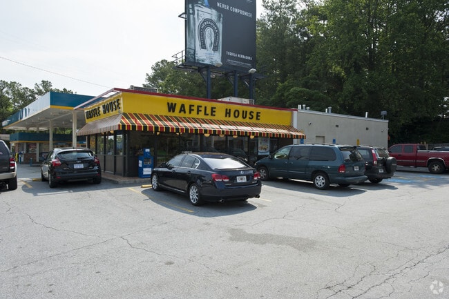
5335 Roswell Rd, Atlanta, GA 30342


NEARBY LISTINGS FOR SALE OR LEASE
Property Detail
5335 Roswell Rd
17-0092-0007-030-3
Alta/Acsm Land Title Surv
Medicalbuilding
Fulton
X
Georgia
13121C0144F
92
2024
0.75 AC
2025
Sandy Spring/N Ctrl
010137
Atlanta
5,583 SF
Atlanta-Sandy Springs-Roswell, GA
DEMOGRAPHICS near 5335 Roswell Rd
1 Mile
3 Mile
5 Mile
2024 Total Population
15,674
77,341
258,726
2029 Population
16,023
79,005
263,063
Pop Growth 2024-2029
+ 2.23%
+ 2.15%
+ 1.68%
Average Age
37
40
39
2024 Total Households
7,032
33,859
120,653
HH Growth 2024-2029
+ 2.47%
+ 2.34%
+ 1.95%
Median Household Inc
$91,220
$125,486
$107,806
Avg Household Size
2.20
2.20
2.10
2024 Avg HH Vehicles
2.00
2.00
2.00
Median Home Value
$715,927
$734,081
$649,735
Median Year Built
1984
1988
1991
Nearby Places
Map Layers
Map Styles
 Street
 Aerial
- Restaurants
- Banks
- Shops
- Fitness
- Groceries
PUBLIC TRANSPORTATION
COMMUTER RAIL
DRIVE
WALK
Distance
14 min
7.5 mi
AIRPORT
Hartsfield - Jackson Atlanta International
DRIVE
WALK
Distance
Hartsfield - Jackson Atlanta International
35 min
23.0 mi
SALE & LEASE HISTORY
LISTING DATE
SALE/LEASE

Jun 21, 2020
For Sale
Nearby Properties
Address
Land Use
TOTAL SIZE
Lot Size
Zoning
Address
Land Use
TOTAL SIZE
Lot Size
Zoning
1,123,714 SF
47.33 AC
C1
Address
Land Use
TOTAL SIZE
Lot Size
Zoning
854,744 SF
2.04 AC
OI
Address
Land Use
TOTAL SIZE
Lot Size
Zoning
374,311 SF
0.19 AC
X
Address
Land Use
TOTAL SIZE
Lot Size
Zoning
216,464 SF
X
Address
Land Use
TOTAL SIZE
Lot Size
Zoning
104,625 SF
0.99 AC
X
Address
Land Use
TOTAL SIZE
Lot Size
Zoning
376,010 SF
3.76 AC
OI
Address
Land Use
TOTAL SIZE
Lot Size
Zoning
543,090 SF
5.51 AC
R2
Address
Land Use
TOTAL SIZE
Lot Size
Zoning
754,619 SF
27.30 AC
RG3C
Address
Land Use
TOTAL SIZE
Lot Size
Zoning
701,195 SF
20.76 AC
X
Address
Land Use
TOTAL SIZE
Lot Size
Zoning
439,052 SF
4.57 AC
OI
Address
Land Use
TOTAL SIZE
Lot Size
Zoning
664,199 SF
2.85 AC
Address
Land Use
TOTAL SIZE
Lot Size
Zoning
937,800 SF
2.65 AC
Address
Land Use
TOTAL SIZE
Lot Size
Zoning
295,885 SF
3.50 AC
X
Address
Land Use
TOTAL SIZE
Lot Size
Zoning
140,183 SF
4.20 AC
OI
Address
Land Use
TOTAL SIZE
Lot Size
Zoning
699,202 SF
13.90 AC
OIC
Address
Land Use
TOTAL SIZE
Lot Size
Zoning
1,088,359 SF
7.07 AC
OIC
Address
Land Use
TOTAL SIZE
Lot Size
Zoning
588,846 SF
3.80 AC
Address
Land Use
TOTAL SIZE
Lot Size
Zoning
912,649 SF
5.21 AC
OIC
Address
Land Use
TOTAL SIZE
Lot Size
Zoning
480,790 SF
5.93 AC
Address
Land Use
TOTAL SIZE
Lot Size
Zoning
106,770 SF
3.13 AC
X
Address
Land Use
TOTAL SIZE
Lot Size
Zoning
572,181 SF
3.76 AC
C1
Address
Land Use
TOTAL SIZE
Lot Size
Zoning
466,569 SF
4.90 AC
A1
Address
Land Use
TOTAL SIZE
Lot Size
Zoning
582,939 SF
5.59 AC
A1
Address
Land Use
TOTAL SIZE
Lot Size
Zoning
478,332 SF
4.07 AC
Address
Land Use
TOTAL SIZE
Lot Size
Zoning
689,759 SF
6.61 AC
A1
Address
Land Use
TOTAL SIZE
Lot Size
Zoning
543,420 SF
4.15 AC
Address
Land Use
TOTAL SIZE
Lot Size
Zoning
1,067,348 SF
6.41 AC
OIC
Address
Land Use
TOTAL SIZE
Lot Size
Zoning
828,002 SF
12.04 AC
R2
Address
Land Use
TOTAL SIZE
Lot Size
Zoning
732,923 SF
2.77 AC
OIC
Address
Land Use
TOTAL SIZE
Lot Size
Zoning
275,745 SF
12.52 AC
OCR
The World's #1 Commercial Real Estate Marketplace
Connect with us
© 2026 CoStar Group
The information above has been obtained from sources believed reliable. While we do not doubt its accuracy we have not verified it and make no guarantee, warranty or representation about it. It is your responsibility to independently confirm its accuracy and completeness. Any projections, opinions, assumptions, or estimates used are for example only and do not represent the current or future performance of the property. The value of this transaction to you depends on tax and other factors which should be evaluated by your tax, financial, and legal advisors. You and your advisors should conduct a careful, independent investigation of the property to determine to your satisfaction the suitability of the property for your needs.