Property Record
534 E Perkins St, Ukiah, CA 95482
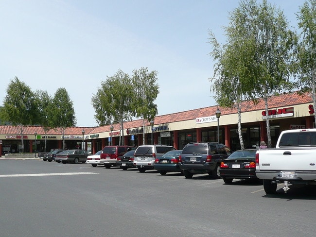


Property Detail
534 E Perkins St
Ukiah, CA
NOW 002-200-43 & 44 PER SURVEY C2 D87 P 64 002-200-41 LEASED TO ALBERTSONS/SAVE MART SUPERMARKETS MORE THAN 35 YEARS EXISTING STORE LEASE LESS THAN 35 YEARS REMAIN ING AT TIME OF PURCHASE TO PEAR TREE RETAIL I LLC RETURN PARCEL BACK TO ORIG
002-200-29
MENDOCINO
Regionalshoppingcenterormallwithanchorstore
California
C and X Area of minimal flood hazard, usually depicted on FIRMs as above the 500-year flood level.
12.25 AC
2024
California North Rural Area
2025
Other Market Areas
011502
NEARBY LISTINGS FOR SALE OR LEASE
DEMOGRAPHICS near 534 E Perkins St
1 mile
3 mile
5 mile
2025 Total Population
11,610
27,044
31,279
2030 Population
11,515
26,769
30,964
Pop Growth 2025-2030
(0.82%)
(1.02%)
(1.01%)
Average Age
40
41
41
2025 Total Households
4,615
10,273
11,756
HH Growth 2025-2030
(0.85%)
(1.04%)
(1.04%)
Median Household Inc
$64,389
$69,767
$69,872
Avg Household Size
2.40
2.50
2.50
2025 Avg HH Vehicles
2.00
2.00
2.00
Median Home Value
$437,644
$494,581
$491,809
Median Year Built
1969
1971
1972
Nearby Places
Map Layers
Map Styles
 Street
 Aerial
Layers
 Traffic
 Biking
Places
Listings with unknown addresses are not visible on the map
- Restaurants
- Banks
- Shops
- Fitness
- Groceries
SALE & LEASE HISTORY
LISTING DATE
SALE/LEASE

Sep 25, 2016
For Lease
Nearby Properties
Address
Land Use
TOTAL SIZE
Lot Size
Zoning
Address
Land Use
TOTAL SIZE
Lot Size
Zoning
6.21 AC
CM
Address
Land Use
TOTAL SIZE
Lot Size
Zoning
Address
Land Use
TOTAL SIZE
Lot Size
Zoning
8.39 AC
Address
Land Use
TOTAL SIZE
Lot Size
Zoning
Address
Land Use
TOTAL SIZE
Lot Size
Zoning
Address
Land Use
TOTAL SIZE
Lot Size
Zoning
31.76 AC
I
Address
Land Use
TOTAL SIZE
Lot Size
Zoning
13.44 AC
PD
Address
Land Use
TOTAL SIZE
Lot Size
Zoning
4.50 AC
C
Address
Land Use
TOTAL SIZE
Lot Size
Zoning
8.75 AC
Address
Land Use
TOTAL SIZE
Lot Size
Zoning
0.89 AC
C1
Address
Land Use
TOTAL SIZE
Lot Size
Zoning
4.12 AC
Address
Land Use
TOTAL SIZE
Lot Size
Zoning
69,689 SF
9 AC
Address
Land Use
TOTAL SIZE
Lot Size
Zoning
1.50 AC
Address
Land Use
TOTAL SIZE
Lot Size
Zoning
1.38 AC
PD
Address
Land Use
TOTAL SIZE
Lot Size
Zoning
20.49 AC
Address
Land Use
TOTAL SIZE
Lot Size
Zoning
3.83 AC
R3
Address
Land Use
TOTAL SIZE
Lot Size
Zoning
2.62 AC
CM
Address
Land Use
TOTAL SIZE
Lot Size
Zoning
4 AC
C
Address
Land Use
TOTAL SIZE
Lot Size
Zoning
4.04 AC
SR
Address
Land Use
TOTAL SIZE
Lot Size
Zoning
2.55 AC
C
Address
Land Use
TOTAL SIZE
Lot Size
Zoning
2.81 AC
Address
Land Use
TOTAL SIZE
Lot Size
Zoning
16.42 AC
R3
Address
Land Use
TOTAL SIZE
Lot Size
Zoning
2.19 AC
C1
Address
Land Use
TOTAL SIZE
Lot Size
Zoning
1.13 AC
C
Address
Land Use
TOTAL SIZE
Lot Size
Zoning
Address
Land Use
TOTAL SIZE
Lot Size
Zoning
5 AC
I2
Address
Land Use
TOTAL SIZE
Lot Size
Zoning
5.14 AC
C
Address
Land Use
TOTAL SIZE
Lot Size
Zoning
The World's #1 Commercial Real Estate Marketplace
Connect with us
© 2026 CoStar Group
The information above has been obtained from sources believed reliable. While we do not doubt its accuracy we have not verified it and make no guarantee, warranty or representation about it. It is your responsibility to independently confirm its accuracy and completeness. Any projections, opinions, assumptions, or estimates used are for example only and do not represent the current or future performance of the property. The value of this transaction to you depends on tax and other factors which should be evaluated by your tax, financial, and legal advisors. You and your advisors should conduct a careful, independent investigation of the property to determine to your satisfaction the suitability of the property for your needs.