Property Record
5343 E Seneca St, Vernon, NY 13476


Property Detail
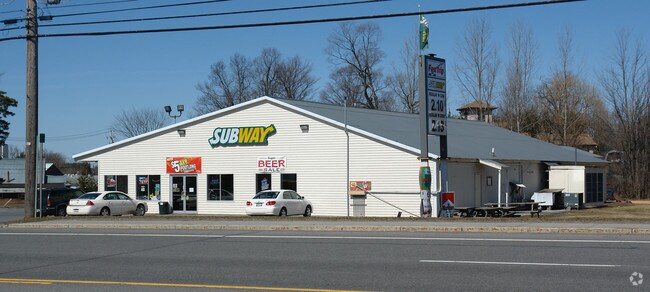
5343 E Seneca St
324-009-0001-005-000-0000
STORE (FOODLAND)
Supermarket
ONEIDA
01 - NOT Z
New York
B and X Area of moderate flood hazard, usually the area between the limits of the 100-year and 500-year floods.
5.000
2025
0.74 AC
2025
Outlying Oneida County
024900
Utica/Rome
3,000 SF
Utica-Rome, NY
NEARBY LISTINGS FOR SALE OR LEASE
-
-
View all Vernon listings for sale on LoopNet.com
DEMOGRAPHICS near 5343 E Seneca St
1 mile
3 mile
5 mile
2025 Total Population
1,008
3,422
11,481
2030 Population
946
3,317
11,253
Pop Growth 2025-2030
(6.15%)
(3.07%)
(1.99%)
Average Age
42
43
44
2025 Total Households
442
1,443
4,800
HH Growth 2025-2030
(6.56%)
(3.40%)
(2.19%)
Median Household Inc
$57,352
$63,414
$78,921
Avg Household Size
2.20
2.40
2.40
2025 Avg HH Vehicles
2.00
2.00
2.00
Median Home Value
$175,567
$187,844
$211,600
Median Year Built
1947
1952
1958
Nearby Places
Map Layers
Map Styles
 Street
 Aerial
Layers
 Traffic
 Biking
Places
Listings with unknown addresses are not visible on the map
- Restaurants
- Banks
- Shops
- Fitness
- Groceries
PUBLIC TRANSPORTATION
AIRPORT
Syracuse Hancock International
Drive
Walk
Distance
Syracuse Hancock International
53 min
40.4 mi
Nearby Properties
Address
Land Use
TOTAL SIZE
Lot Size
Zoning
Address
Land Use
TOTAL SIZE
Lot Size
Zoning
179,325 SF
131.08 AC
01 - NOT Z
Address
Land Use
TOTAL SIZE
Lot Size
Zoning
6,000 SF
123.32 AC
Address
Land Use
TOTAL SIZE
Lot Size
Zoning
133,580 SF
01 - NOT Z
Address
Land Use
TOTAL SIZE
Lot Size
Zoning
159.97 AC
Address
Land Use
TOTAL SIZE
Lot Size
Zoning
42,454 SF
12.07 AC
01 - NOT Z
Address
Land Use
TOTAL SIZE
Lot Size
Zoning
32,956 SF
23.95 AC
01 - NOT Z
Address
Land Use
TOTAL SIZE
Lot Size
Zoning
53.30 AC
Address
Land Use
TOTAL SIZE
Lot Size
Zoning
15,752 SF
9.12 AC
Address
Land Use
TOTAL SIZE
Lot Size
Zoning
15,752 SF
9.12 AC
Address
Land Use
TOTAL SIZE
Lot Size
Zoning
38.70 AC
01 - NOT Z
Address
Land Use
TOTAL SIZE
Lot Size
Zoning
34.86 AC
01 - NOT Z
Address
Land Use
TOTAL SIZE
Lot Size
Zoning
81,228 SF
19.48 AC
01 - NOT Z
Address
Land Use
TOTAL SIZE
Lot Size
Zoning
40,312 SF
1 AC
01 - NOT Z
Address
Land Use
TOTAL SIZE
Lot Size
Zoning
30.49 AC
01 - NOT Z
Address
Land Use
TOTAL SIZE
Lot Size
Zoning
Address
Land Use
TOTAL SIZE
Lot Size
Zoning
5,024 SF
2.65 AC
01 - NOT Z
Address
Land Use
TOTAL SIZE
Lot Size
Zoning
5,024 SF
2.65 AC
01 - NOT Z
Address
Land Use
TOTAL SIZE
Lot Size
Zoning
9,980 SF
6.40 AC
01 - NOT Z
Address
Land Use
TOTAL SIZE
Lot Size
Zoning
14,889 SF
1.81 AC
05 - COMME
Address
Land Use
TOTAL SIZE
Lot Size
Zoning
2,320 SF
231.76 AC
01 - NOT Z
Address
Land Use
TOTAL SIZE
Lot Size
Zoning
31,150 SF
2.30 AC
01 - NOT Z
Address
Land Use
TOTAL SIZE
Lot Size
Zoning
9,200 SF
2.17 AC
Address
Land Use
TOTAL SIZE
Lot Size
Zoning
9,200 SF
2.17 AC
Address
Land Use
TOTAL SIZE
Lot Size
Zoning
9,405 SF
01 - NOT Z
Address
Land Use
TOTAL SIZE
Lot Size
Zoning
22,434 SF
8.90 AC
01 - NOT Z
Address
Land Use
TOTAL SIZE
Lot Size
Zoning
21,264 SF
2.52 AC
01 - NOT Z
Address
Land Use
TOTAL SIZE
Lot Size
Zoning
5,200 SF
1.27 AC
01 - NOT Z
Address
Land Use
TOTAL SIZE
Lot Size
Zoning
2,918 SF
0.77 AC
01 - NOT Z
Address
Land Use
TOTAL SIZE
Lot Size
Zoning
7,000 SF
16.06 AC
01 - NOT Z
Address
Land Use
TOTAL SIZE
Lot Size
Zoning
1.25 AC
The World's #1 Commercial Real Estate Marketplace
Connect with us
© 2026 CoStar Group
The information above has been obtained from sources believed reliable. While we do not doubt its accuracy we have not verified it and make no guarantee, warranty or representation about it. It is your responsibility to independently confirm its accuracy and completeness. Any projections, opinions, assumptions, or estimates used are for example only and do not represent the current or future performance of the property. The value of this transaction to you depends on tax and other factors which should be evaluated by your tax, financial, and legal advisors. You and your advisors should conduct a careful, independent investigation of the property to determine to your satisfaction the suitability of the property for your needs.