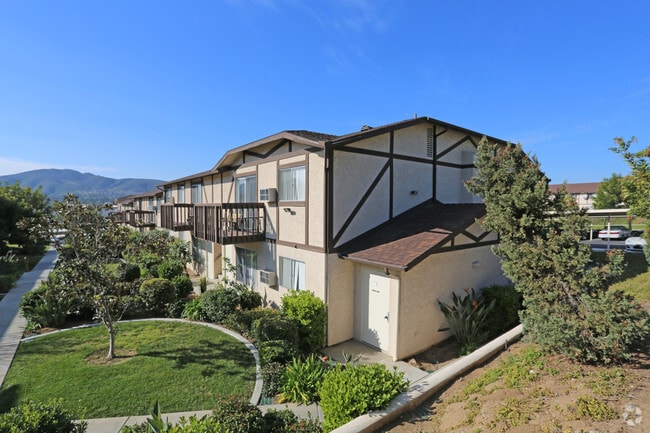
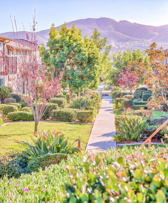
Property Record
535 Autumn Dr, San Marcos, CA 92069

Property Detail
535 Autumn Dr
San Diego-Chula Vista-Carlsbad, CA
PAR A TR PM14425
220-120-15
San Diego
Multifamilydwelling
California
R-3-10
9
B and X Area of moderate flood hazard, usually the area between the limits of the 100-year and 500-year floods.
10.89 AC
2025
San Marcos
2025
San Diego
020028
NEARBY LISTINGS FOR SALE OR LEASE
DEMOGRAPHICS near 535 Autumn Dr
1 mile
3 mile
5 mile
2025 Total Population
15,971
94,517
202,655
2030 Population
16,157
94,910
203,360
Pop Growth 2025-2030
+ 1.16%
+ 0.42%
+ 0.35%
Average Age
33
39
40
2025 Total Households
4,952
31,135
69,233
HH Growth 2025-2030
+ 1.05%
+ 0.42%
+ 0.24%
Median Household Inc
$80,576
$103,423
$110,608
Avg Household Size
3.10
2.90
2.80
2025 Avg HH Vehicles
2.00
2.00
2.00
Median Home Value
$780,780
$808,396
$842,309
Median Year Built
1991
1989
1987
Nearby Places
Map Layers
Map Styles
 Street
 Aerial
Layers
 Traffic
 Biking
Places
Listings with unknown addresses are not visible on the map
- Restaurants
- Banks
- Shops
- Fitness
- Groceries
PUBLIC TRANSPORTATION
TRANSIT/SUBWAY
Palomar College (Sprinter - San Diego North County Transit District (Coaster/Sprinter/Breeze))
Drive
Walk
Distance
Palomar College (Sprinter - San Diego North County Transit District (Coaster/Sprinter/Breeze))
1 min
15 min
0.8 mi
San Marcos Civic Center (Sprinter - San Diego North County Transit District (Coaster/Sprinter/Breeze))
Drive
Walk
Distance
San Marcos Civic Center (Sprinter - San Diego North County Transit District (Coaster/Sprinter/Breeze))
1 min
15 min
0.8 mi
AIRPORT
San Diego International
Drive
Walk
Distance
San Diego International
46 min
35.7 mi
Freight Ports
Port of San Diego
Drive
Walk
Distance
Port of San Diego
49 min
37.9 mi
Nearby Properties
Address
Land Use
TOTAL SIZE
Lot Size
Zoning
Address
Land Use
TOTAL SIZE
Lot Size
Zoning
27.98 AC
SPA
Address
Land Use
TOTAL SIZE
Lot Size
Zoning
9,999 SF
15.37 AC
SPA
Address
Land Use
TOTAL SIZE
Lot Size
Zoning
5.25 AC
SPA
Address
Land Use
TOTAL SIZE
Lot Size
Zoning
5.37 AC
SPA
Address
Land Use
TOTAL SIZE
Lot Size
Zoning
10.82 AC
SPA
Address
Land Use
TOTAL SIZE
Lot Size
Zoning
11.87 AC
R-M
Address
Land Use
TOTAL SIZE
Lot Size
Zoning
9.41 AC
SPI
Address
Land Use
TOTAL SIZE
Lot Size
Zoning
16.91 AC
C
Address
Land Use
TOTAL SIZE
Lot Size
Zoning
11.08 AC
SPI
Address
Land Use
TOTAL SIZE
Lot Size
Zoning
9.88 AC
R-3-10
Address
Land Use
TOTAL SIZE
Lot Size
Zoning
SPECIFIC P
Address
Land Use
TOTAL SIZE
Lot Size
Zoning
4.76 AC
C34
Address
Land Use
TOTAL SIZE
Lot Size
Zoning
9.80 AC
I
Address
Land Use
TOTAL SIZE
Lot Size
Zoning
10.80 AC
SPA
Address
Land Use
TOTAL SIZE
Lot Size
Zoning
1.94 AC
C
Address
Land Use
TOTAL SIZE
Lot Size
Zoning
9.99 AC
MU-1
Address
Land Use
TOTAL SIZE
Lot Size
Zoning
4.65 AC
SPI
Address
Land Use
TOTAL SIZE
Lot Size
Zoning
1.49 AC
SPA
Address
Land Use
TOTAL SIZE
Lot Size
Zoning
5.85 AC
SPA
Address
Land Use
TOTAL SIZE
Lot Size
Zoning
9.75 AC
RU
Address
Land Use
TOTAL SIZE
Lot Size
Zoning
7.06 AC
SR
Address
Land Use
TOTAL SIZE
Lot Size
Zoning
95,713 SF
0.51 AC
C
Address
Land Use
TOTAL SIZE
Lot Size
Zoning
10.69 AC
R-3-10
Address
Land Use
TOTAL SIZE
Lot Size
Zoning
16.12 AC
SPA
Address
Land Use
TOTAL SIZE
Lot Size
Zoning
96,747 SF
3.34 AC
SPA
Address
Land Use
TOTAL SIZE
Lot Size
Zoning
4.79 AC
SR
Address
Land Use
TOTAL SIZE
Lot Size
Zoning
91,354 SF
2.66 AC
SPA
Address
Land Use
TOTAL SIZE
Lot Size
Zoning
99,500 SF
4.57 AC
SPA
Address
Land Use
TOTAL SIZE
Lot Size
Zoning
6.16 AC
SPA
Address
Land Use
TOTAL SIZE
Lot Size
Zoning
8.52 AC
R-2
The World's #1 Commercial Real Estate Marketplace
Connect with us
© 2026 CoStar Group
The information above has been obtained from sources believed reliable. While we do not doubt its accuracy we have not verified it and make no guarantee, warranty or representation about it. It is your responsibility to independently confirm its accuracy and completeness. Any projections, opinions, assumptions, or estimates used are for example only and do not represent the current or future performance of the property. The value of this transaction to you depends on tax and other factors which should be evaluated by your tax, financial, and legal advisors. You and your advisors should conduct a careful, independent investigation of the property to determine to your satisfaction the suitability of the property for your needs.