Property Record
535 E Eads Pky, Greendale, IN 47025


Property Detail
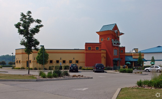
535 E Eads Pky
Cincinnati, OH-KY-IN
10-45 PT 11-5-1 1.766A
15-07-11-600-020.002-016
Dearborn
Restaurantbuilding
Indiana
2025
1.77 AC
2025
Dearborn County
080302
Cincinnati/Dayton
5,730 SF
NEARBY LISTINGS FOR SALE OR LEASE
-
-
View all Greendale listings for lease on LoopNet.com
DEMOGRAPHICS near 535 E Eads Pky
1 mile
3 mile
5 mile
2025 Total Population
3,653
11,434
23,683
2030 Population
3,703
11,672
24,150
Pop Growth 2025-2030
+ 1.37%
+ 2.08%
+ 1.97%
Average Age
40
41
41
2025 Total Households
1,538
4,656
9,286
HH Growth 2025-2030
+ 1.43%
+ 2.15%
+ 2.02%
Median Household Inc
$72,890
$68,720
$78,964
Avg Household Size
2.30
2.30
2.50
2025 Avg HH Vehicles
2.00
2.00
2.00
Median Home Value
$176,714
$204,566
$229,471
Median Year Built
1950
1973
1977
Nearby Places
Map Layers
Map Styles
 Street
 Aerial
Layers
 Traffic
 Biking
Places
Listings with unknown addresses are not visible on the map
- Restaurants
- Banks
- Shops
- Fitness
- Groceries
PUBLIC TRANSPORTATION
AIRPORT
Cincinnati/Northern Kentucky International
Drive
Walk
Distance
Cincinnati/Northern Kentucky International
30 min
17.8 mi
Freight Ports
Port of Toledo
Drive
Walk
Distance
Port of Toledo
256 min
219.8 mi
SALE & LEASE HISTORY
LISTING DATE
SALE/LEASE

May 24, 2023
For Sale
Jul 19, 2023
For Lease
Nearby Properties
Address
Land Use
TOTAL SIZE
Lot Size
Zoning
Address
Land Use
TOTAL SIZE
Lot Size
Zoning
491,407 SF
10.84 AC
Address
Land Use
TOTAL SIZE
Lot Size
Zoning
1,712 SF
Address
Land Use
TOTAL SIZE
Lot Size
Zoning
255,203 SF
3.04 AC
Address
Land Use
TOTAL SIZE
Lot Size
Zoning
2.08 AC
Address
Land Use
TOTAL SIZE
Lot Size
Zoning
2.10 AC
G
Address
Land Use
TOTAL SIZE
Lot Size
Zoning
24,487 SF
9.29 AC
Address
Land Use
TOTAL SIZE
Lot Size
Zoning
205,455 SF
20.32 AC
Address
Land Use
TOTAL SIZE
Lot Size
Zoning
12,000 SF
61.29 AC
Address
Land Use
TOTAL SIZE
Lot Size
Zoning
60,868 SF
8.90 AC
Address
Land Use
TOTAL SIZE
Lot Size
Zoning
7,180 SF
16 AC
Address
Land Use
TOTAL SIZE
Lot Size
Zoning
3.30 AC
Address
Land Use
TOTAL SIZE
Lot Size
Zoning
43,895 SF
59.12 AC
Address
Land Use
TOTAL SIZE
Lot Size
Zoning
18,114 SF
18.96 AC
Address
Land Use
TOTAL SIZE
Lot Size
Zoning
111,861 SF
11.72 AC
Address
Land Use
TOTAL SIZE
Lot Size
Zoning
38,583 SF
11.23 AC
Address
Land Use
TOTAL SIZE
Lot Size
Zoning
68,146 SF
7.06 AC
Address
Land Use
TOTAL SIZE
Lot Size
Zoning
63,980 SF
10.50 AC
Address
Land Use
TOTAL SIZE
Lot Size
Zoning
10.96 AC
Address
Land Use
TOTAL SIZE
Lot Size
Zoning
35,018 SF
4 AC
Address
Land Use
TOTAL SIZE
Lot Size
Zoning
94,974 SF
8.06 AC
Address
Land Use
TOTAL SIZE
Lot Size
Zoning
1,868 SF
441.70 AC
Address
Land Use
TOTAL SIZE
Lot Size
Zoning
19,377 SF
6 AC
Address
Land Use
TOTAL SIZE
Lot Size
Zoning
32,169 SF
5.49 AC
Address
Land Use
TOTAL SIZE
Lot Size
Zoning
69,075 SF
3.10 AC
Address
Land Use
TOTAL SIZE
Lot Size
Zoning
43,920 SF
11.46 AC
Address
Land Use
TOTAL SIZE
Lot Size
Zoning
2,853 SF
9 AC
Address
Land Use
TOTAL SIZE
Lot Size
Zoning
40,872 SF
1.31 AC
Address
Land Use
TOTAL SIZE
Lot Size
Zoning
7,236 SF
6.97 AC
Address
Land Use
TOTAL SIZE
Lot Size
Zoning
222,717 SF
9.94 AC
Address
Land Use
TOTAL SIZE
Lot Size
Zoning
40,400 SF
10.74 AC
The World's #1 Commercial Real Estate Marketplace
Connect with us
© 2026 CoStar Group
The information above has been obtained from sources believed reliable. While we do not doubt its accuracy we have not verified it and make no guarantee, warranty or representation about it. It is your responsibility to independently confirm its accuracy and completeness. Any projections, opinions, assumptions, or estimates used are for example only and do not represent the current or future performance of the property. The value of this transaction to you depends on tax and other factors which should be evaluated by your tax, financial, and legal advisors. You and your advisors should conduct a careful, independent investigation of the property to determine to your satisfaction the suitability of the property for your needs.