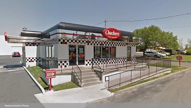
Property Record
535 N State Highway H St, Sikeston, MO 63801

NEARBY LISTINGS FOR SALE OR LEASE
Property Detail
535 N State Highway H St
Sikeston, MO
Tannerland Subd
18-4.0-19.00-004-006-001.00
LOT 1 P & J MARKETING ADDN SIKESTON PB 2019/4187 223.23 X 260.14 I
Storebuilding
Scott
X
Missouri
29201C0314D
1
2024
1.33 AC
2025
Missouri South Area
780600
Other Market Areas
4,824 SF
DEMOGRAPHICS near 535 N State Highway H St
1 Mile
3 Mile
5 Mile
2024 Total Population
6,218
17,584
20,827
2029 Population
6,186
17,488
20,706
Pop Growth 2024-2029
(0.51%)
(0.55%)
(0.58%)
Average Age
40
40
40
2024 Total Households
2,680
7,199
8,495
HH Growth 2024-2029
(0.49%)
(0.58%)
(0.61%)
Median Household Inc
$43,577
$47,707
$49,938
Avg Household Size
2.20
2.30
2.40
2024 Avg HH Vehicles
2.00
2.00
2.00
Median Home Value
$139,435
$128,601
$129,567
Median Year Built
1971
1976
1977
Nearby Places
Map Layers
Map Styles
 Street
 Aerial
- Restaurants
- Banks
- Shops
- Fitness
- Groceries
SALE & LEASE HISTORY
LISTING DATE
SALE/LEASE

Sep 21, 2022
For Sale
Nearby Properties
Address
Land Use
TOTAL SIZE
Lot Size
Zoning
Address
Land Use
TOTAL SIZE
Lot Size
Zoning
2.35 AC
Address
Land Use
TOTAL SIZE
Lot Size
Zoning
130,737 SF
20.47 AC
Address
Land Use
TOTAL SIZE
Lot Size
Zoning
122,545 SF
13.22 AC
Address
Land Use
TOTAL SIZE
Lot Size
Zoning
4.39 AC
Address
Land Use
TOTAL SIZE
Lot Size
Zoning
2.70 AC
Address
Land Use
TOTAL SIZE
Lot Size
Zoning
173,997 SF
25.02 AC
Address
Land Use
TOTAL SIZE
Lot Size
Zoning
2.64 AC
Address
Land Use
TOTAL SIZE
Lot Size
Zoning
154,901 SF
11.22 AC
Address
Land Use
TOTAL SIZE
Lot Size
Zoning
2,199,266 SF
11.30 AC
Address
Land Use
TOTAL SIZE
Lot Size
Zoning
Address
Land Use
TOTAL SIZE
Lot Size
Zoning
13,078 SF
1.54 AC
Address
Land Use
TOTAL SIZE
Lot Size
Zoning
9.78 AC
Address
Land Use
TOTAL SIZE
Lot Size
Zoning
11,376 SF
1.19 AC
Address
Land Use
TOTAL SIZE
Lot Size
Zoning
15,140 SF
2.20 AC
Address
Land Use
TOTAL SIZE
Lot Size
Zoning
30,350 SF
4.29 AC
Address
Land Use
TOTAL SIZE
Lot Size
Zoning
30,150 SF
5 AC
Address
Land Use
TOTAL SIZE
Lot Size
Zoning
31,804 SF
2.53 AC
Address
Land Use
TOTAL SIZE
Lot Size
Zoning
17,613 SF
7.14 AC
Address
Land Use
TOTAL SIZE
Lot Size
Zoning
91,059 SF
9 AC
Address
Land Use
TOTAL SIZE
Lot Size
Zoning
32,400 SF
7.01 AC
Address
Land Use
TOTAL SIZE
Lot Size
Zoning
12,294 SF
2.04 AC
Address
Land Use
TOTAL SIZE
Lot Size
Zoning
210,000 SF
32.77 AC
Address
Land Use
TOTAL SIZE
Lot Size
Zoning
5,856 SF
1.59 AC
Address
Land Use
TOTAL SIZE
Lot Size
Zoning
34,721 SF
4.53 AC
Address
Land Use
TOTAL SIZE
Lot Size
Zoning
14,866 SF
1.52 AC
Address
Land Use
TOTAL SIZE
Lot Size
Zoning
2.55 AC
Address
Land Use
TOTAL SIZE
Lot Size
Zoning
6,887 SF
3.30 AC
Address
Land Use
TOTAL SIZE
Lot Size
Zoning
40,144 SF
10.10 AC
Address
Land Use
TOTAL SIZE
Lot Size
Zoning
1,080 SF
5.41 AC
Address
Land Use
TOTAL SIZE
Lot Size
Zoning
3,822 SF
4.35 AC
The World's #1 Commercial Real Estate Marketplace
Connect with us
© 2026 CoStar Group
The information above has been obtained from sources believed reliable. While we do not doubt its accuracy we have not verified it and make no guarantee, warranty or representation about it. It is your responsibility to independently confirm its accuracy and completeness. Any projections, opinions, assumptions, or estimates used are for example only and do not represent the current or future performance of the property. The value of this transaction to you depends on tax and other factors which should be evaluated by your tax, financial, and legal advisors. You and your advisors should conduct a careful, independent investigation of the property to determine to your satisfaction the suitability of the property for your needs.