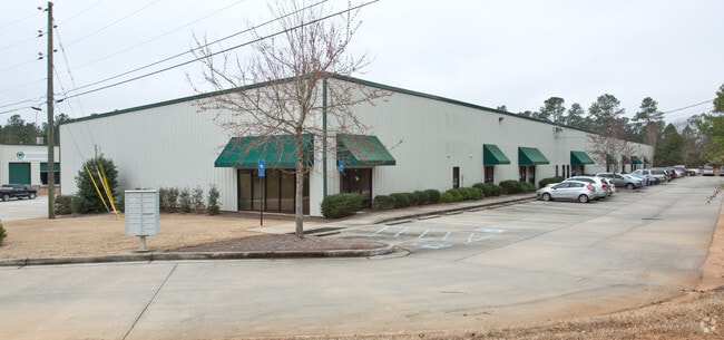
Property Record
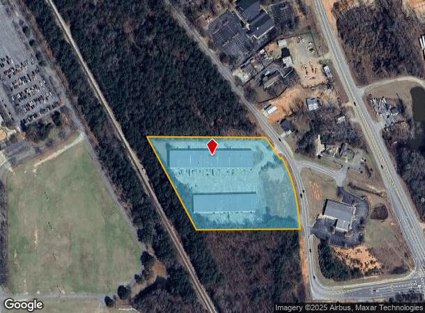
535 Pine Rd, Newnan, GA 30263
NEARBY LISTINGS FOR SALE OR LEASE
Property Detail
535 Pine Rd
Atlanta-Sandy Springs-Roswell, GA
Tg Ayres
076-2072-007
2 BUILDING/5.556AC LL72 2LD PINE RD
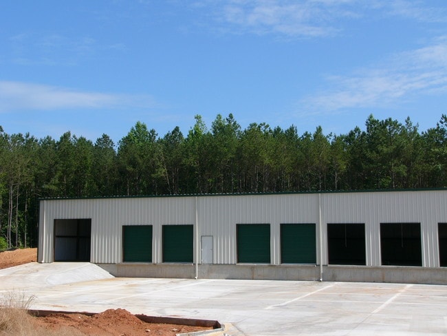
Warehouse
Coweta
X
Georgia
13077C0233D
72
2025
5.56 AC
2025
Fayette/Coweta County
170801
Atlanta
56,160 SF
DEMOGRAPHICS near 535 Pine Rd
1 mile
3 mile
5 mile
2024 Total Population
293
14,960
55,338
2029 Population
332
16,887
61,881
Pop Growth 2024-2029
+ 13.31%
+ 12.88%
+ 11.82%
Average Age
39
37
38
2024 Total Households
109
5,618
21,267
HH Growth 2024-2029
+ 12.84%
+ 12.90%
+ 11.85%
Median Household Inc
$49,999
$62,140
$73,391
Avg Household Size
2.60
2.60
2.60
2024 Avg HH Vehicles
2.00
2.00
2.00
Median Home Value
$225,000
$241,188
$261,880
Median Year Built
1985
1991
1999
Nearby Places
Map Layers
Map Styles
 Street
 Aerial
Transit
 Traffic
 Biking
Places
Listings with unknown addresses are not visible on the map
- Restaurants
- Banks
- Shops
- Fitness
- Groceries
PUBLIC TRANSPORTATION
AIRPORT
Hartsfield - Jackson Atlanta International
Drive
Walk
Distance
Hartsfield - Jackson Atlanta International
45 min
35.2 mi
Freight Ports
Port of Panama City
Drive
Walk
Distance
Port of Panama City
307 min
251.7 mi
SALE & LEASE HISTORY
LISTING DATE
SALE/LEASE

Nov 12, 2024
For Lease
Jul 25, 2022
For Lease
Nearby Properties
Address
Land Use
TOTAL SIZE
Lot Size
Zoning
Address
Land Use
TOTAL SIZE
Lot Size
Zoning
409,449 SF
93.83 AC
R1
Address
Land Use
TOTAL SIZE
Lot Size
Zoning
1,514,040 SF
147.92 AC
C1
Address
Land Use
TOTAL SIZE
Lot Size
Zoning
1,396,640 SF
78.52 AC
C1
Address
Land Use
TOTAL SIZE
Lot Size
Zoning
1,002,450 SF
62.54 AC
R1
Address
Land Use
TOTAL SIZE
Lot Size
Zoning
340,087 SF
24.91 AC
R1
Address
Land Use
TOTAL SIZE
Lot Size
Zoning
562,800 SF
34.39 AC
R1
Address
Land Use
TOTAL SIZE
Lot Size
Zoning
205,636 SF
32 AC
R1
Address
Land Use
TOTAL SIZE
Lot Size
Zoning
1,432 SF
324.32 AC
R1
Address
Land Use
TOTAL SIZE
Lot Size
Zoning
208,524 SF
19.59 AC
R2
Address
Land Use
TOTAL SIZE
Lot Size
Zoning
274,787 SF
31.66 AC
001
Address
Land Use
TOTAL SIZE
Lot Size
Zoning
113,618 SF
0.88 AC
R1
Address
Land Use
TOTAL SIZE
Lot Size
Zoning
99,789 SF
0.88 AC
R1
Address
Land Use
TOTAL SIZE
Lot Size
Zoning
121,224 SF
15.94 AC
R2
Address
Land Use
TOTAL SIZE
Lot Size
Zoning
271,408 SF
30.33 AC
R1
Address
Land Use
TOTAL SIZE
Lot Size
Zoning
237,975 SF
20 AC
C1
Address
Land Use
TOTAL SIZE
Lot Size
Zoning
118,282 SF
4.85 AC
C2
Address
Land Use
TOTAL SIZE
Lot Size
Zoning
124,120 SF
30.64 AC
001
Address
Land Use
TOTAL SIZE
Lot Size
Zoning
131,836 SF
16.01 AC
R2
Address
Land Use
TOTAL SIZE
Lot Size
Zoning
135,456 SF
7.28 AC
R1
Address
Land Use
TOTAL SIZE
Lot Size
Zoning
42,672 SF
5.32 AC
R1
Address
Land Use
TOTAL SIZE
Lot Size
Zoning
42,672 SF
3.95 AC
R1
Address
Land Use
TOTAL SIZE
Lot Size
Zoning
42,670 SF
129 AC
R1
Address
Land Use
TOTAL SIZE
Lot Size
Zoning
42,672 SF
3.30 AC
R1
Address
Land Use
TOTAL SIZE
Lot Size
Zoning
58,839 SF
11.31 AC
R1
Address
Land Use
TOTAL SIZE
Lot Size
Zoning
112,444 SF
15.27 AC
R2
Address
Land Use
TOTAL SIZE
Lot Size
Zoning
166,314 SF
15 AC
R2
Address
Land Use
TOTAL SIZE
Lot Size
Zoning
2,544 SF
409.94 AC
R1
Address
Land Use
TOTAL SIZE
Lot Size
Zoning
43,005 SF
854 AC
R1
The World's #1 Commercial Real Estate Marketplace
Connect with us
© 2026 CoStar Group
The information above has been obtained from sources believed reliable. While we do not doubt its accuracy we have not verified it and make no guarantee, warranty or representation about it. It is your responsibility to independently confirm its accuracy and completeness. Any projections, opinions, assumptions, or estimates used are for example only and do not represent the current or future performance of the property. The value of this transaction to you depends on tax and other factors which should be evaluated by your tax, financial, and legal advisors. You and your advisors should conduct a careful, independent investigation of the property to determine to your satisfaction the suitability of the property for your needs.