Property Record
5350 E Franklin Rd, Nampa, ID 83687
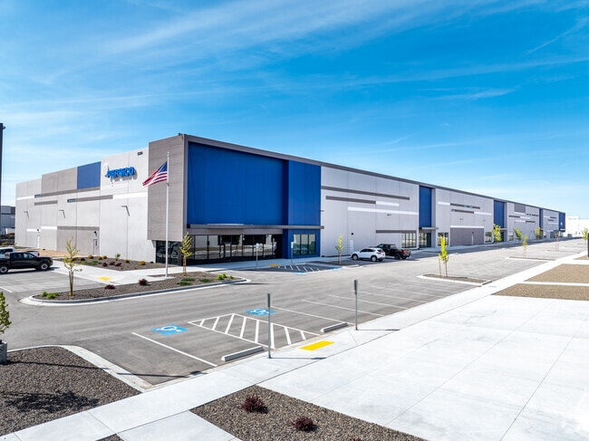


Property Detail
5350 E Franklin Rd
3040600000
07-3N-1W SE TX 21535 IN SE LS ROW
Industrialgeneral
CANYON
M1
Idaho
B and X Area of moderate flood hazard, usually the area between the limits of the 100-year and 500-year floods.
33.22 AC
2024
Nampa
2025
Boise City/Nampa
021104
Boise City, ID
NEARBY LISTINGS FOR SALE OR LEASE
DEMOGRAPHICS near 5350 E Franklin Rd
1 mile
3 mile
5 mile
2025 Total Population
2,348
34,147
128,869
2030 Population
2,676
38,006
140,955
Pop Growth 2025-2030
+ 13.97%
+ 11.30%
+ 9.38%
Average Age
41
38
38
2025 Total Households
810
11,879
45,409
HH Growth 2025-2030
+ 14.44%
+ 11.59%
+ 9.72%
Median Household Inc
$73,124
$79,190
$78,525
Avg Household Size
2.80
2.80
2.80
2025 Avg HH Vehicles
3.00
2.00
2.00
Median Home Value
$578,704
$427,303
$419,475
Median Year Built
2003
2003
1999
Nearby Places
Map Layers
Map Styles
 Street
 Aerial
Layers
 Traffic
 Biking
Places
Listings with unknown addresses are not visible on the map
- Restaurants
- Banks
- Shops
- Fitness
- Groceries
PUBLIC TRANSPORTATION
AIRPORT
Boise Air Trml/Gowen Field
Drive
Walk
Distance
Boise Air Trml/Gowen Field
38 min
19.9 mi
Freight Ports
Port of Portland
Drive
Walk
Distance
Port of Portland
461 min
417.8 mi
SALE & LEASE HISTORY
LISTING DATE
SALE/LEASE

Jun 15, 2021
For Lease
Nearby Properties
Address
Land Use
TOTAL SIZE
Lot Size
Zoning
Address
Land Use
TOTAL SIZE
Lot Size
Zoning
61.03 AC
Address
Land Use
TOTAL SIZE
Lot Size
Zoning
52,235 SF
16.19 AC
Address
Land Use
TOTAL SIZE
Lot Size
Zoning
28.03 AC
M1
Address
Land Use
TOTAL SIZE
Lot Size
Zoning
239,139 SF
38.34 AC
M1
Address
Land Use
TOTAL SIZE
Lot Size
Zoning
40.26 AC
Address
Land Use
TOTAL SIZE
Lot Size
Zoning
908 SF
48.85 AC
Address
Land Use
TOTAL SIZE
Lot Size
Zoning
2,222 SF
12.28 AC
RR
Address
Land Use
TOTAL SIZE
Lot Size
Zoning
95.54 AC
Address
Land Use
TOTAL SIZE
Lot Size
Zoning
3,308 SF
7.06 AC
Address
Land Use
TOTAL SIZE
Lot Size
Zoning
164,916 SF
8.89 AC
R-15
Address
Land Use
TOTAL SIZE
Lot Size
Zoning
128,063 SF
10.78 AC
R-15
Address
Land Use
TOTAL SIZE
Lot Size
Zoning
219,520 SF
26.72 AC
Address
Land Use
TOTAL SIZE
Lot Size
Zoning
149.04 AC
Address
Land Use
TOTAL SIZE
Lot Size
Zoning
8.34 AC
R1
Address
Land Use
TOTAL SIZE
Lot Size
Zoning
136,249 SF
16.36 AC
Address
Land Use
TOTAL SIZE
Lot Size
Zoning
11.75 AC
Address
Land Use
TOTAL SIZE
Lot Size
Zoning
1,696 SF
5.28 AC
R1
Address
Land Use
TOTAL SIZE
Lot Size
Zoning
18.39 AC
Address
Land Use
TOTAL SIZE
Lot Size
Zoning
11.74 AC
Address
Land Use
TOTAL SIZE
Lot Size
Zoning
189,415 SF
10 AC
Address
Land Use
TOTAL SIZE
Lot Size
Zoning
104,041 SF
4.36 AC
R-15
Address
Land Use
TOTAL SIZE
Lot Size
Zoning
212,196 SF
24.14 AC
Address
Land Use
TOTAL SIZE
Lot Size
Zoning
98,768 SF
13.49 AC
Address
Land Use
TOTAL SIZE
Lot Size
Zoning
55.24 AC
Address
Land Use
TOTAL SIZE
Lot Size
Zoning
16.19 AC
Address
Land Use
TOTAL SIZE
Lot Size
Zoning
95,785 SF
5.04 AC
Address
Land Use
TOTAL SIZE
Lot Size
Zoning
132,417 SF
10.53 AC
I-L
Address
Land Use
TOTAL SIZE
Lot Size
Zoning
10,000 SF
8.50 AC
Address
Land Use
TOTAL SIZE
Lot Size
Zoning
152,140 SF
9.71 AC
The World's #1 Commercial Real Estate Marketplace
Connect with us
© 2026 CoStar Group
The information above has been obtained from sources believed reliable. While we do not doubt its accuracy we have not verified it and make no guarantee, warranty or representation about it. It is your responsibility to independently confirm its accuracy and completeness. Any projections, opinions, assumptions, or estimates used are for example only and do not represent the current or future performance of the property. The value of this transaction to you depends on tax and other factors which should be evaluated by your tax, financial, and legal advisors. You and your advisors should conduct a careful, independent investigation of the property to determine to your satisfaction the suitability of the property for your needs.