Property Record
5350 E Thompson Rd, Indianapolis, IN 46237


Save to a Folder
{{folder.Name}}
{{folder.ListingIds.length}} Properties
{{folder.ListingIds.length}} Property
Create a New Folder
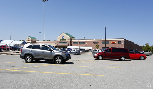
Property Detail
5350 E Thompson Rd
49-10-34-132-007.000-300
ROSS PARK L1
Supermarket
Marion
ZO01
Indiana
B and X Area of moderate flood hazard, usually the area between the limits of the 100-year and 500-year floods.
1
2024
12.71 AC
2025
Beech Grove/SE County
390102
Indianapolis
121,055 SF
Indianapolis-Carmel-Greenwood, IN
NEARBY LISTINGS FOR SALE OR LEASE
DEMOGRAPHICS near 5350 E Thompson Rd
1 mile
3 mile
5 mile
2025 Total Population
10,405
72,499
199,901
2030 Population
10,348
72,787
201,978
Pop Growth 2025-2030
(0.55%)
+ 0.40%
+ 1.04%
Average Age
39
38
37
2025 Total Households
4,317
27,993
76,994
HH Growth 2025-2030
(0.53%)
+ 0.40%
+ 1.07%
Median Household Inc
$66,458
$72,289
$68,794
Avg Household Size
2.40
2.50
2.50
2025 Avg HH Vehicles
2.00
2.00
2.00
Median Home Value
$207,177
$238,402
$234,350
Median Year Built
1976
1979
1973
Nearby Places
Map Layers
Map Styles
 Street
 Aerial
Layers
 Traffic
 Biking
Places
Listings with unknown addresses are not visible on the map
- Restaurants
- Banks
- Shops
- Fitness
- Groceries
PUBLIC TRANSPORTATION
COMMUTER RAIL
Indianapolis (Cardinal - Amtrak)
Drive
Walk
Distance
Indianapolis (Cardinal - Amtrak)
13 min
7.8 mi
AIRPORT
Indianapolis International
Drive
Walk
Distance
Indianapolis International
32 min
18.8 mi
Freight Ports
Port of Toledo
Drive
Walk
Distance
Port of Toledo
274 min
229.5 mi
Nearby Properties
Address
Land Use
TOTAL SIZE
Lot Size
Zoning
Address
Land Use
TOTAL SIZE
Lot Size
Zoning
5,846 SF
43.64 AC
ZO01
Address
Land Use
TOTAL SIZE
Lot Size
Zoning
3,586 SF
30.28 AC
ZO01
Address
Land Use
TOTAL SIZE
Lot Size
Zoning
6,786 SF
45.81 AC
Address
Land Use
TOTAL SIZE
Lot Size
Zoning
19,927 SF
28.82 AC
ZO01
Address
Land Use
TOTAL SIZE
Lot Size
Zoning
1,362 SF
6.66 AC
ZO01
Address
Land Use
TOTAL SIZE
Lot Size
Zoning
3,003 SF
3.52 AC
ZO01
Address
Land Use
TOTAL SIZE
Lot Size
Zoning
352,000 SF
22.72 AC
ZO01
Address
Land Use
TOTAL SIZE
Lot Size
Zoning
405,664 SF
35.56 AC
ZO01
Address
Land Use
TOTAL SIZE
Lot Size
Zoning
37,718 SF
11.77 AC
ZO01
Address
Land Use
TOTAL SIZE
Lot Size
Zoning
1,660 SF
15.01 AC
ZO01
Address
Land Use
TOTAL SIZE
Lot Size
Zoning
405 SF
23.81 AC
ZO01
Address
Land Use
TOTAL SIZE
Lot Size
Zoning
2,486 SF
13.75 AC
ZO01
Address
Land Use
TOTAL SIZE
Lot Size
Zoning
233,818 SF
26.42 AC
ZO01
Address
Land Use
TOTAL SIZE
Lot Size
Zoning
4,212 SF
16 AC
Address
Land Use
TOTAL SIZE
Lot Size
Zoning
4,179 SF
28.11 AC
ZO01
Address
Land Use
TOTAL SIZE
Lot Size
Zoning
354,398 SF
18.36 AC
ZO01
Address
Land Use
TOTAL SIZE
Lot Size
Zoning
1,040 SF
15.62 AC
ZO01
Address
Land Use
TOTAL SIZE
Lot Size
Zoning
4,872 SF
12.37 AC
Address
Land Use
TOTAL SIZE
Lot Size
Zoning
208,224 SF
23.41 AC
ZO01
Address
Land Use
TOTAL SIZE
Lot Size
Zoning
82,126 SF
8.31 AC
Address
Land Use
TOTAL SIZE
Lot Size
Zoning
20,944 SF
8.27 AC
ZO01
Address
Land Use
TOTAL SIZE
Lot Size
Zoning
101,122 SF
16.44 AC
Address
Land Use
TOTAL SIZE
Lot Size
Zoning
151,946 SF
15.04 AC
Address
Land Use
TOTAL SIZE
Lot Size
Zoning
13,876 SF
28.93 AC
ZO01
Address
Land Use
TOTAL SIZE
Lot Size
Zoning
61,750 SF
18.59 AC
Address
Land Use
TOTAL SIZE
Lot Size
Zoning
175,326 SF
13.80 AC
ZO01
Address
Land Use
TOTAL SIZE
Lot Size
Zoning
209,756 SF
12.33 AC
ZO01
Address
Land Use
TOTAL SIZE
Lot Size
Zoning
27,703 SF
22 AC
Address
Land Use
TOTAL SIZE
Lot Size
Zoning
161,008 SF
14.19 AC
ZO01
The World's #1 Commercial Real Estate Marketplace
Connect with us
© 2026 CoStar Group
The information above has been obtained from sources believed reliable. While we do not doubt its accuracy we have not verified it and make no guarantee, warranty or representation about it. It is your responsibility to independently confirm its accuracy and completeness. Any projections, opinions, assumptions, or estimates used are for example only and do not represent the current or future performance of the property. The value of this transaction to you depends on tax and other factors which should be evaluated by your tax, financial, and legal advisors. You and your advisors should conduct a careful, independent investigation of the property to determine to your satisfaction the suitability of the property for your needs.