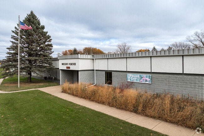
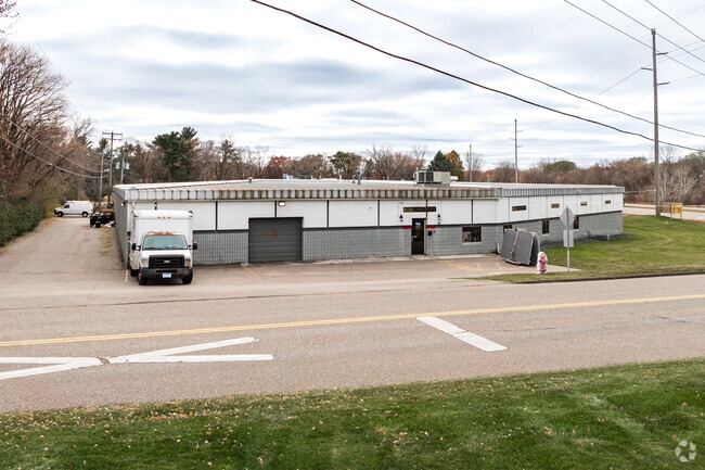
Property Record
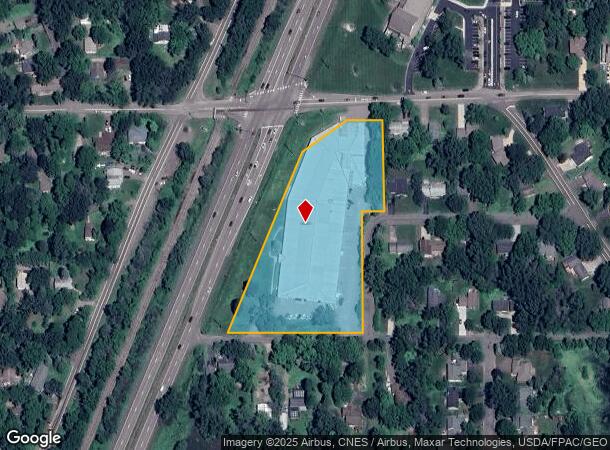
5350 Highway 61 N, Saint Paul, MN 55110
NEARBY LISTINGS FOR SALE OR LEASE
Property Detail
5350 Highway 61 N
Minneapolis-St. Paul-Bloomington, MN-WI
Buffalo Street Addition
12-30-22-24-0047
BUFFALO STREET ADDITION LOT 1 BLK 1
Heavyindustrial
Ramsey
X
Minnesota
27123C0055G
1
2024
3.79 AC
2025
East
040102
Minneapolis/St Paul
76,771 SF
DEMOGRAPHICS near 5350 Highway 61 N
1 Mile
3 Mile
5 Mile
2024 Total Population
3,363
25,914
80,122
2029 Population
3,267
25,894
81,464
Pop Growth 2024-2029
(2.85%)
(0.08%)
+ 1.67%
Average Age
45
43
42
2024 Total Households
1,330
10,184
31,555
HH Growth 2024-2029
(3.16%)
(0.47%)
+ 1.40%
Median Household Inc
$118,869
$102,630
$103,772
Avg Household Size
2.50
2.50
2.50
2024 Avg HH Vehicles
2.00
2.00
2.00
Median Home Value
$369,733
$353,842
$359,946
Median Year Built
1984
1979
1984
Nearby Places
Map Layers
Map Styles
 Street
 Aerial
- Restaurants
- Banks
- Shops
- Fitness
- Groceries
PUBLIC TRANSPORTATION
AIRPORT
Minneapolis-St Paul International/Wold-Chamberlain
DRIVE
WALK
Distance
Minneapolis-St Paul International/Wold-Chamberlain
35 min
23.2 mi
Freight Ports
Port Milwaukee
DRIVE
WALK
Distance
Port Milwaukee
374 min
336.7 mi
SALE & LEASE HISTORY
LISTING DATE
SALE/LEASE

Sep 25, 2016
For Lease
Sep 20, 2024
For Lease
Mar 14, 2024
For Lease
Jan 05, 2022
For Sale
Nearby Properties
Address
Land Use
TOTAL SIZE
Lot Size
Zoning
Address
Land Use
TOTAL SIZE
Lot Size
Zoning
106,400 SF
18.29 AC
Address
Land Use
TOTAL SIZE
Lot Size
Zoning
78,163 SF
5.62 AC
Address
Land Use
TOTAL SIZE
Lot Size
Zoning
960 SF
17.11 AC
Address
Land Use
TOTAL SIZE
Lot Size
Zoning
13,358 SF
311.47 AC
W8OPSP
Address
Land Use
TOTAL SIZE
Lot Size
Zoning
3,200 SF
14.31 AC
W7PUBLC
Address
Land Use
TOTAL SIZE
Lot Size
Zoning
163,709 SF
1.22 AC
Address
Land Use
TOTAL SIZE
Lot Size
Zoning
295,860 SF
11.84 AC
Address
Land Use
TOTAL SIZE
Lot Size
Zoning
204,399 SF
12.82 AC
Address
Land Use
TOTAL SIZE
Lot Size
Zoning
202,460 SF
26.72 AC
Address
Land Use
TOTAL SIZE
Lot Size
Zoning
1,357 SF
8.22 AC
Address
Land Use
TOTAL SIZE
Lot Size
Zoning
234,156 SF
12.01 AC
Address
Land Use
TOTAL SIZE
Lot Size
Zoning
82,403 SF
41.35 AC
Address
Land Use
TOTAL SIZE
Lot Size
Zoning
128,462 SF
2.07 AC
Address
Land Use
TOTAL SIZE
Lot Size
Zoning
132,487 SF
2.19 AC
Address
Land Use
TOTAL SIZE
Lot Size
Zoning
113,858 SF
27.82 AC
Address
Land Use
TOTAL SIZE
Lot Size
Zoning
98,905 SF
11.34 AC
Address
Land Use
TOTAL SIZE
Lot Size
Zoning
94,768 SF
6.90 AC
Address
Land Use
TOTAL SIZE
Lot Size
Zoning
1,920 SF
42.80 AC
Address
Land Use
TOTAL SIZE
Lot Size
Zoning
Address
Land Use
TOTAL SIZE
Lot Size
Zoning
128,364 SF
19.10 AC
Address
Land Use
TOTAL SIZE
Lot Size
Zoning
145,704 SF
7.05 AC
Address
Land Use
TOTAL SIZE
Lot Size
Zoning
3,880 SF
9.14 AC
Address
Land Use
TOTAL SIZE
Lot Size
Zoning
155,674 SF
10.60 AC
Address
Land Use
TOTAL SIZE
Lot Size
Zoning
Address
Land Use
TOTAL SIZE
Lot Size
Zoning
62,110 SF
6.34 AC
Address
Land Use
TOTAL SIZE
Lot Size
Zoning
162,486 SF
12.44 AC
Address
Land Use
TOTAL SIZE
Lot Size
Zoning
109,188 SF
5.05 AC
Address
Land Use
TOTAL SIZE
Lot Size
Zoning
23,779 SF
6.21 AC
Address
Land Use
TOTAL SIZE
Lot Size
Zoning
100,383 SF
5.75 AC
Address
Land Use
TOTAL SIZE
Lot Size
Zoning
202,000 SF
11.43 AC
The World's #1 Commercial Real Estate Marketplace
Connect with us
© 2026 CoStar Group
The information above has been obtained from sources believed reliable. While we do not doubt its accuracy we have not verified it and make no guarantee, warranty or representation about it. It is your responsibility to independently confirm its accuracy and completeness. Any projections, opinions, assumptions, or estimates used are for example only and do not represent the current or future performance of the property. The value of this transaction to you depends on tax and other factors which should be evaluated by your tax, financial, and legal advisors. You and your advisors should conduct a careful, independent investigation of the property to determine to your satisfaction the suitability of the property for your needs.