Property Record
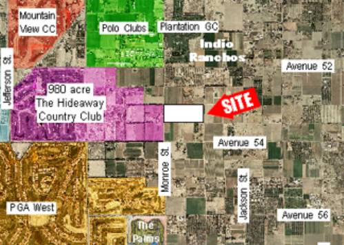
53500 Monroe St, Thermal, CA 92274


Property Detail
53500 Monroe St
780-020-001
38.20 ACRES M/L IN POR SW 1/4 OF SEC 11 T6S R7E FOR TOTAL DESCRIPTION SEE ASSESSORS MAPS
Agriculturalland
RIVERSIDE
A120
California
B and X Area of moderate flood hazard, usually the area between the limits of the 100-year and 500-year floods.
38.20 AC
2024
Coachella Valley
2025
Inland Empire (California)
045618
Riverside-San Bernardino-Ontario, CA
NEARBY LISTINGS FOR SALE OR LEASE
DEMOGRAPHICS near 53500 Monroe St
1 mile
3 mile
5 mile
2025 Total Population
2,308
60,221
152,085
2030 Population
2,542
63,826
159,049
Pop Growth 2025-2030
+ 10.14%
+ 5.99%
+ 4.58%
Average Age
51
41
40
2025 Total Households
936
19,618
48,885
HH Growth 2025-2030
+ 10.04%
+ 7.32%
+ 5.33%
Median Household Inc
$98,663
$87,399
$81,488
Avg Household Size
2.40
3.00
3.00
2025 Avg HH Vehicles
2.00
2.00
2.00
Median Home Value
$791,852
$614,471
$557,910
Median Year Built
2010
2001
1995
Nearby Places
Map Layers
Map Styles
 Street
 Aerial
Layers
 Traffic
 Biking
Places
Listings with unknown addresses are not visible on the map
- Restaurants
- Banks
- Shops
- Fitness
- Groceries
PUBLIC TRANSPORTATION
AIRPORT
Palm Springs International
Drive
Walk
Distance
Palm Springs International
34 min
24.9 mi
Freight Ports
Port of San Diego
Drive
Walk
Distance
Port of San Diego
180 min
149.0 mi
Nearby Properties
Address
Land Use
TOTAL SIZE
Lot Size
Zoning
Address
Land Use
TOTAL SIZE
Lot Size
Zoning
182,439 SF
10.76 AC
A110
Address
Land Use
TOTAL SIZE
Lot Size
Zoning
170,272 SF
16.28 AC
Address
Land Use
TOTAL SIZE
Lot Size
Zoning
2,841 SF
7.51 AC
A1
Address
Land Use
TOTAL SIZE
Lot Size
Zoning
41,091 SF
4.65 AC
Address
Land Use
TOTAL SIZE
Lot Size
Zoning
53,705 SF
5.10 AC
A1
Address
Land Use
TOTAL SIZE
Lot Size
Zoning
76.89 AC
A120
Address
Land Use
TOTAL SIZE
Lot Size
Zoning
1,589 SF
65.71 AC
A110
Address
Land Use
TOTAL SIZE
Lot Size
Zoning
19,059 SF
8.15 AC
Address
Land Use
TOTAL SIZE
Lot Size
Zoning
21,170 SF
7.27 AC
RM
Address
Land Use
TOTAL SIZE
Lot Size
Zoning
25,370 SF
6.61 AC
A1050
Address
Land Use
TOTAL SIZE
Lot Size
Zoning
42,249 SF
4.97 AC
Address
Land Use
TOTAL SIZE
Lot Size
Zoning
57,541 SF
5.58 AC
Address
Land Use
TOTAL SIZE
Lot Size
Zoning
4.95 AC
RS
Address
Land Use
TOTAL SIZE
Lot Size
Zoning
7,168 SF
11.03 AC
Address
Land Use
TOTAL SIZE
Lot Size
Zoning
27,675 SF
4.82 AC
RM
Address
Land Use
TOTAL SIZE
Lot Size
Zoning
63,962 SF
5.90 AC
Address
Land Use
TOTAL SIZE
Lot Size
Zoning
13,955 SF
3.47 AC
Address
Land Use
TOTAL SIZE
Lot Size
Zoning
7.64 AC
RM
Address
Land Use
TOTAL SIZE
Lot Size
Zoning
40,060 SF
3.17 AC
Address
Land Use
TOTAL SIZE
Lot Size
Zoning
89,024 SF
6.13 AC
A1
Address
Land Use
TOTAL SIZE
Lot Size
Zoning
18,360 SF
1.75 AC
NC
Address
Land Use
TOTAL SIZE
Lot Size
Zoning
17,369 SF
1.69 AC
Address
Land Use
TOTAL SIZE
Lot Size
Zoning
19.02 AC
A110
Address
Land Use
TOTAL SIZE
Lot Size
Zoning
32,433 SF
6.08 AC
Address
Land Use
TOTAL SIZE
Lot Size
Zoning
48,140 SF
4.69 AC
RS
The World's #1 Commercial Real Estate Marketplace
Connect with us
© 2026 CoStar Group
The information above has been obtained from sources believed reliable. While we do not doubt its accuracy we have not verified it and make no guarantee, warranty or representation about it. It is your responsibility to independently confirm its accuracy and completeness. Any projections, opinions, assumptions, or estimates used are for example only and do not represent the current or future performance of the property. The value of this transaction to you depends on tax and other factors which should be evaluated by your tax, financial, and legal advisors. You and your advisors should conduct a careful, independent investigation of the property to determine to your satisfaction the suitability of the property for your needs.