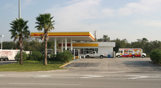
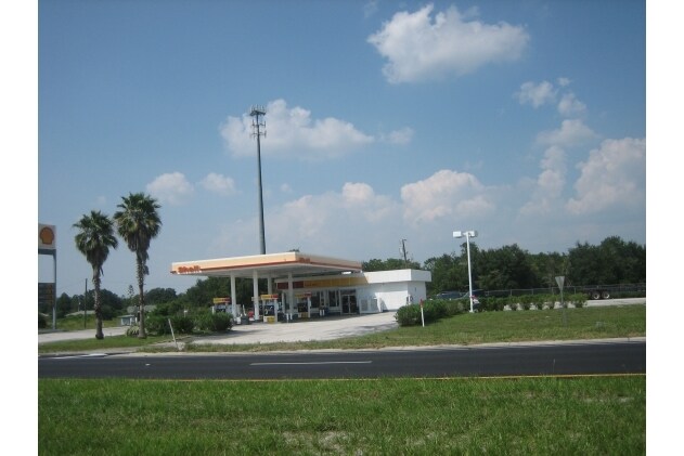
Property Record
5355 E Irlo Bronson Memorial Hwy, Saint Cloud, FL 34771


NEARBY LISTINGS FOR SALE OR LEASE
Property Detail
5355 E Irlo Bronson Memorial Hwy
Orlando-Kissimmee-Sanford, FL
Acreage & Unrec
09-26-31-0000-0050-0000
BEG N LINE SEC & WLY R/W LINE NOVA RD RUN SWLY ALONG NOVA RD. 517.14 FT FOR P.O.B CONT SLY ALONG R/W 200 FT, S 57 DEG 08 MIN W 113.13 FT, N 77 DEG 52 MIN W 200 FT, N 12 DEG 08 MIN E 279.9 FT, S 77 DEG 53 MIN 15 SEC E 279.9 FT TO POB
Storebuilding
Osceola
X
Florida
12097C0280G
50
2024
1.73 AC
2025
Osceola Outlying
043700
Orlando
3,794 SF
DEMOGRAPHICS near 5355 E Irlo Bronson Memorial Hwy
1 Mile
3 Mile
5 Mile
2024 Total Population
4,050
22,992
63,772
2029 Population
5,044
28,202
77,485
Pop Growth 2024-2029
+ 24.54%
+ 22.66%
+ 21.50%
Average Age
41
40
39
2024 Total Households
1,407
8,134
22,092
HH Growth 2024-2029
+ 24.52%
+ 22.62%
+ 21.31%
Median Household Inc
$79,927
$75,083
$71,567
Avg Household Size
2.90
2.80
2.90
2024 Avg HH Vehicles
2.00
2.00
2.00
Median Home Value
$354,307
$347,400
$324,929
Median Year Built
2010
2008
2003
Nearby Places
Map Layers
Map Styles
 Street
 Aerial
- Restaurants
- Banks
- Shops
- Fitness
- Groceries
PUBLIC TRANSPORTATION
AIRPORT
Orlando International
DRIVE
WALK
Distance
Orlando International
35 min
21.8 mi
Nearby Properties
Address
Land Use
TOTAL SIZE
Lot Size
Zoning
Address
Land Use
TOTAL SIZE
Lot Size
Zoning
77,928 SF
24.79 AC
SHB
Address
Land Use
TOTAL SIZE
Lot Size
Zoning
127,960 SF
14.40 AC
SPUD
Address
Land Use
TOTAL SIZE
Lot Size
Zoning
107,288 SF
10.23 AC
OMXD
Address
Land Use
TOTAL SIZE
Lot Size
Zoning
55,521 SF
10.75 AC
SHB
Address
Land Use
TOTAL SIZE
Lot Size
Zoning
89,482 SF
4.82 AC
SPUD
Address
Land Use
TOTAL SIZE
Lot Size
Zoning
30,520 SF
5.94 AC
SHB
Address
Land Use
TOTAL SIZE
Lot Size
Zoning
159.30 AC
Address
Land Use
TOTAL SIZE
Lot Size
Zoning
13.38 AC
Address
Land Use
TOTAL SIZE
Lot Size
Zoning
60,211 SF
6.46 AC
SPUD
Address
Land Use
TOTAL SIZE
Lot Size
Zoning
44,380 SF
7.84 AC
SHB
Address
Land Use
TOTAL SIZE
Lot Size
Zoning
159.24 AC
OAC
Address
Land Use
TOTAL SIZE
Lot Size
Zoning
20,634 SF
4.55 AC
SHB
Address
Land Use
TOTAL SIZE
Lot Size
Zoning
57,600 SF
4.83 AC
SHB
Address
Land Use
TOTAL SIZE
Lot Size
Zoning
13,900 SF
3.90 AC
SI3
Address
Land Use
TOTAL SIZE
Lot Size
Zoning
50,570 SF
4.98 AC
SPUD
Address
Land Use
TOTAL SIZE
Lot Size
Zoning
99.81 AC
Address
Land Use
TOTAL SIZE
Lot Size
Zoning
14,234 SF
1.79 AC
SHB
Address
Land Use
TOTAL SIZE
Lot Size
Zoning
23,000 SF
3.09 AC
SI3
Address
Land Use
TOTAL SIZE
Lot Size
Zoning
4,308 SF
1.84 AC
RM-2
Address
Land Use
TOTAL SIZE
Lot Size
Zoning
50,442 SF
13.86 AC
E-1
Address
Land Use
TOTAL SIZE
Lot Size
Zoning
35,838 SF
20.56 AC
SA
Address
Land Use
TOTAL SIZE
Lot Size
Zoning
13,712 SF
1.06 AC
SNB
Address
Land Use
TOTAL SIZE
Lot Size
Zoning
44,565 SF
7 AC
AC
Address
Land Use
TOTAL SIZE
Lot Size
Zoning
5,755 SF
1.76 AC
SHB
Address
Land Use
TOTAL SIZE
Lot Size
Zoning
31,640 SF
2.04 AC
SI3
Address
Land Use
TOTAL SIZE
Lot Size
Zoning
31,430 SF
2.07 AC
SI3
Address
Land Use
TOTAL SIZE
Lot Size
Zoning
1,104 SF
11.77 AC
OCG
Address
Land Use
TOTAL SIZE
Lot Size
Zoning
17,136 SF
1.98 AC
SPUD
Address
Land Use
TOTAL SIZE
Lot Size
Zoning
59.90 AC
Address
Land Use
TOTAL SIZE
Lot Size
Zoning
22.31 AC
OAC
The World's #1 Commercial Real Estate Marketplace
Connect with us
© 2025 CoStar Group
The information above has been obtained from sources believed reliable. While we do not doubt its accuracy we have not verified it and make no guarantee, warranty or representation about it. It is your responsibility to independently confirm its accuracy and completeness. Any projections, opinions, assumptions, or estimates used are for example only and do not represent the current or future performance of the property. The value of this transaction to you depends on tax and other factors which should be evaluated by your tax, financial, and legal advisors. You and your advisors should conduct a careful, independent investigation of the property to determine to your satisfaction the suitability of the property for your needs.