Property Record
536 High St, Lock Haven, PA 17745


Property Detail
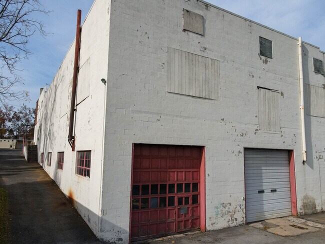
536 High St
011-05472
E F G G1 N & N/POR O
Storebuilding
CLINTON
B and X Area of moderate flood hazard, usually the area between the limits of the 100-year and 500-year floods.
Pennsylvania
2026
1.34 AC
2026
Pennsylvania Central Area
030500
Other Market Areas
25,801 SF
Lock Haven, PA
NEARBY LISTINGS FOR SALE OR LEASE
DEMOGRAPHICS near 536 High St
1 mile
3 mile
5 mile
2025 Total Population
6,207
16,574
20,310
2030 Population
6,139
16,515
20,196
Pop Growth 2025-2030
(1.10%)
(0.36%)
(0.56%)
Average Age
38
40
41
2025 Total Households
2,178
6,661
8,121
HH Growth 2025-2030
(1.61%)
(0.42%)
(0.59%)
Median Household Inc
$41,802
$47,968
$53,400
Avg Household Size
2.20
2.20
2.30
2025 Avg HH Vehicles
2.00
2.00
2.00
Median Home Value
$150,875
$167,719
$180,443
Median Year Built
1961
1965
1967
Nearby Places
Map Layers
Map Styles
 Street
 Aerial
Layers
 Traffic
 Biking
Places
Listings with unknown addresses are not visible on the map
- Restaurants
- Banks
- Shops
- Fitness
- Groceries
PUBLIC TRANSPORTATION
AIRPORT
State College Regional
Drive
Walk
Distance
State College Regional
53 min
32.3 mi
SALE & LEASE HISTORY
LISTING DATE
SALE/LEASE

Aug 23, 2024
For Lease
Nearby Properties
Address
Land Use
TOTAL SIZE
Lot Size
Zoning
Address
Land Use
TOTAL SIZE
Lot Size
Zoning
277.71 AC
Address
Land Use
TOTAL SIZE
Lot Size
Zoning
59.72 AC
AG
Address
Land Use
TOTAL SIZE
Lot Size
Zoning
12,048 SF
4.75 AC
PI
Address
Land Use
TOTAL SIZE
Lot Size
Zoning
12,000 SF
52.70 AC
Address
Land Use
TOTAL SIZE
Lot Size
Zoning
80,760 SF
4.37 AC
PI
Address
Land Use
TOTAL SIZE
Lot Size
Zoning
10.48 AC
Address
Land Use
TOTAL SIZE
Lot Size
Zoning
364,870 SF
20.87 AC
HI
Address
Land Use
TOTAL SIZE
Lot Size
Zoning
85,160 SF
1.48 AC
PI
Address
Land Use
TOTAL SIZE
Lot Size
Zoning
64,140 SF
3.45 AC
Address
Land Use
TOTAL SIZE
Lot Size
Zoning
10,659 SF
12.85 AC
RM
Address
Land Use
TOTAL SIZE
Lot Size
Zoning
339,124 SF
17.01 AC
Address
Land Use
TOTAL SIZE
Lot Size
Zoning
75,172 SF
0.28 AC
PI
Address
Land Use
TOTAL SIZE
Lot Size
Zoning
45,914 SF
13.21 AC
IND
Address
Land Use
TOTAL SIZE
Lot Size
Zoning
94,336 SF
1.87 AC
PI
Address
Land Use
TOTAL SIZE
Lot Size
Zoning
106,857 SF
6.56 AC
PI
Address
Land Use
TOTAL SIZE
Lot Size
Zoning
52,120 SF
1.98 AC
PI
Address
Land Use
TOTAL SIZE
Lot Size
Zoning
2,440 SF
8.02 AC
RM
Address
Land Use
TOTAL SIZE
Lot Size
Zoning
108,536 SF
1.59 AC
Address
Land Use
TOTAL SIZE
Lot Size
Zoning
33,240 SF
4.49 AC
Address
Land Use
TOTAL SIZE
Lot Size
Zoning
1,896 SF
2.19 AC
Address
Land Use
TOTAL SIZE
Lot Size
Zoning
242,674 SF
12.67 AC
HI
Address
Land Use
TOTAL SIZE
Lot Size
Zoning
54,138 SF
2.92 AC
Address
Land Use
TOTAL SIZE
Lot Size
Zoning
68,560 SF
1.47 AC
Address
Land Use
TOTAL SIZE
Lot Size
Zoning
76,398 SF
4.10 AC
RH
Address
Land Use
TOTAL SIZE
Lot Size
Zoning
27,540 SF
102.11 AC
AI
Address
Land Use
TOTAL SIZE
Lot Size
Zoning
57,893 SF
0.75 AC
Address
Land Use
TOTAL SIZE
Lot Size
Zoning
26,784 SF
1.97 AC
GC
Address
Land Use
TOTAL SIZE
Lot Size
Zoning
31,063 SF
1.20 AC
GC
Address
Land Use
TOTAL SIZE
Lot Size
Zoning
963,220 SF
16.93 AC
Address
Land Use
TOTAL SIZE
Lot Size
Zoning
60,026 SF
5.29 AC
GC
The World's #1 Commercial Real Estate Marketplace
Connect with us
© 2026 CoStar Group
The information above has been obtained from sources believed reliable. While we do not doubt its accuracy we have not verified it and make no guarantee, warranty or representation about it. It is your responsibility to independently confirm its accuracy and completeness. Any projections, opinions, assumptions, or estimates used are for example only and do not represent the current or future performance of the property. The value of this transaction to you depends on tax and other factors which should be evaluated by your tax, financial, and legal advisors. You and your advisors should conduct a careful, independent investigation of the property to determine to your satisfaction the suitability of the property for your needs.