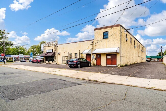
Property Record
544 Highway 33, Trenton, NJ 08619


NEARBY LISTINGS FOR SALE OR LEASE
Property Detail
544 Highway 33
03-01807-0000-00025
09320-F
Commercialnec
Mercer
X
New Jersey
34021C0231F
25
2024
0.50 AC
2025
Trenton
003006
Northern New Jersey
11,925 SF
Trenton-Princeton, NJ
DEMOGRAPHICS near 544 Highway 33
1 mile
3 mile
5 mile
2024 Total Population
12,003
77,494
216,139
2029 Population
11,753
76,136
213,085
Pop Growth 2024-2029
(2.08%)
(1.75%)
(1.41%)
Average Age
45
42
40
2024 Total Households
4,987
30,359
78,618
HH Growth 2024-2029
(2.21%)
(1.88%)
(1.48%)
Median Household Inc
$94,635
$91,429
$78,200
Avg Household Size
2.30
2.50
2.60
2024 Avg HH Vehicles
2.00
2.00
2.00
Median Home Value
$288,991
$277,477
$265,978
Median Year Built
1963
1967
1960
Nearby Places
Map Layers
Map Styles
 Street
 Aerial
Transit
 Traffic
 Biking
Places
Listings with unknown addresses are not visible on the map
- Restaurants
- Banks
- Shops
- Fitness
- Groceries
PUBLIC TRANSPORTATION
COMMUTER RAIL
Hamilton (Northeast Corridor Line - NJ Transit Commuter Rail (NJ Transit))
Drive
Walk
Distance
Hamilton (Northeast Corridor Line - NJ Transit Commuter Rail (NJ Transit))
7 min
2.7 mi
Trenton Transit Center (NJT) (Northeast Corridor Line - NJ Transit Commuter Rail (NJ Transit), River LINE - River LINE (River LINE))
Drive
Walk
Distance
Trenton Transit Center (NJT) (Northeast Corridor Line - NJ Transit Commuter Rail (NJ Transit), River LINE - River LINE (River LINE))
10 min
4.4 mi
AIRPORT
Trenton Mercer
Drive
Walk
Distance
Trenton Mercer
20 min
12.5 mi
Philadelphia International
Drive
Walk
Distance
Philadelphia International
66 min
47.4 mi
Freight Ports
South Jersey Port
Drive
Walk
Distance
South Jersey Port
49 min
37.2 mi
SALE & LEASE HISTORY
LISTING DATE
SALE/LEASE

Nov 23, 2016
For Lease
Jan 31, 2023
For Lease
Nearby Properties
Address
Land Use
TOTAL SIZE
Lot Size
Zoning
Address
Land Use
TOTAL SIZE
Lot Size
Zoning
40.83 AC
E
Address
Land Use
TOTAL SIZE
Lot Size
Zoning
Address
Land Use
TOTAL SIZE
Lot Size
Zoning
23.13 AC
RD
Address
Land Use
TOTAL SIZE
Lot Size
Zoning
60.26 AC
RD
Address
Land Use
TOTAL SIZE
Lot Size
Zoning
44.82 AC
RD
Address
Land Use
TOTAL SIZE
Lot Size
Zoning
18.33 AC
Address
Land Use
TOTAL SIZE
Lot Size
Zoning
17.84 AC
HC
Address
Land Use
TOTAL SIZE
Lot Size
Zoning
Address
Land Use
TOTAL SIZE
Lot Size
Zoning
44.83 AC
I
Address
Land Use
TOTAL SIZE
Lot Size
Zoning
21.17 AC
I
Address
Land Use
TOTAL SIZE
Lot Size
Zoning
1,836 SF
33.91 AC
RD
Address
Land Use
TOTAL SIZE
Lot Size
Zoning
9.63 AC
RD
Address
Land Use
TOTAL SIZE
Lot Size
Zoning
27.50 AC
R7
Address
Land Use
TOTAL SIZE
Lot Size
Zoning
Address
Land Use
TOTAL SIZE
Lot Size
Zoning
Address
Land Use
TOTAL SIZE
Lot Size
Zoning
15.80 AC
C
Address
Land Use
TOTAL SIZE
Lot Size
Zoning
28.36 AC
E
Address
Land Use
TOTAL SIZE
Lot Size
Zoning
156,128 SF
6.33 AC
RB
Address
Land Use
TOTAL SIZE
Lot Size
Zoning
Address
Land Use
TOTAL SIZE
Lot Size
Zoning
Address
Land Use
TOTAL SIZE
Lot Size
Zoning
Address
Land Use
TOTAL SIZE
Lot Size
Zoning
17,500 SF
18.14 AC
HC
Address
Land Use
TOTAL SIZE
Lot Size
Zoning
9.31 AC
HC
Address
Land Use
TOTAL SIZE
Lot Size
Zoning
16.62 AC
Address
Land Use
TOTAL SIZE
Lot Size
Zoning
60,564 SF
18.37 AC
RD
Address
Land Use
TOTAL SIZE
Lot Size
Zoning
77,722 SF
39.13 AC
Address
Land Use
TOTAL SIZE
Lot Size
Zoning
14,574 SF
20.23 AC
R10
Address
Land Use
TOTAL SIZE
Lot Size
Zoning
2.89 AC
RD
Address
Land Use
TOTAL SIZE
Lot Size
Zoning
21.91 AC
R10
Address
Land Use
TOTAL SIZE
Lot Size
Zoning
16,199 SF
11.80 AC
REO4
The World's #1 Commercial Real Estate Marketplace
Connect with us
© 2026 CoStar Group
The information above has been obtained from sources believed reliable. While we do not doubt its accuracy we have not verified it and make no guarantee, warranty or representation about it. It is your responsibility to independently confirm its accuracy and completeness. Any projections, opinions, assumptions, or estimates used are for example only and do not represent the current or future performance of the property. The value of this transaction to you depends on tax and other factors which should be evaluated by your tax, financial, and legal advisors. You and your advisors should conduct a careful, independent investigation of the property to determine to your satisfaction the suitability of the property for your needs.