Property Record
536 N Maple Ave, Ridgewood, NJ 07450


Property Detail
536 N Maple Ave
New York-Jersey City-White Plains, NY-NJ
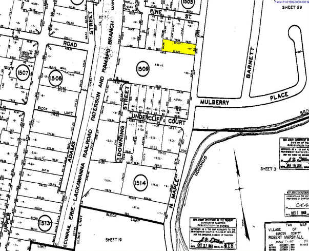
.831 AC 17,19 (1509,20)
51-01509-0000-00018
Bergen
Commercialnec
New Jersey
B2R2
18
B and X Area of moderate flood hazard, usually the area between the limits of the 100-year and 500-year floods.
0.83 AC
2024
North Central Bergen
2025
Northern New Jersey
047100
NEARBY LISTINGS FOR SALE OR LEASE
DEMOGRAPHICS near 536 N Maple Ave
1 mile
3 mile
5 mile
2025 Total Population
14,724
98,461
270,311
2030 Population
15,279
101,813
278,634
Pop Growth 2025-2030
+ 3.77%
+ 3.40%
+ 3.08%
Average Age
41
42
42
2025 Total Households
4,867
33,688
93,383
HH Growth 2025-2030
+ 3.84%
+ 3.39%
+ 3.08%
Median Household Inc
$217,136
$174,479
$153,996
Avg Household Size
3.00
2.90
2.80
2025 Avg HH Vehicles
2.00
2.00
2.00
Median Home Value
$923,597
$796,029
$750,500
Median Year Built
1949
1956
1957
Nearby Places
Map Layers
Map Styles
 Street
 Aerial
Layers
 Traffic
 Biking
Places
Listings with unknown addresses are not visible on the map
- Restaurants
- Banks
- Shops
- Fitness
- Groceries
PUBLIC TRANSPORTATION
TRANSIT/SUBWAY
Ho-Ho-Kus (Bergen County/Port Jervis Line - NJ Transit Commuter Rail (NJ Transit), Main/Port Jervis Line - NJ Transit Commuter Rail (NJ Transit))
Drive
Walk
Distance
Ho-Ho-Kus (Bergen County/Port Jervis Line - NJ Transit Commuter Rail (NJ Transit), Main/Port Jervis Line - NJ Transit Commuter Rail (NJ Transit))
2 min
7 min
0.4 mi
COMMUTER RAIL
Ho-Ho-Kus (Bergen County/Port Jervis Line - NJ Transit Commuter Rail (NJ Transit), Main/Port Jervis Line - NJ Transit Commuter Rail (NJ Transit))
Drive
Walk
Distance
Ho-Ho-Kus (Bergen County/Port Jervis Line - NJ Transit Commuter Rail (NJ Transit), Main/Port Jervis Line - NJ Transit Commuter Rail (NJ Transit))
2 min
7 min
0.4 mi
Ridgewood (Bergen County/Port Jervis Line - NJ Transit Commuter Rail (NJ Transit), Main/Port Jervis Line - NJ Transit Commuter Rail (NJ Transit))
Drive
Walk
Distance
Ridgewood (Bergen County/Port Jervis Line - NJ Transit Commuter Rail (NJ Transit), Main/Port Jervis Line - NJ Transit Commuter Rail (NJ Transit))
4 min
1.2 mi
AIRPORT
LaGuardia
Drive
Walk
Distance
LaGuardia
42 min
25.5 mi
Newark Liberty International
Drive
Walk
Distance
Newark Liberty International
34 min
25.9 mi
Westchester County
Drive
Walk
Distance
Westchester County
53 min
33.8 mi
Freight Ports
Maher Terminal
Drive
Walk
Distance
Maher Terminal
43 min
28.0 mi
Nearby Properties
Address
Land Use
TOTAL SIZE
Lot Size
Zoning
Address
Land Use
TOTAL SIZE
Lot Size
Zoning
45,191 SF
3.11 AC
BL
Address
Land Use
TOTAL SIZE
Lot Size
Zoning
15.57 AC
H
Address
Land Use
TOTAL SIZE
Lot Size
Zoning
164,588 SF
14.60 AC
BG
Address
Land Use
TOTAL SIZE
Lot Size
Zoning
59 AC
AA
Address
Land Use
TOTAL SIZE
Lot Size
Zoning
156,877 SF
12.60 AC
BG
Address
Land Use
TOTAL SIZE
Lot Size
Zoning
29,018 SF
4.40 AC
BG
Address
Land Use
TOTAL SIZE
Lot Size
Zoning
45,269 SF
5.66 AC
BG
Address
Land Use
TOTAL SIZE
Lot Size
Zoning
127,333 SF
8.30 AC
R100
Address
Land Use
TOTAL SIZE
Lot Size
Zoning
80.80 AC
Address
Land Use
TOTAL SIZE
Lot Size
Zoning
23.19 AC
R1
Address
Land Use
TOTAL SIZE
Lot Size
Zoning
20.30 AC
Address
Land Use
TOTAL SIZE
Lot Size
Zoning
144,868 SF
11.14 AC
BG
Address
Land Use
TOTAL SIZE
Lot Size
Zoning
3,165 SF
2.07 AC
VC2
Address
Land Use
TOTAL SIZE
Lot Size
Zoning
210,907 SF
10 AC
R100
Address
Land Use
TOTAL SIZE
Lot Size
Zoning
9.58 AC
R125
Address
Land Use
TOTAL SIZE
Lot Size
Zoning
117,101 SF
25.06 AC
R100
Address
Land Use
TOTAL SIZE
Lot Size
Zoning
110,814 SF
10 AC
BG
Address
Land Use
TOTAL SIZE
Lot Size
Zoning
Address
Land Use
TOTAL SIZE
Lot Size
Zoning
2.67 AC
AH2
Address
Land Use
TOTAL SIZE
Lot Size
Zoning
3.63 AC
Address
Land Use
TOTAL SIZE
Lot Size
Zoning
52,908 SF
13.37 AC
BG
Address
Land Use
TOTAL SIZE
Lot Size
Zoning
8.12 AC
BIL
Address
Land Use
TOTAL SIZE
Lot Size
Zoning
78,432 SF
4.80 AC
R100
Address
Land Use
TOTAL SIZE
Lot Size
Zoning
6.11 AC
OB1
Address
Land Use
TOTAL SIZE
Lot Size
Zoning
74,278 SF
6.91 AC
C2
Address
Land Use
TOTAL SIZE
Lot Size
Zoning
107,584 SF
9.19 AC
EM
Address
Land Use
TOTAL SIZE
Lot Size
Zoning
9.23 AC
Address
Land Use
TOTAL SIZE
Lot Size
Zoning
10.94 AC
AA
Address
Land Use
TOTAL SIZE
Lot Size
Zoning
80,632 SF
6 AC
BG
Address
Land Use
TOTAL SIZE
Lot Size
Zoning
61,104 SF
3.84 AC
BG
The World's #1 Commercial Real Estate Marketplace
Connect with us
© 2026 CoStar Group
The information above has been obtained from sources believed reliable. While we do not doubt its accuracy we have not verified it and make no guarantee, warranty or representation about it. It is your responsibility to independently confirm its accuracy and completeness. Any projections, opinions, assumptions, or estimates used are for example only and do not represent the current or future performance of the property. The value of this transaction to you depends on tax and other factors which should be evaluated by your tax, financial, and legal advisors. You and your advisors should conduct a careful, independent investigation of the property to determine to your satisfaction the suitability of the property for your needs.