Property Record
5360 Mapledale Plz, Woodbridge, VA 22193

Save to a Folder
{{folder.Name}}
{{folder.ListingIds.length}} Properties
{{folder.ListingIds.length}} Property
Create a New Folder
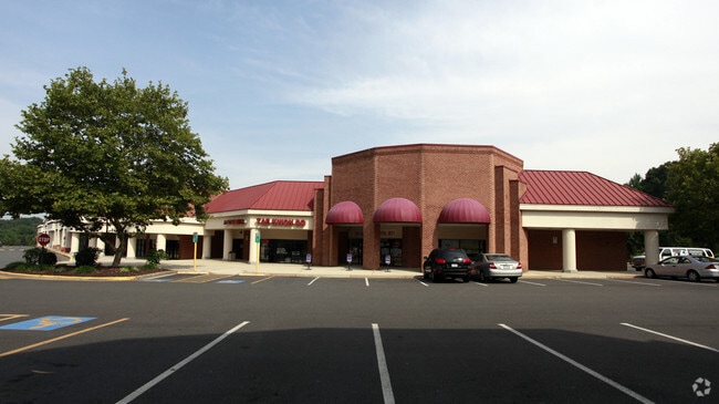
Property Detail
5360 Mapledale Plz
8092-65-5085
PCL H2 MAPLEDALE PLAZA
Regionalshoppingcenterormallwithanchorstore
PRINCE WILLIAM
RPC
Virginia
B and X Area of moderate flood hazard, usually the area between the limits of the 100-year and 500-year floods.
27.55 AC
2024
Woodbridge/I-95 Corridor
2025
Washington, DC
901203
Washington-Arlington-Alexandria, DC-VA-MD-WV
167,230 SF
NEARBY LISTINGS FOR SALE OR LEASE
DEMOGRAPHICS near 5360 Mapledale Plz
1 mile
3 mile
5 mile
2025 Total Population
14,511
94,041
175,099
2030 Population
14,843
96,244
179,164
Pop Growth 2025-2030
+ 2.29%
+ 2.34%
+ 2.32%
Average Age
37
38
38
2025 Total Households
3,952
28,356
54,497
HH Growth 2025-2030
+ 2.23%
+ 2.30%
+ 2.24%
Median Household Inc
$148,675
$139,133
$138,098
Avg Household Size
3.50
3.20
3.10
2025 Avg HH Vehicles
3.00
2.00
2.00
Median Home Value
$485,544
$487,542
$506,616
Median Year Built
1985
1987
1986
Nearby Places
Map Layers
Map Styles
 Street
 Aerial
Layers
 Traffic
 Biking
Places
Listings with unknown addresses are not visible on the map
- Restaurants
- Banks
- Shops
- Fitness
- Groceries
PUBLIC TRANSPORTATION
COMMUTER RAIL
Drive
Walk
Distance
20 min
8.7 mi
Woodbridge (Fredericksburg Line - Virginia Railway Express)
Drive
Walk
Distance
Woodbridge (Fredericksburg Line - Virginia Railway Express)
17 min
8.9 mi
AIRPORT
Ronald Reagan Washington Ntl
Drive
Walk
Distance
Ronald Reagan Washington Ntl
44 min
28.2 mi
Washington Dulles International
Drive
Walk
Distance
Washington Dulles International
52 min
29.0 mi
Freight Ports
Port of Baltimore
Drive
Walk
Distance
Port of Baltimore
101 min
68.3 mi
SALE & LEASE HISTORY
LISTING DATE
SALE/LEASE

Sep 25, 2016
For Lease
Sep 19, 2023
For Lease
Nearby Properties
Address
Land Use
TOTAL SIZE
Lot Size
Zoning
Address
Land Use
TOTAL SIZE
Lot Size
Zoning
202,395 SF
40.68 AC
A1
Address
Land Use
TOTAL SIZE
Lot Size
Zoning
283,209 SF
72.49 AC
A1
Address
Land Use
TOTAL SIZE
Lot Size
Zoning
148,814 SF
16.42 AC
R16
Address
Land Use
TOTAL SIZE
Lot Size
Zoning
40,578 SF
13.34 AC
PMD
Address
Land Use
TOTAL SIZE
Lot Size
Zoning
25,357 SF
15.96 AC
R16
Address
Land Use
TOTAL SIZE
Lot Size
Zoning
147,132 SF
14.66 AC
R16
Address
Land Use
TOTAL SIZE
Lot Size
Zoning
120,304 SF
10.88 AC
R16
Address
Land Use
TOTAL SIZE
Lot Size
Zoning
198,692 SF
11.06 AC
R16
Address
Land Use
TOTAL SIZE
Lot Size
Zoning
45,346 SF
64.42 AC
A1
Address
Land Use
TOTAL SIZE
Lot Size
Zoning
53,754 SF
14.98 AC
RPC
Address
Land Use
TOTAL SIZE
Lot Size
Zoning
102,928 SF
17.06 AC
MIXED
Address
Land Use
TOTAL SIZE
Lot Size
Zoning
326,559 SF
11.45 AC
RPC
Address
Land Use
TOTAL SIZE
Lot Size
Zoning
135,400 SF
42.13 AC
RPC
Address
Land Use
TOTAL SIZE
Lot Size
Zoning
139,698 SF
4.36 AC
PMD
Address
Land Use
TOTAL SIZE
Lot Size
Zoning
139,060 SF
14.75 AC
B1
Address
Land Use
TOTAL SIZE
Lot Size
Zoning
110,332 SF
19.47 AC
A1
Address
Land Use
TOTAL SIZE
Lot Size
Zoning
59,509 SF
18.94 AC
B1
Address
Land Use
TOTAL SIZE
Lot Size
Zoning
106,408 SF
22.57 AC
A1
Address
Land Use
TOTAL SIZE
Lot Size
Zoning
132,794 SF
29.46 AC
A1
Address
Land Use
TOTAL SIZE
Lot Size
Zoning
84.05 AC
MIXED
Address
Land Use
TOTAL SIZE
Lot Size
Zoning
121,464 SF
29.98 AC
RPC
Address
Land Use
TOTAL SIZE
Lot Size
Zoning
143,955 SF
5.41 AC
PMD
Address
Land Use
TOTAL SIZE
Lot Size
Zoning
102,262 SF
11.75 AC
B2
Address
Land Use
TOTAL SIZE
Lot Size
Zoning
93,132 SF
2.71 AC
PMD
Address
Land Use
TOTAL SIZE
Lot Size
Zoning
120,600 SF
6.25 AC
M2
Address
Land Use
TOTAL SIZE
Lot Size
Zoning
97,560 SF
14.74 AC
MIXED
Address
Land Use
TOTAL SIZE
Lot Size
Zoning
136,186 SF
2.97 AC
B1
Address
Land Use
TOTAL SIZE
Lot Size
Zoning
186,624 SF
7.04 AC
PMR
Address
Land Use
TOTAL SIZE
Lot Size
Zoning
86,477 SF
15.03 AC
A1
The World's #1 Commercial Real Estate Marketplace
Connect with us
© 2026 CoStar Group
The information above has been obtained from sources believed reliable. While we do not doubt its accuracy we have not verified it and make no guarantee, warranty or representation about it. It is your responsibility to independently confirm its accuracy and completeness. Any projections, opinions, assumptions, or estimates used are for example only and do not represent the current or future performance of the property. The value of this transaction to you depends on tax and other factors which should be evaluated by your tax, financial, and legal advisors. You and your advisors should conduct a careful, independent investigation of the property to determine to your satisfaction the suitability of the property for your needs.