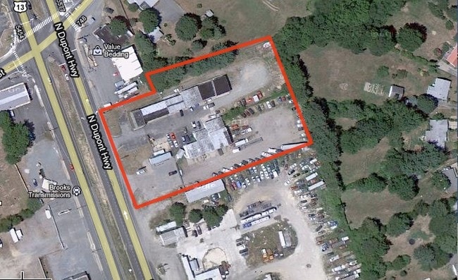
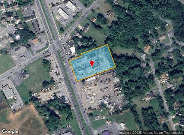
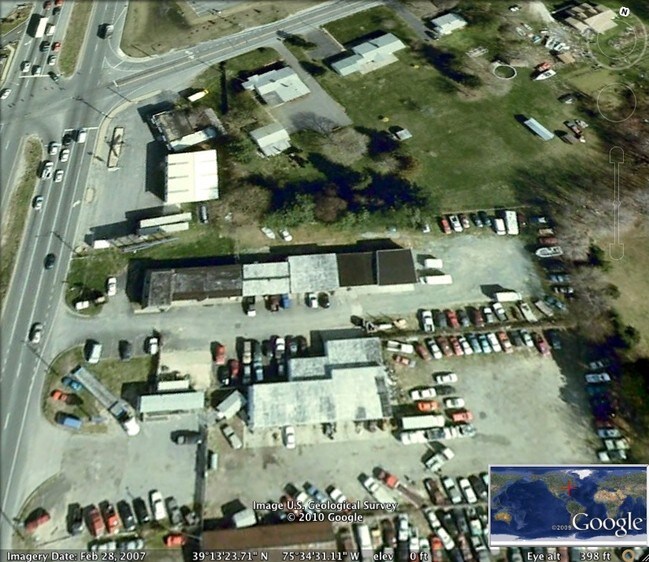
Property Record
5360 N Dupont Hwy, Dover, DE 19901
NEARBY LISTINGS FOR SALE OR LEASE
Property Detail
5360 N Dupont Hwy
4-00-04602-02-0500-000
E. SD. HWY. DOVER TO SMYRNA, 2.3454 A.
Commercialnec
Kent
X
Delaware
10001C0152J
2.50 AC
2024
Kent County
2025
Philadelphia
040501
Dover, DE
7,369 SF
DEMOGRAPHICS near 5360 N Dupont Hwy
1 Mile
3 Mile
5 Mile
2024 Total Population
3,773
18,794
62,702
2029 Population
4,095
20,440
67,876
Pop Growth 2024-2029
+ 8.53%
+ 8.76%
+ 8.25%
Average Age
41
41
40
2024 Total Households
1,377
6,700
23,215
HH Growth 2024-2029
+ 8.79%
+ 9.01%
+ 8.51%
Median Household Inc
$59,021
$71,932
$69,075
Avg Household Size
2.60
2.60
2.50
2024 Avg HH Vehicles
2.00
2.00
2.00
Median Home Value
$244,512
$275,790
$263,316
Median Year Built
2002
2003
1999
Nearby Places
- Restaurants
- Banks
- Shops
- Fitness
- Groceries
SALE & LEASE HISTORY
LISTING DATE
SALE/LEASE

Apr 07, 2017
For Sale
Nearby Properties
Address
Land Use
TOTAL SIZE
Lot Size
Zoning
Address
Land Use
TOTAL SIZE
Lot Size
Zoning
81,711 SF
93.70 AC
IO
Address
Land Use
TOTAL SIZE
Lot Size
Zoning
379,358 SF
67.30 AC
SC3
Address
Land Use
TOTAL SIZE
Lot Size
Zoning
55,456 SF
43.90 AC
IO
Address
Land Use
TOTAL SIZE
Lot Size
Zoning
210,400 SF
30 AC
IPM
Address
Land Use
TOTAL SIZE
Lot Size
Zoning
97,248 SF
9 AC
RG2
Address
Land Use
TOTAL SIZE
Lot Size
Zoning
98,669 SF
12.40 AC
C4
Address
Land Use
TOTAL SIZE
Lot Size
Zoning
1,292 SF
65.25 AC
RMH
Address
Land Use
TOTAL SIZE
Lot Size
Zoning
56.90 AC
IO
Address
Land Use
TOTAL SIZE
Lot Size
Zoning
14,214 SF
319.30 AC
MULTI
Address
Land Use
TOTAL SIZE
Lot Size
Zoning
137,247 SF
17 AC
C4
Address
Land Use
TOTAL SIZE
Lot Size
Zoning
132,449 SF
6 AC
RC
Address
Land Use
TOTAL SIZE
Lot Size
Zoning
184,072 SF
22 AC
BG
Address
Land Use
TOTAL SIZE
Lot Size
Zoning
136,933 SF
20.40 AC
C4
Address
Land Use
TOTAL SIZE
Lot Size
Zoning
47,245 SF
4.92 AC
C4
Address
Land Use
TOTAL SIZE
Lot Size
Zoning
76.70 AC
NA
Address
Land Use
TOTAL SIZE
Lot Size
Zoning
73,810 SF
17.90 AC
MULTI
Address
Land Use
TOTAL SIZE
Lot Size
Zoning
3,816 SF
56.40 AC
RMH
Address
Land Use
TOTAL SIZE
Lot Size
Zoning
274,907 SF
14.61 AC
IPM
Address
Land Use
TOTAL SIZE
Lot Size
Zoning
63,145 SF
5.90 AC
C4
Address
Land Use
TOTAL SIZE
Lot Size
Zoning
164,121 SF
50.40 AC
IG
Address
Land Use
TOTAL SIZE
Lot Size
Zoning
37,968 SF
5.70 AC
IO
Address
Land Use
TOTAL SIZE
Lot Size
Zoning
4,635 SF
32.60 AC
RMH
Address
Land Use
TOTAL SIZE
Lot Size
Zoning
50,309 SF
19.90 AC
MULTI
Address
Land Use
TOTAL SIZE
Lot Size
Zoning
17,552 SF
5.70 AC
IO
Address
Land Use
TOTAL SIZE
Lot Size
Zoning
25.30 AC
IO
Address
Land Use
TOTAL SIZE
Lot Size
Zoning
32,484 SF
10.40 AC
R15
Address
Land Use
TOTAL SIZE
Lot Size
Zoning
115,752 SF
8.60 AC
SC3
Address
Land Use
TOTAL SIZE
Lot Size
Zoning
28,008 SF
7.80 AC
C4
Address
Land Use
TOTAL SIZE
Lot Size
Zoning
44,168 SF
2.10 AC
RC
Address
Land Use
TOTAL SIZE
Lot Size
Zoning
23,250 SF
4.65 AC
NA
The World's #1 Commercial Real Estate Marketplace
Connect with us
© 2025 CoStar Group
The information above has been obtained from sources believed reliable. While we do not doubt its accuracy we have not verified it and make no guarantee, warranty or representation about it. It is your responsibility to independently confirm its accuracy and completeness. Any projections, opinions, assumptions, or estimates used are for example only and do not represent the current or future performance of the property. The value of this transaction to you depends on tax and other factors which should be evaluated by your tax, financial, and legal advisors. You and your advisors should conduct a careful, independent investigation of the property to determine to your satisfaction the suitability of the property for your needs.