Property Record
5361 Bayshore Rd, North Fort Myers, FL 33917

NEARBY LISTINGS FOR SALE OR LEASE
Property Detail
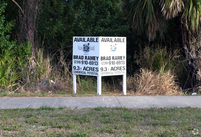
5361 Bayshore Rd
Cape Coral-Fort Myers, FL
North Fort Myers 36-43-24
36-43-24-00-00024.0000
PARL IN S W 1/4 AS DESC IN OR 554 PG 327 + 328 LESS SR 78 DESC OR 1675 PG 3690
Commercialacreage
Lee
AE
Florida
12071C0286G
9.27 AC
2024
North Ft Myers
2025
Southwest Florida
020301
DEMOGRAPHICS near 5361 Bayshore Rd
1 Mile
3 Mile
5 Mile
2024 Total Population
7,898
44,872
118,422
2029 Population
9,341
53,402
140,332
Pop Growth 2024-2029
+ 18.27%
+ 19.01%
+ 18.50%
Average Age
58
50
45
2024 Total Households
4,165
21,029
49,589
HH Growth 2024-2029
+ 17.79%
+ 18.55%
+ 18.20%
Median Household Inc
$36,540
$43,598
$46,399
Avg Household Size
1.80
2.00
2.30
2024 Avg HH Vehicles
1.00
1.00
1.00
Median Home Value
$97,855
$122,522
$172,038
Median Year Built
1978
1981
1984
Nearby Places
Map Layers
Map Styles
 Street
 Aerial
- Restaurants
- Banks
- Shops
- Fitness
- Groceries
PUBLIC TRANSPORTATION
AIRPORT
Southwest Florida International
DRIVE
WALK
Distance
Southwest Florida International
29 min
19.9 mi
Punta Gorda
DRIVE
WALK
Distance
Punta Gorda
31 min
21.3 mi
Freight Ports
Port Manatee
DRIVE
WALK
Distance
Port Manatee
111 min
93.0 mi
Nearby Properties
Address
Land Use
TOTAL SIZE
Lot Size
Zoning
Address
Land Use
TOTAL SIZE
Lot Size
Zoning
4.48 AC
U-CTR
Address
Land Use
TOTAL SIZE
Lot Size
Zoning
347,871 SF
29.40 AC
RML
Address
Land Use
TOTAL SIZE
Lot Size
Zoning
723,322 SF
1.73 AC
PUD
Address
Land Use
TOTAL SIZE
Lot Size
Zoning
13.60 AC
CC
Address
Land Use
TOTAL SIZE
Lot Size
Zoning
163,618 SF
1.32 AC
CIVIC
Address
Land Use
TOTAL SIZE
Lot Size
Zoning
551,003 SF
3.24 AC
PUD
Address
Land Use
TOTAL SIZE
Lot Size
Zoning
305,410 SF
1.38 AC
U-CTR
Address
Land Use
TOTAL SIZE
Lot Size
Zoning
451,348 SF
21.43 AC
CPD
Address
Land Use
TOTAL SIZE
Lot Size
Zoning
76,154 SF
2.88 AC
U-CTR
Address
Land Use
TOTAL SIZE
Lot Size
Zoning
209,881 SF
63.03 AC
AG-2
Address
Land Use
TOTAL SIZE
Lot Size
Zoning
1,666 SF
35.55 AC
AG-2
Address
Land Use
TOTAL SIZE
Lot Size
Zoning
182,503 SF
1.34 AC
CIVIC
Address
Land Use
TOTAL SIZE
Lot Size
Zoning
73,644 SF
34.16 AC
AG-2
Address
Land Use
TOTAL SIZE
Lot Size
Zoning
227,527 SF
0.95 AC
CIVIC
Address
Land Use
TOTAL SIZE
Lot Size
Zoning
8,811 SF
11.79 AC
PUD
Address
Land Use
TOTAL SIZE
Lot Size
Zoning
112,356 SF
18.99 AC
AG-2
Address
Land Use
TOTAL SIZE
Lot Size
Zoning
109,404 SF
14.22 AC
AG-2
Address
Land Use
TOTAL SIZE
Lot Size
Zoning
51,478 SF
68.97 AC
C-2
Address
Land Use
TOTAL SIZE
Lot Size
Zoning
107,321 SF
7.80 AC
C-1A
Address
Land Use
TOTAL SIZE
Lot Size
Zoning
101,343 SF
8.06 AC
IL
Address
Land Use
TOTAL SIZE
Lot Size
Zoning
116,513 SF
1.61 AC
U-CTR
Address
Land Use
TOTAL SIZE
Lot Size
Zoning
47,082 SF
1.20 AC
U-CTR
Address
Land Use
TOTAL SIZE
Lot Size
Zoning
141,571 SF
4.57 AC
C-1A
Address
Land Use
TOTAL SIZE
Lot Size
Zoning
222,159 SF
25.12 AC
CP-D
Address
Land Use
TOTAL SIZE
Lot Size
Zoning
127,525 SF
12.90 AC
RS6
Address
Land Use
TOTAL SIZE
Lot Size
Zoning
81,160 SF
9.40 AC
CPD
Address
Land Use
TOTAL SIZE
Lot Size
Zoning
99,939 SF
3.39 AC
C-1A
Address
Land Use
TOTAL SIZE
Lot Size
Zoning
48,780 SF
14.99 AC
Address
Land Use
TOTAL SIZE
Lot Size
Zoning
85,915 SF
9.33 AC
CC
Address
Land Use
TOTAL SIZE
Lot Size
Zoning
91,107 SF
35.31 AC
REC
The World's #1 Commercial Real Estate Marketplace
Connect with us
© 2025 CoStar Group
The information above has been obtained from sources believed reliable. While we do not doubt its accuracy we have not verified it and make no guarantee, warranty or representation about it. It is your responsibility to independently confirm its accuracy and completeness. Any projections, opinions, assumptions, or estimates used are for example only and do not represent the current or future performance of the property. The value of this transaction to you depends on tax and other factors which should be evaluated by your tax, financial, and legal advisors. You and your advisors should conduct a careful, independent investigation of the property to determine to your satisfaction the suitability of the property for your needs.