Property Record
5361 Mooretown Rd, Williamsburg, VA 23188
NEARBY LISTINGS FOR SALE OR LEASE
-
-
View all Williamsburg listings for sale on LoopNet.com
Property Detail
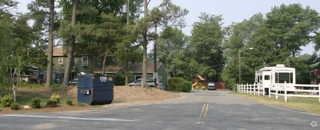
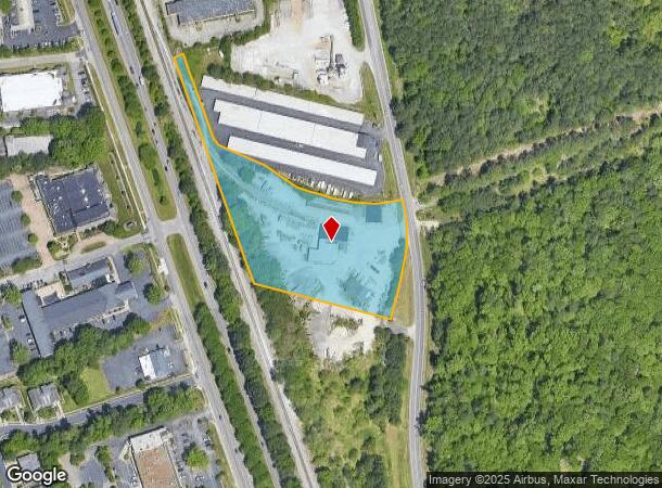
5361 Mooretown Rd
33-3-01-0-0022
Acreage Lots Jamestown
Commercialnec
AT EWELL ADJ C &; O R AND PART OF (33-3)(1-23)
X
James City
51095C0136D
Virginia
2025
3.83 AC
2025
Williamsburg Extended
080205
Hampton Roads
14,684 SF
Virginia Beach-Norfolk-Newport News, VA-NC
DEMOGRAPHICS near 5361 Mooretown Rd
1 Mile
3 Mile
5 Mile
2024 Total Population
3,014
33,227
72,836
2029 Population
3,273
36,397
79,238
Pop Growth 2024-2029
+ 8.59%
+ 9.54%
+ 8.79%
Average Age
40
41
44
2024 Total Households
1,380
12,994
29,441
HH Growth 2024-2029
+ 9.78%
+ 10.34%
+ 9.37%
Median Household Inc
$54,434
$71,969
$82,660
Avg Household Size
2.20
2.20
2.30
2024 Avg HH Vehicles
2.00
2.00
2.00
Median Home Value
$249,056
$353,117
$374,331
Median Year Built
1990
1996
1995
Nearby Places
Map Layers
Map Styles
 Street
 Aerial
- Restaurants
- Banks
- Shops
- Fitness
- Groceries
PUBLIC TRANSPORTATION
COMMUTER RAIL
Williamsburg Amtrak Station (Northeast Regional - Amtrak)
DRIVE
WALK
Distance
Williamsburg Amtrak Station (Northeast Regional - Amtrak)
9 min
3.7 mi
AIRPORT
Newport News/Williamsburg International
DRIVE
WALK
Distance
Newport News/Williamsburg International
32 min
20.5 mi
Freight Ports
Virginia Port Authority - Newport News
DRIVE
WALK
Distance
Virginia Port Authority - Newport News
45 min
34.5 mi
Nearby Properties
Address
Land Use
TOTAL SIZE
Lot Size
Zoning
Address
Land Use
TOTAL SIZE
Lot Size
Zoning
55,136 SF
348.94 AC
WM (WILLIA
Address
Land Use
TOTAL SIZE
Lot Size
Zoning
232,812 SF
77.99 AC
ECONOMIC O
Address
Land Use
TOTAL SIZE
Lot Size
Zoning
10,008 SF
83.06 AC
ECONOMIC O
Address
Land Use
TOTAL SIZE
Lot Size
Zoning
83,748 SF
B-3 (GENER
Address
Land Use
TOTAL SIZE
Lot Size
Zoning
104,404 SF
20.23 AC
PLANNED DE
Address
Land Use
TOTAL SIZE
Lot Size
Zoning
257 SF
105.86 AC
MU MIXED U
Address
Land Use
TOTAL SIZE
Lot Size
Zoning
71,980 SF
6 AC
ED-2 (ECON
Address
Land Use
TOTAL SIZE
Lot Size
Zoning
52,774 SF
9.07 AC
PLANNED DE
Address
Land Use
TOTAL SIZE
Lot Size
Zoning
5,184 SF
16.47 AC
PLANNED DE
Address
Land Use
TOTAL SIZE
Lot Size
Zoning
263,288 SF
34.22 AC
MU MIXED U
Address
Land Use
TOTAL SIZE
Lot Size
Zoning
625,352 SF
13.60 AC
MU MIXED U
Address
Land Use
TOTAL SIZE
Lot Size
Zoning
252,940 SF
54.18 AC
PL PUBLIC
Address
Land Use
TOTAL SIZE
Lot Size
Zoning
109,045 SF
18.31 AC
RS-2 (SING
Address
Land Use
TOTAL SIZE
Lot Size
Zoning
164,647 SF
34.11 AC
MS (MUSEUM
Address
Land Use
TOTAL SIZE
Lot Size
Zoning
491.07 AC
PL PUBLIC
Address
Land Use
TOTAL SIZE
Lot Size
Zoning
182,259 SF
3.60 AC
B-1 (DOWNT
Address
Land Use
TOTAL SIZE
Lot Size
Zoning
49,631 SF
15.58 AC
B1 GENERAL
Address
Land Use
TOTAL SIZE
Lot Size
Zoning
501.93 AC
WM (WILLIA
Address
Land Use
TOTAL SIZE
Lot Size
Zoning
3,465 SF
24.94 AC
R5 MULTIFA
Address
Land Use
TOTAL SIZE
Lot Size
Zoning
32,730 SF
4.89 AC
ED-2 (ECON
Address
Land Use
TOTAL SIZE
Lot Size
Zoning
113,000 SF
22.20 AC
WM (WILLIA
Address
Land Use
TOTAL SIZE
Lot Size
Zoning
167,811 SF
51.70 AC
PUDR PLANN
Address
Land Use
TOTAL SIZE
Lot Size
Zoning
55,122 SF
11.33 AC
LB-1 (DOWN
Address
Land Use
TOTAL SIZE
Lot Size
Zoning
60,344 SF
11.41 AC
LB-4 (LIMI
Address
Land Use
TOTAL SIZE
Lot Size
Zoning
38,577 SF
16.58 AC
MU MIXED U
Address
Land Use
TOTAL SIZE
Lot Size
Zoning
55,861 SF
18.86 AC
M1 LIMITED
Address
Land Use
TOTAL SIZE
Lot Size
Zoning
154,809 SF
7.31 AC
PLANNED DE
Address
Land Use
TOTAL SIZE
Lot Size
Zoning
9,528 SF
4.78 AC
ED-2 (ECON
Address
Land Use
TOTAL SIZE
Lot Size
Zoning
23,782 SF
7.52 AC
B1 GENERAL
The World's #1 Commercial Real Estate Marketplace
Connect with us
© 2025 CoStar Group
The information above has been obtained from sources believed reliable. While we do not doubt its accuracy we have not verified it and make no guarantee, warranty or representation about it. It is your responsibility to independently confirm its accuracy and completeness. Any projections, opinions, assumptions, or estimates used are for example only and do not represent the current or future performance of the property. The value of this transaction to you depends on tax and other factors which should be evaluated by your tax, financial, and legal advisors. You and your advisors should conduct a careful, independent investigation of the property to determine to your satisfaction the suitability of the property for your needs.