Property Record
5363 Us Highway 70 E, Princeton, NC 27569
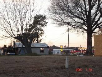

Property Detail
5363 Us Highway 70 E
04O10033
H W OLIVER
Vacantlandnec
Johnston
COM
North Carolina
B and X Area of moderate flood hazard, usually the area between the limits of the 100-year and 500-year floods.
43.06 AC
2025
Johnston County
2025
Raleigh/Durham
040502
Raleigh-Cary, NC
NEARBY LISTINGS FOR SALE OR LEASE
DEMOGRAPHICS near 5363 Us Highway 70 E
1 mile
3 mile
5 mile
2025 Total Population
714
7,005
15,698
2030 Population
798
7,831
17,527
Pop Growth 2025-2030
+ 11.76%
+ 11.79%
+ 11.65%
Average Age
38
39
39
2025 Total Households
259
2,645
5,983
HH Growth 2025-2030
+ 11.97%
+ 11.87%
+ 11.70%
Median Household Inc
$80,382
$73,591
$69,492
Avg Household Size
2.70
2.60
2.60
2025 Avg HH Vehicles
3.00
2.00
2.00
Median Home Value
$166,233
$211,506
$214,643
Median Year Built
1992
1993
1993
Nearby Places
Map Layers
Map Styles
 Street
 Aerial
Layers
 Traffic
 Biking
Places
Listings with unknown addresses are not visible on the map
- Restaurants
- Banks
- Shops
- Fitness
- Groceries
PUBLIC TRANSPORTATION
COMMUTER RAIL
Selma (Carolinian - Amtrak, Palmetto - Amtrak)
Drive
Walk
Distance
Selma (Carolinian - Amtrak, Palmetto - Amtrak)
10 min
6.2 mi
Freight Ports
Port of Wilmington
Drive
Walk
Distance
Port of Wilmington
133 min
106.7 mi
Nearby Properties
Address
Land Use
TOTAL SIZE
Lot Size
Zoning
Address
Land Use
TOTAL SIZE
Lot Size
Zoning
17,000 SF
33.85 AC
RAG
Address
Land Use
TOTAL SIZE
Lot Size
Zoning
20,602 SF
4.52 AC
COM
Address
Land Use
TOTAL SIZE
Lot Size
Zoning
19,854 SF
7.86 AC
COM
Address
Land Use
TOTAL SIZE
Lot Size
Zoning
3,840 SF
3.05 AC
REW
Address
Land Use
TOTAL SIZE
Lot Size
Zoning
34.19 AC
IND
Address
Land Use
TOTAL SIZE
Lot Size
Zoning
46,830 SF
22.60 AC
IND
Address
Land Use
TOTAL SIZE
Lot Size
Zoning
37,320 SF
6.32 AC
IND
Address
Land Use
TOTAL SIZE
Lot Size
Zoning
2,200 SF
17.33 AC
MHP
Address
Land Use
TOTAL SIZE
Lot Size
Zoning
286.62 AC
IND
Address
Land Use
TOTAL SIZE
Lot Size
Zoning
15.76 AC
IND
Address
Land Use
TOTAL SIZE
Lot Size
Zoning
40,940 SF
3.54 AC
IND
Address
Land Use
TOTAL SIZE
Lot Size
Zoning
26,000 SF
2.82 AC
COM
Address
Land Use
TOTAL SIZE
Lot Size
Zoning
32,374 SF
26.45 AC
COW
Address
Land Use
TOTAL SIZE
Lot Size
Zoning
14,848 SF
3.17 AC
RAG
Address
Land Use
TOTAL SIZE
Lot Size
Zoning
11,918 SF
2.73 AC
IND
Address
Land Use
TOTAL SIZE
Lot Size
Zoning
3,775 SF
2.49 AC
COM
Address
Land Use
TOTAL SIZE
Lot Size
Zoning
10,576 SF
1.65 AC
COW
Address
Land Use
TOTAL SIZE
Lot Size
Zoning
7,675 SF
70.58 AC
COM
Address
Land Use
TOTAL SIZE
Lot Size
Zoning
9,720 SF
13.12 AC
RAG
Address
Land Use
TOTAL SIZE
Lot Size
Zoning
129 AC
IND
Address
Land Use
TOTAL SIZE
Lot Size
Zoning
10,666 SF
1.90 AC
COM
Address
Land Use
TOTAL SIZE
Lot Size
Zoning
7,050 SF
6.01 AC
COM
Address
Land Use
TOTAL SIZE
Lot Size
Zoning
3,456 SF
22.68 AC
RAG
Address
Land Use
TOTAL SIZE
Lot Size
Zoning
159.77 AC
RAG
Address
Land Use
TOTAL SIZE
Lot Size
Zoning
2,601 SF
1.38 AC
RES
Address
Land Use
TOTAL SIZE
Lot Size
Zoning
19.11 AC
RAG
Address
Land Use
TOTAL SIZE
Lot Size
Zoning
4,200 SF
2.26 AC
COM
Address
Land Use
TOTAL SIZE
Lot Size
Zoning
862 SF
113.85 AC
RAG
Address
Land Use
TOTAL SIZE
Lot Size
Zoning
1,536 SF
31.61 AC
COM
The World's #1 Commercial Real Estate Marketplace
Connect with us
© 2026 CoStar Group
The information above has been obtained from sources believed reliable. While we do not doubt its accuracy we have not verified it and make no guarantee, warranty or representation about it. It is your responsibility to independently confirm its accuracy and completeness. Any projections, opinions, assumptions, or estimates used are for example only and do not represent the current or future performance of the property. The value of this transaction to you depends on tax and other factors which should be evaluated by your tax, financial, and legal advisors. You and your advisors should conduct a careful, independent investigation of the property to determine to your satisfaction the suitability of the property for your needs.