Property Record
5367 Woodbine Rd, Milton, FL 32571


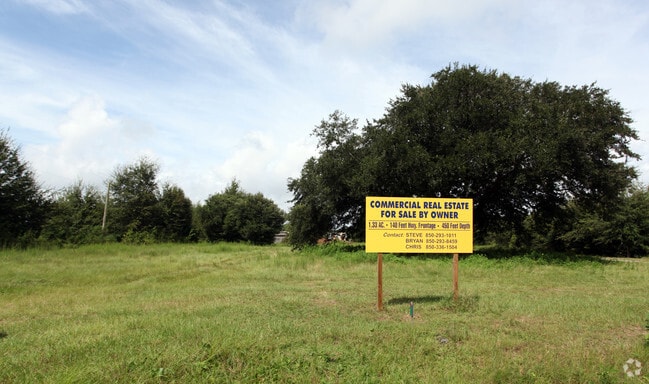
Property Detail
5367 Woodbine Rd
06-1N-29-0000-00500-0000
*DESCRIPTION UPDATED FOR 2025* COMMENCE AT THE NORTHEAST CORNER OF SECTION 6, TOWNSHIP 1 NORTH, RANGE 29 WEST, SANTA ROSA COUNTY, FLORIDA; THENCE RUN NORTH 89 DEGREES 11'56 WEST ALONG THE NORTH LINE OF SAID SECTION 6 A DISTANCE OF 78.45 FEET TO AN IN
Storemultistory
Santa Rosa
HCD
Florida
B and X Area of moderate flood hazard, usually the area between the limits of the 100-year and 500-year floods.
1.33 AC
2024
Gonzalez/SW Santa Rosa
2025
Pensacola
010707
Pensacola-Ferry Pass-Brent, FL
15,940 SF
NEARBY LISTINGS FOR SALE OR LEASE
DEMOGRAPHICS near 5367 Woodbine Rd
1 mile
3 mile
5 mile
2025 Total Population
4,352
24,323
37,403
2030 Population
4,732
26,250
40,421
Pop Growth 2025-2030
+ 8.73%
+ 7.92%
+ 8.07%
Average Age
42
40
40
2025 Total Households
1,569
8,625
13,384
HH Growth 2025-2030
+ 8.48%
+ 7.72%
+ 7.86%
Median Household Inc
$107,954
$93,359
$89,762
Avg Household Size
2.80
2.80
2.80
2025 Avg HH Vehicles
2.00
2.00
2.00
Median Home Value
$383,333
$341,394
$329,014
Median Year Built
1998
2000
1999
Nearby Places
Map Layers
Map Styles
 Street
 Aerial
Layers
 Traffic
 Biking
Places
Listings with unknown addresses are not visible on the map
- Restaurants
- Banks
- Shops
- Fitness
- Groceries
PUBLIC TRANSPORTATION
AIRPORT
Pensacola International
Drive
Walk
Distance
Pensacola International
26 min
14.3 mi
Nearby Properties
Address
Land Use
TOTAL SIZE
Lot Size
Zoning
Address
Land Use
TOTAL SIZE
Lot Size
Zoning
47.05 AC
AG-RR
Address
Land Use
TOTAL SIZE
Lot Size
Zoning
52,875 SF
5.24 AC
HCD
Address
Land Use
TOTAL SIZE
Lot Size
Zoning
51,329 SF
5.65 AC
HCD
Address
Land Use
TOTAL SIZE
Lot Size
Zoning
81,123 SF
8.78 AC
HCD
Address
Land Use
TOTAL SIZE
Lot Size
Zoning
60,129 SF
0.11 AC
HCD
Address
Land Use
TOTAL SIZE
Lot Size
Zoning
23.33 AC
AG-RR
Address
Land Use
TOTAL SIZE
Lot Size
Zoning
13.70 AC
HCD
Address
Land Use
TOTAL SIZE
Lot Size
Zoning
76,674 SF
2.80 AC
HCD
Address
Land Use
TOTAL SIZE
Lot Size
Zoning
93,476 SF
7.43 AC
HCD
Address
Land Use
TOTAL SIZE
Lot Size
Zoning
94,231 SF
14.72 AC
HCD
Address
Land Use
TOTAL SIZE
Lot Size
Zoning
389.54 AC
AG-RR
Address
Land Use
TOTAL SIZE
Lot Size
Zoning
50,616 SF
2.56 AC
R3
Address
Land Use
TOTAL SIZE
Lot Size
Zoning
30,564 SF
11.12 AC
HCD
Address
Land Use
TOTAL SIZE
Lot Size
Zoning
23,668 SF
2.30 AC
HCD
Address
Land Use
TOTAL SIZE
Lot Size
Zoning
13,560 SF
5.93 AC
HCD
Address
Land Use
TOTAL SIZE
Lot Size
Zoning
45,485 SF
6.49 AC
HCD
Address
Land Use
TOTAL SIZE
Lot Size
Zoning
80,141 SF
11.33 AC
HCD
Address
Land Use
TOTAL SIZE
Lot Size
Zoning
62,174 SF
4 AC
HCD
Address
Land Use
TOTAL SIZE
Lot Size
Zoning
40,250 SF
2.19 AC
HCD
Address
Land Use
TOTAL SIZE
Lot Size
Zoning
25,700 SF
4.34 AC
HCD
Address
Land Use
TOTAL SIZE
Lot Size
Zoning
45,825 SF
3.26 AC
HCD
Address
Land Use
TOTAL SIZE
Lot Size
Zoning
35,878 SF
10 AC
HCD
Address
Land Use
TOTAL SIZE
Lot Size
Zoning
26,638 SF
3.08 AC
HCD
Address
Land Use
TOTAL SIZE
Lot Size
Zoning
27,839 SF
4 AC
AG-RR
Address
Land Use
TOTAL SIZE
Lot Size
Zoning
15,573 SF
1.65 AC
HCD
Address
Land Use
TOTAL SIZE
Lot Size
Zoning
34,880 SF
2.42 AC
HCD
Address
Land Use
TOTAL SIZE
Lot Size
Zoning
16,675 SF
2 AC
HCD
Address
Land Use
TOTAL SIZE
Lot Size
Zoning
14,765 SF
173.09 AC
R1
Address
Land Use
TOTAL SIZE
Lot Size
Zoning
24,061 SF
1.95 AC
HCD
The World's #1 Commercial Real Estate Marketplace
Connect with us
© 2026 CoStar Group
The information above has been obtained from sources believed reliable. While we do not doubt its accuracy we have not verified it and make no guarantee, warranty or representation about it. It is your responsibility to independently confirm its accuracy and completeness. Any projections, opinions, assumptions, or estimates used are for example only and do not represent the current or future performance of the property. The value of this transaction to you depends on tax and other factors which should be evaluated by your tax, financial, and legal advisors. You and your advisors should conduct a careful, independent investigation of the property to determine to your satisfaction the suitability of the property for your needs.