Property Record
537 Main St, Coventry, RI 02816
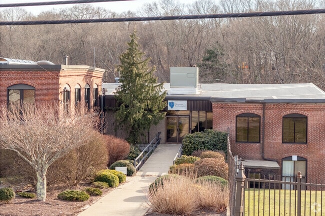

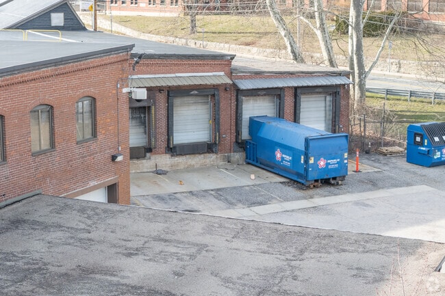
Property Detail
537 Main St
COVE-000103-000000-000002
Kent
Industrialgeneral
Rhode Island
2000
2
B and X Area of moderate flood hazard, usually the area between the limits of the 100-year and 500-year floods.
14.65 AC
2025
Coventry/West Greenwich
2025
Providence
020601
Providence-Warwick, RI-MA
NEARBY LISTINGS FOR SALE OR LEASE
DEMOGRAPHICS near 537 Main St
1 mile
3 mile
5 mile
2025 Total Population
6,202
45,526
114,580
2030 Population
6,345
46,322
117,079
Pop Growth 2025-2030
+ 2.31%
+ 1.75%
+ 2.18%
Average Age
41
42
43
2025 Total Households
2,356
18,722
47,630
HH Growth 2025-2030
+ 2.42%
+ 1.67%
+ 2.15%
Median Household Inc
$124,072
$92,138
$92,772
Avg Household Size
2.60
2.40
2.30
2025 Avg HH Vehicles
2.00
2.00
2.00
Median Home Value
$385,732
$366,651
$378,489
Median Year Built
1958
1961
1971
Nearby Places
Map Layers
Map Styles
 Street
 Aerial
Transit
 Traffic
 Biking
Places
Listings with unknown addresses are not visible on the map
- Restaurants
- Banks
- Shops
- Fitness
- Groceries
PUBLIC TRANSPORTATION
COMMUTER RAIL
Tf Green Airport (Providence/Stoughton Line - MBTA)
Drive
Walk
Distance
Tf Green Airport (Providence/Stoughton Line - MBTA)
14 min
7.6 mi
AIRPORT
Rhode Island Tf Green International
Drive
Walk
Distance
Rhode Island Tf Green International
19 min
9.9 mi
Freight Ports
Port of Davisville, RI
Drive
Walk
Distance
Port of Davisville, RI
28 min
15.2 mi
SALE & LEASE HISTORY
LISTING DATE
SALE/LEASE

Jun 28, 2022
For Lease
Nearby Properties
Address
Land Use
TOTAL SIZE
Lot Size
Zoning
Address
Land Use
TOTAL SIZE
Lot Size
Zoning
11.48 AC
R-10
Address
Land Use
TOTAL SIZE
Lot Size
Zoning
11.63 AC
R-10
Address
Land Use
TOTAL SIZE
Lot Size
Zoning
240,425 SF
104.76 AC
R-10
Address
Land Use
TOTAL SIZE
Lot Size
Zoning
225,075 SF
4.29 AC
6000
Address
Land Use
TOTAL SIZE
Lot Size
Zoning
169,035 SF
4 AC
6000
Address
Land Use
TOTAL SIZE
Lot Size
Zoning
131,136 SF
32.78 AC
GB
Address
Land Use
TOTAL SIZE
Lot Size
Zoning
123,035 SF
99 AC
R-20
Address
Land Use
TOTAL SIZE
Lot Size
Zoning
137,992 SF
1.30 AC
B
Address
Land Use
TOTAL SIZE
Lot Size
Zoning
6.36 AC
CI
Address
Land Use
TOTAL SIZE
Lot Size
Zoning
11.80 AC
R-10
Address
Land Use
TOTAL SIZE
Lot Size
Zoning
3,503 SF
65.88 AC
A15
Address
Land Use
TOTAL SIZE
Lot Size
Zoning
120,625 SF
57.93 AC
GB
Address
Land Use
TOTAL SIZE
Lot Size
Zoning
103,936 SF
2.13 AC
R-6
Address
Land Use
TOTAL SIZE
Lot Size
Zoning
10.46 AC
R-10
Address
Land Use
TOTAL SIZE
Lot Size
Zoning
80,563 SF
15.09 AC
R-10
Address
Land Use
TOTAL SIZE
Lot Size
Zoning
43,809 SF
75.59 AC
S1
Address
Land Use
TOTAL SIZE
Lot Size
Zoning
9,720 SF
12.12 AC
6000
Address
Land Use
TOTAL SIZE
Lot Size
Zoning
68,206 SF
2.70 AC
2000
Address
Land Use
TOTAL SIZE
Lot Size
Zoning
22,445 SF
5 AC
A80
Address
Land Use
TOTAL SIZE
Lot Size
Zoning
108,722 SF
5.23 AC
6000
Address
Land Use
TOTAL SIZE
Lot Size
Zoning
73,051 SF
2.24 AC
R-8
Address
Land Use
TOTAL SIZE
Lot Size
Zoning
81,164 SF
2.49 AC
R-10
Address
Land Use
TOTAL SIZE
Lot Size
Zoning
7.24 AC
CI
Address
Land Use
TOTAL SIZE
Lot Size
Zoning
2.16 AC
R-20
Address
Land Use
TOTAL SIZE
Lot Size
Zoning
40,716 SF
3.72 AC
CI
Address
Land Use
TOTAL SIZE
Lot Size
Zoning
40,085 SF
1.23 AC
R-6
Address
Land Use
TOTAL SIZE
Lot Size
Zoning
2.60 AC
R-8
Address
Land Use
TOTAL SIZE
Lot Size
Zoning
48,420 SF
6.89 AC
Address
Land Use
TOTAL SIZE
Lot Size
Zoning
69,192 SF
1.83 AC
R-10
Address
Land Use
TOTAL SIZE
Lot Size
Zoning
60,637 SF
1.90 AC
R-6
The World's #1 Commercial Real Estate Marketplace
Connect with us
© 2026 CoStar Group
The information above has been obtained from sources believed reliable. While we do not doubt its accuracy we have not verified it and make no guarantee, warranty or representation about it. It is your responsibility to independently confirm its accuracy and completeness. Any projections, opinions, assumptions, or estimates used are for example only and do not represent the current or future performance of the property. The value of this transaction to you depends on tax and other factors which should be evaluated by your tax, financial, and legal advisors. You and your advisors should conduct a careful, independent investigation of the property to determine to your satisfaction the suitability of the property for your needs.