Property Record
537 N Mccall Ave, Sanger, CA 93657

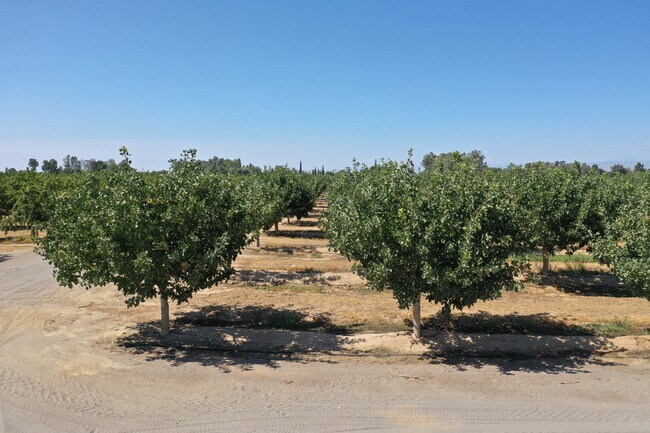
Property Detail
537 N Mccall Ave
314-021-27
75.99 AC IN S1/2 OF NW1/4 SEC 35 T13R22
Agriculturalland
FRESNO
AE20
California
B and X Area of moderate flood hazard, usually the area between the limits of the 100-year and 500-year floods.
49.97 AC
2025
E Outlying Fresno County
2025
Fresno
005906
Fresno, CA
2,516 SF
NEARBY LISTINGS FOR SALE OR LEASE
DEMOGRAPHICS near 537 N Mccall Ave
1 mile
3 mile
5 mile
2025 Total Population
737
22,114
125,405
2030 Population
777
23,078
128,493
Pop Growth 2025-2030
+ 5.43%
+ 4.36%
+ 2.46%
Average Age
39
36
36
2025 Total Households
228
6,521
37,548
HH Growth 2025-2030
+ 5.26%
+ 4.34%
+ 2.44%
Median Household Inc
$135,833
$115,453
$106,413
Avg Household Size
3.20
3.30
3.30
2025 Avg HH Vehicles
2.00
2.00
2.00
Median Home Value
$645,833
$482,453
$471,620
Median Year Built
1987
2010
2001
Nearby Places
Map Layers
Map Styles
 Street
 Aerial
Transit
 Traffic
 Biking
Places
Listings with unknown addresses are not visible on the map
- Restaurants
- Banks
- Shops
- Fitness
- Groceries
PUBLIC TRANSPORTATION
AIRPORT
Fresno Yosemite International
Drive
Walk
Distance
Fresno Yosemite International
13 min
8.6 mi
Freight Ports
Port of Stockton
Drive
Walk
Distance
Port of Stockton
164 min
138.6 mi
SALE & LEASE HISTORY
LISTING DATE
SALE/LEASE

Sep 02, 2021
For Sale
Nearby Properties
Address
Land Use
TOTAL SIZE
Lot Size
Zoning
Address
Land Use
TOTAL SIZE
Lot Size
Zoning
158.81 AC
AE20
Address
Land Use
TOTAL SIZE
Lot Size
Zoning
924 SF
154 AC
AE20
Address
Land Use
TOTAL SIZE
Lot Size
Zoning
12,527 SF
3.97 AC
C2
Address
Land Use
TOTAL SIZE
Lot Size
Zoning
153,312 SF
15.02 AC
IL
Address
Land Use
TOTAL SIZE
Lot Size
Zoning
156.04 AC
AE20
Address
Land Use
TOTAL SIZE
Lot Size
Zoning
32,070 SF
109.34 AC
RR
Address
Land Use
TOTAL SIZE
Lot Size
Zoning
73,577 SF
25.18 AC
AE20
Address
Land Use
TOTAL SIZE
Lot Size
Zoning
5,088 SF
31.46 AC
AE20
Address
Land Use
TOTAL SIZE
Lot Size
Zoning
1,058 SF
77.22 AC
AE20
Address
Land Use
TOTAL SIZE
Lot Size
Zoning
890 SF
39.26 AC
AE20
Address
Land Use
TOTAL SIZE
Lot Size
Zoning
4,828 SF
29.30 AC
AE20
Address
Land Use
TOTAL SIZE
Lot Size
Zoning
94,589 SF
20.81 AC
AE20
Address
Land Use
TOTAL SIZE
Lot Size
Zoning
40 AC
AE20
Address
Land Use
TOTAL SIZE
Lot Size
Zoning
39.55 AC
AE20
Address
Land Use
TOTAL SIZE
Lot Size
Zoning
1,070 SF
221.11 AC
AE20
Address
Land Use
TOTAL SIZE
Lot Size
Zoning
1,886 SF
56.46 AC
AE20
Address
Land Use
TOTAL SIZE
Lot Size
Zoning
16,676 SF
14.03 AC
C6
Address
Land Use
TOTAL SIZE
Lot Size
Zoning
2,412 SF
38.50 AC
AE20
Address
Land Use
TOTAL SIZE
Lot Size
Zoning
55.77 AC
AE20
Address
Land Use
TOTAL SIZE
Lot Size
Zoning
3,468 SF
35.66 AC
RR
Address
Land Use
TOTAL SIZE
Lot Size
Zoning
3,318 SF
54 AC
AE20
Address
Land Use
TOTAL SIZE
Lot Size
Zoning
5,000 SF
18.95 AC
AE20
Address
Land Use
TOTAL SIZE
Lot Size
Zoning
2,014 SF
39.67 AC
AE20
Address
Land Use
TOTAL SIZE
Lot Size
Zoning
3,960 SF
37.25 AC
AE20
Address
Land Use
TOTAL SIZE
Lot Size
Zoning
34.56 AC
AE20
Address
Land Use
TOTAL SIZE
Lot Size
Zoning
4,676 SF
23.96 AC
AE20
Address
Land Use
TOTAL SIZE
Lot Size
Zoning
60 AC
AE20
The World's #1 Commercial Real Estate Marketplace
Connect with us
© 2026 CoStar Group
The information above has been obtained from sources believed reliable. While we do not doubt its accuracy we have not verified it and make no guarantee, warranty or representation about it. It is your responsibility to independently confirm its accuracy and completeness. Any projections, opinions, assumptions, or estimates used are for example only and do not represent the current or future performance of the property. The value of this transaction to you depends on tax and other factors which should be evaluated by your tax, financial, and legal advisors. You and your advisors should conduct a careful, independent investigation of the property to determine to your satisfaction the suitability of the property for your needs.