Property Record
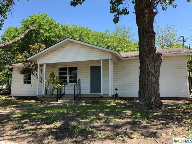
5371 State Highway 95, Temple, TX 76502

Property Detail
5371 State Highway 95
11584
A0014BC M MORENO, 385-1, PT 386, ACRES 10.763
Farms
Bell
A Areas with a 1% annual chance of flooding and a 26% chance of flooding over the life of a 30-year mortgage.
Texas
2025
32.29 AC
2025
Outlying Bell County
020900
Killeen/Temple/Fort Hood
1,918 SF
Killeen-Temple, TX
NEARBY LISTINGS FOR SALE OR LEASE
-
-
-
SW HK Dodgen Loop 363 & S 5th St @ State Hwy 36
Temple, TX 76502
$505,296 - $1,069,398
2.32 - 2.59 AC Lot
Land
-
-
-
View all Temple listings for lease on LoopNet.com
DEMOGRAPHICS near 5371 State Highway 95
1 mile
3 mile
5 mile
2025 Total Population
292
18,516
58,143
2030 Population
319
19,830
61,969
Pop Growth 2025-2030
+ 9.25%
+ 7.10%
+ 6.58%
Average Age
32
36
39
2025 Total Households
115
7,641
23,969
HH Growth 2025-2030
+ 9.57%
+ 7.46%
+ 6.72%
Median Household Inc
$86,071
$68,388
$63,774
Avg Household Size
2.60
2.30
2.30
2025 Avg HH Vehicles
1.00
2.00
2.00
Median Home Value
$246,875
$257,179
$242,236
Median Year Built
2004
2007
1985
Nearby Places
Map Layers
Map Styles
 Street
 Aerial
Layers
 Traffic
 Biking
Places
Listings with unknown addresses are not visible on the map
- Restaurants
- Banks
- Shops
- Fitness
- Groceries
PUBLIC TRANSPORTATION
COMMUTER RAIL
Temple (Texas Eagle - Amtrak)
Drive
Walk
Distance
Temple (Texas Eagle - Amtrak)
7 min
4.7 mi
AIRPORT
Killeen Municipal
Drive
Walk
Distance
Killeen Municipal
32 min
24.0 mi
Robert Gray AAF
Drive
Walk
Distance
Robert Gray AAF
51 min
37.9 mi
Freight Ports
Port of Houston
Drive
Walk
Distance
Port of Houston
224 min
178.3 mi
SALE & LEASE HISTORY
LISTING DATE
SALE/LEASE

Jul 09, 2018
For Lease
Nearby Properties
Address
Land Use
TOTAL SIZE
Lot Size
Zoning
Address
Land Use
TOTAL SIZE
Lot Size
Zoning
1,546,481 SF
111.97 AC
MF2
Address
Land Use
TOTAL SIZE
Lot Size
Zoning
1 SF
23.50 AC
Address
Land Use
TOTAL SIZE
Lot Size
Zoning
250,571 SF
12 AC
Address
Land Use
TOTAL SIZE
Lot Size
Zoning
202,292 SF
10.17 AC
Address
Land Use
TOTAL SIZE
Lot Size
Zoning
167,344 SF
11.29 AC
Address
Land Use
TOTAL SIZE
Lot Size
Zoning
198,957 SF
15.18 AC
Address
Land Use
TOTAL SIZE
Lot Size
Zoning
175,904 SF
20.33 AC
C
Address
Land Use
TOTAL SIZE
Lot Size
Zoning
45,641 SF
3.94 AC
O
Address
Land Use
TOTAL SIZE
Lot Size
Zoning
48,463 SF
5.18 AC
Address
Land Use
TOTAL SIZE
Lot Size
Zoning
124,897 SF
8.70 AC
C
Address
Land Use
TOTAL SIZE
Lot Size
Zoning
235,358 SF
14.41 AC
Address
Land Use
TOTAL SIZE
Lot Size
Zoning
219,464 SF
12.82 AC
GR
Address
Land Use
TOTAL SIZE
Lot Size
Zoning
150,382 SF
9.48 AC
MF2
Address
Land Use
TOTAL SIZE
Lot Size
Zoning
153,933 SF
16.24 AC
C
Address
Land Use
TOTAL SIZE
Lot Size
Zoning
149,621 SF
15 AC
Address
Land Use
TOTAL SIZE
Lot Size
Zoning
180,586 SF
10.48 AC
Address
Land Use
TOTAL SIZE
Lot Size
Zoning
38,665 SF
6 AC
Address
Land Use
TOTAL SIZE
Lot Size
Zoning
277,885 SF
31.07 AC
Address
Land Use
TOTAL SIZE
Lot Size
Zoning
135,240 SF
20.71 AC
Address
Land Use
TOTAL SIZE
Lot Size
Zoning
106,740 SF
5.02 AC
MF2
Address
Land Use
TOTAL SIZE
Lot Size
Zoning
90,418 SF
5.43 AC
C
Address
Land Use
TOTAL SIZE
Lot Size
Zoning
177,215 SF
41.99 AC
C
Address
Land Use
TOTAL SIZE
Lot Size
Zoning
130,513 SF
19.64 AC
Address
Land Use
TOTAL SIZE
Lot Size
Zoning
450,820 SF
32.19 AC
Address
Land Use
TOTAL SIZE
Lot Size
Zoning
140,000 SF
9 AC
Address
Land Use
TOTAL SIZE
Lot Size
Zoning
117,679 SF
6.33 AC
Address
Land Use
TOTAL SIZE
Lot Size
Zoning
57,096 SF
2.16 AC
Address
Land Use
TOTAL SIZE
Lot Size
Zoning
100,800 SF
3 AC
Address
Land Use
TOTAL SIZE
Lot Size
Zoning
54,568 SF
3.92 AC
C
Address
Land Use
TOTAL SIZE
Lot Size
Zoning
69,974 SF
9.25 AC
The World's #1 Commercial Real Estate Marketplace
Connect with us
© 2026 CoStar Group
The information above has been obtained from sources believed reliable. While we do not doubt its accuracy we have not verified it and make no guarantee, warranty or representation about it. It is your responsibility to independently confirm its accuracy and completeness. Any projections, opinions, assumptions, or estimates used are for example only and do not represent the current or future performance of the property. The value of this transaction to you depends on tax and other factors which should be evaluated by your tax, financial, and legal advisors. You and your advisors should conduct a careful, independent investigation of the property to determine to your satisfaction the suitability of the property for your needs.