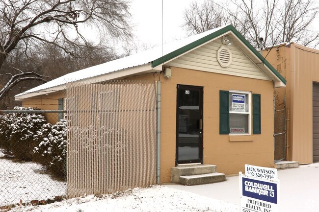
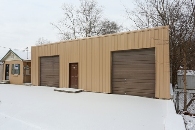
Property Record
538 Holmes St, Frankfort, KY 40601
NEARBY LISTINGS FOR SALE OR LEASE
Property Detail
538 Holmes St
Frankfort, KY
Hoge Montgomery Sub
074-21-01-017.00
LOTS 2-3-4
Commercialnec
Franklin
X
Kentucky
21073C0128E
2-4
2025
0.10 AC
2025
Kentucky East Area
071200
Other Market Areas
DEMOGRAPHICS near 538 Holmes St
1 Mile
3 Mile
5 Mile
2024 Total Population
7,027
29,781
42,356
2029 Population
7,126
30,055
42,713
Pop Growth 2024-2029
+ 1.41%
+ 0.92%
+ 0.84%
Average Age
36
40
41
2024 Total Households
2,755
12,945
18,265
HH Growth 2024-2029
+ 1.49%
+ 0.97%
+ 0.89%
Median Household Inc
$39,916
$57,521
$61,279
Avg Household Size
2.20
2.20
2.20
2024 Avg HH Vehicles
2.00
2.00
2.00
Median Home Value
$89,654
$158,775
$173,478
Median Year Built
1962
1969
1973
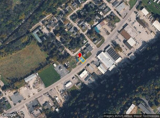
Nearby Places
Map Layers
Map Styles
 Street
 Aerial
- Restaurants
- Banks
- Shops
- Fitness
- Groceries
PUBLIC TRANSPORTATION
AIRPORT
Blue Grass
DRIVE
WALK
Distance
Blue Grass
29 min
21.4 mi
Freight Ports
Port of Toledo
DRIVE
WALK
Distance
Port of Toledo
344 min
292.6 mi
SALE & LEASE HISTORY
LISTING DATE
SALE/LEASE

Jan 18, 2017
For Sale
Nearby Properties
Address
Land Use
TOTAL SIZE
Lot Size
Zoning
Address
Land Use
TOTAL SIZE
Lot Size
Zoning
242.53 AC
Address
Land Use
TOTAL SIZE
Lot Size
Zoning
600 SF
29.08 AC
Address
Land Use
TOTAL SIZE
Lot Size
Zoning
114.60 AC
Address
Land Use
TOTAL SIZE
Lot Size
Zoning
Address
Land Use
TOTAL SIZE
Lot Size
Zoning
80.60 AC
Address
Land Use
TOTAL SIZE
Lot Size
Zoning
82.18 AC
Address
Land Use
TOTAL SIZE
Lot Size
Zoning
22.08 AC
Address
Land Use
TOTAL SIZE
Lot Size
Zoning
13.85 AC
Address
Land Use
TOTAL SIZE
Lot Size
Zoning
Address
Land Use
TOTAL SIZE
Lot Size
Zoning
15.79 AC
Address
Land Use
TOTAL SIZE
Lot Size
Zoning
4.05 AC
Address
Land Use
TOTAL SIZE
Lot Size
Zoning
Address
Land Use
TOTAL SIZE
Lot Size
Zoning
14.80 AC
Address
Land Use
TOTAL SIZE
Lot Size
Zoning
14.76 AC
Address
Land Use
TOTAL SIZE
Lot Size
Zoning
20.21 AC
Address
Land Use
TOTAL SIZE
Lot Size
Zoning
3.40 AC
Address
Land Use
TOTAL SIZE
Lot Size
Zoning
16,800 SF
6.50 AC
Address
Land Use
TOTAL SIZE
Lot Size
Zoning
Address
Land Use
TOTAL SIZE
Lot Size
Zoning
Address
Land Use
TOTAL SIZE
Lot Size
Zoning
49.66 AC
Address
Land Use
TOTAL SIZE
Lot Size
Zoning
3.93 AC
Address
Land Use
TOTAL SIZE
Lot Size
Zoning
14.93 AC
Address
Land Use
TOTAL SIZE
Lot Size
Zoning
Address
Land Use
TOTAL SIZE
Lot Size
Zoning
Address
Land Use
TOTAL SIZE
Lot Size
Zoning
2.86 AC
Address
Land Use
TOTAL SIZE
Lot Size
Zoning
Address
Land Use
TOTAL SIZE
Lot Size
Zoning
Address
Land Use
TOTAL SIZE
Lot Size
Zoning
0.92 AC
Address
Land Use
TOTAL SIZE
Lot Size
Zoning
Address
Land Use
TOTAL SIZE
Lot Size
Zoning
16.38 AC
The World's #1 Commercial Real Estate Marketplace
Connect with us
© 2025 CoStar Group
The information above has been obtained from sources believed reliable. While we do not doubt its accuracy we have not verified it and make no guarantee, warranty or representation about it. It is your responsibility to independently confirm its accuracy and completeness. Any projections, opinions, assumptions, or estimates used are for example only and do not represent the current or future performance of the property. The value of this transaction to you depends on tax and other factors which should be evaluated by your tax, financial, and legal advisors. You and your advisors should conduct a careful, independent investigation of the property to determine to your satisfaction the suitability of the property for your needs.