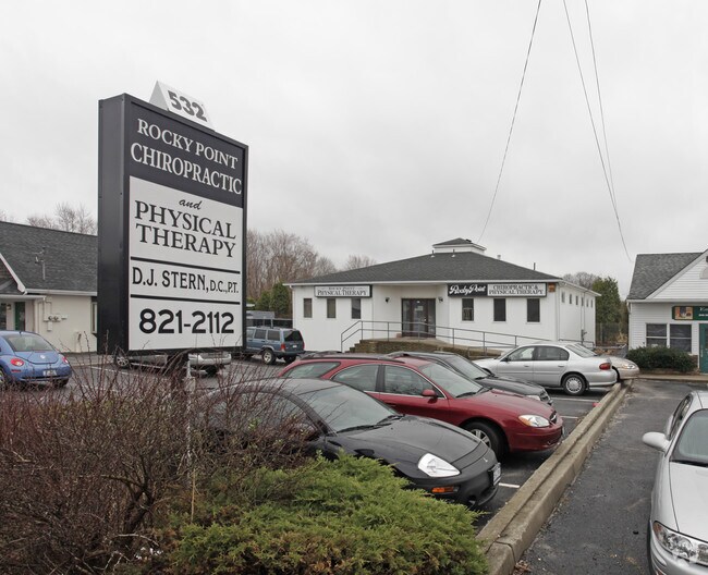
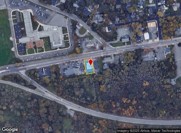
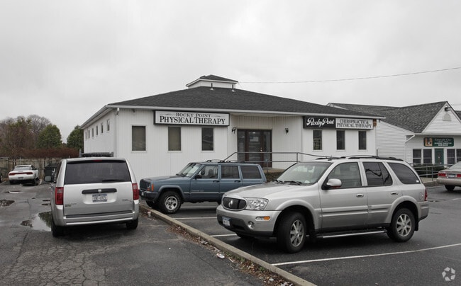
Property Record
538 Route 25A, Rocky Point, NY 11778
NEARBY LISTINGS FOR SALE OR LEASE
Property Detail
538 Route 25A
Nassau County-Suffolk County, NY
Rocky Point
0200-077-00-08-00-003-000
N RT 25A T-210 E EKBC REALTY S STAT
Regionalshoppingcenterormallwithanchorstore
Suffolk
X
New York
36103C0408H
3
2024
0.27 AC
2024
Central Suffolk
158401
Long Island (New York)
DEMOGRAPHICS near 538 Route 25A
1 Mile
3 Mile
5 Mile
2024 Total Population
7,546
34,914
80,662
2029 Population
7,481
34,618
79,925
Pop Growth 2024-2029
(0.86%)
(0.85%)
(0.91%)
Average Age
38
43
43
2024 Total Households
2,624
13,145
30,163
HH Growth 2024-2029
(1.03%)
(0.81%)
(1.01%)
Median Household Inc
$96,380
$104,684
$110,292
Avg Household Size
2.80
2.60
2.60
2024 Avg HH Vehicles
2.00
2.00
2.00
Median Home Value
$350,608
$397,379
$428,554
Median Year Built
1964
1973
1976
Nearby Places
Map Layers
Map Styles
 Street
 Aerial
- Restaurants
- Banks
- Shops
- Fitness
- Groceries
PUBLIC TRANSPORTATION
COMMUTER RAIL
Port Jefferson Station (Port Jefferson Branch - Long Island Rail Road)
DRIVE
WALK
Distance
Port Jefferson Station (Port Jefferson Branch - Long Island Rail Road)
12 min
6.9 mi
AIRPORT
Long Island MacArthur
DRIVE
WALK
Distance
Long Island MacArthur
35 min
21.8 mi
Tweed/New Haven
DRIVE
WALK
Distance
Tweed/New Haven
128 min
48.0 mi
Freight Ports
Port of New Haven
DRIVE
WALK
Distance
Port of New Haven
123 min
45.2 mi
Nearby Properties
Address
Land Use
TOTAL SIZE
Lot Size
Zoning
Address
Land Use
TOTAL SIZE
Lot Size
Zoning
15.70 AC
Address
Land Use
TOTAL SIZE
Lot Size
Zoning
2,842 SF
0.21 AC
VILLA
Address
Land Use
TOTAL SIZE
Lot Size
Zoning
17.70 AC
Address
Land Use
TOTAL SIZE
Lot Size
Zoning
838.32 AC
Address
Land Use
TOTAL SIZE
Lot Size
Zoning
Address
Land Use
TOTAL SIZE
Lot Size
Zoning
19.25 AC
Address
Land Use
TOTAL SIZE
Lot Size
Zoning
2,456 SF
0.88 AC
R15
Address
Land Use
TOTAL SIZE
Lot Size
Zoning
Address
Land Use
TOTAL SIZE
Lot Size
Zoning
18.30 AC
Address
Land Use
TOTAL SIZE
Lot Size
Zoning
149.80 AC
Address
Land Use
TOTAL SIZE
Lot Size
Zoning
Address
Land Use
TOTAL SIZE
Lot Size
Zoning
571 AC
Address
Land Use
TOTAL SIZE
Lot Size
Zoning
10 AC
Address
Land Use
TOTAL SIZE
Lot Size
Zoning
21.63 AC
Address
Land Use
TOTAL SIZE
Lot Size
Zoning
222.70 AC
Address
Land Use
TOTAL SIZE
Lot Size
Zoning
Address
Land Use
TOTAL SIZE
Lot Size
Zoning
0.41 AC
R10
Address
Land Use
TOTAL SIZE
Lot Size
Zoning
178.18 AC
Address
Land Use
TOTAL SIZE
Lot Size
Zoning
59.84 AC
Address
Land Use
TOTAL SIZE
Lot Size
Zoning
Address
Land Use
TOTAL SIZE
Lot Size
Zoning
11.22 AC
Address
Land Use
TOTAL SIZE
Lot Size
Zoning
13.74 AC
Address
Land Use
TOTAL SIZE
Lot Size
Zoning
Address
Land Use
TOTAL SIZE
Lot Size
Zoning
11.46 AC
Address
Land Use
TOTAL SIZE
Lot Size
Zoning
6.04 AC
C2
Address
Land Use
TOTAL SIZE
Lot Size
Zoning
398 AC
Address
Land Use
TOTAL SIZE
Lot Size
Zoning
0.11 AC
R20
Address
Land Use
TOTAL SIZE
Lot Size
Zoning
Address
Land Use
TOTAL SIZE
Lot Size
Zoning
Address
Land Use
TOTAL SIZE
Lot Size
Zoning
10.74 AC
The World's #1 Commercial Real Estate Marketplace
Connect with us
© 2025 CoStar Group
The information above has been obtained from sources believed reliable. While we do not doubt its accuracy we have not verified it and make no guarantee, warranty or representation about it. It is your responsibility to independently confirm its accuracy and completeness. Any projections, opinions, assumptions, or estimates used are for example only and do not represent the current or future performance of the property. The value of this transaction to you depends on tax and other factors which should be evaluated by your tax, financial, and legal advisors. You and your advisors should conduct a careful, independent investigation of the property to determine to your satisfaction the suitability of the property for your needs.